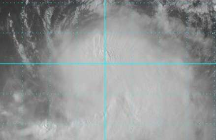
National Hurricane Center Hurricane Jose.
With Florida and Texas still picking up the pieces from Hurricanes Irma and Harvey, unfortunately, there is a new hurricane looming. Its name is Hurricane Jose (although, technically, it was Tropical Storm Jose on September 15. An Air Force plane was “en route to determine if Jose is a hurricane again,” The National Hurricane Center wrote.)
As of September 15, where was Hurricane/Tropical Storm Jose headed?
The latest spaghetti models of the storm show its current projected path. It’s possible the storm will not make landfall but will still affect parts of the east coast, or it might “brush” the coast. The Morning Call reported: “Some model forecasts show it could brush the East Coast next week, triggering high seas and coastal flooding…The long range guidance then continues to keep Jose offshore of the Mid-Atlantic region as it lifts northward into Wednesday. However, some models have shifted farther west with their tracks and its now believed we will see some impacts from this system late Monday night and early Tuesday into late Tuesday night and early Wednesday.”
Here are the lastest “Spaghetti🍝 Plots” for Tropical Storm Jose! No US landfall in sight as #Jose will likely become a hurricane again soon!
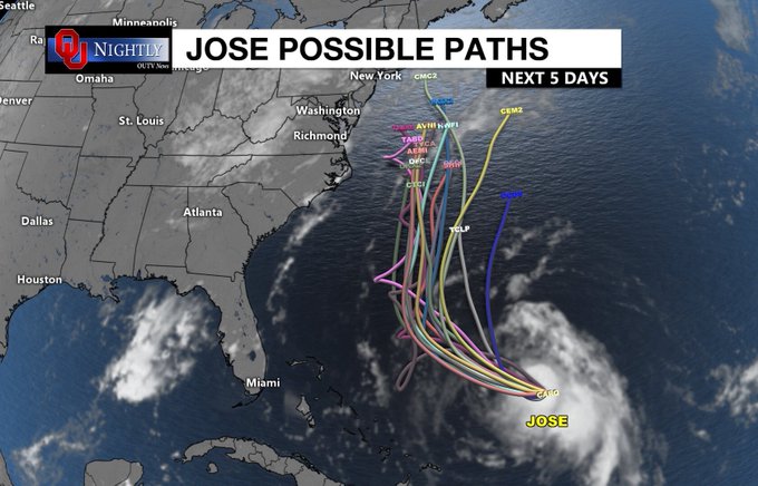
Cyclocane has a constantly updating page of Hurricane Jose spaghetti models. You can see them here. You can see other Jose trackers here. The storm is headed toward the northeastern seaboard now, in the direction of Philadelphia and New York.
The National Center for Atmospheric Research also has Hurricane Jose spaghetti models that it updates regularly. See the September 15 model here and here. See NCAR’s full Jose page here.
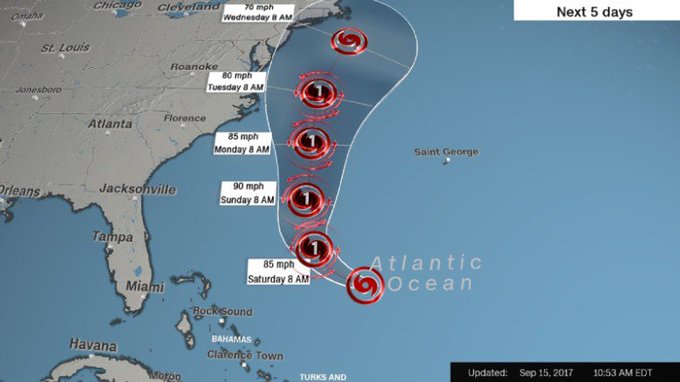
The National Hurricane Center uses a forecast cone model. Here’s the model for September 15:
Here’s another model of the storm:
Jose is expected to strengthen into a hurricane again, threatening to bring rain and wind to the Northeast next week t.co/WQAVkD6tML
As of 11 a.m. on September 15, The National Weather Service reported that this was Jose’s location:
LOCATION…26.5N 69.4W
ABOUT 360 MI…575 KM NE OF THE SOUTHEASTERN BAHAMAS
ABOUT 485 MI…785 KM SW OF BERMUDA
MAXIMUM SUSTAINED WINDS…70 MPH…110 KM/H
PRESENT MOVEMENT…NW OR 305 DEGREES AT 9 MPH…15 KM/H
MINIMUM CENTRAL PRESSURE…989 MB…29.21 INCHES
Here are the key messages for #Jose for Advisory 41- East coast of the US from N Carolina northward should monitor t.co/tW4KeGdBFb
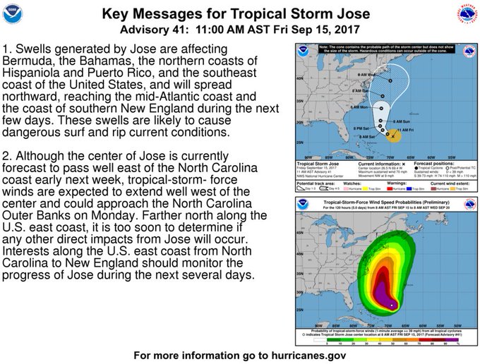
The NWS wrote: “At 1100 AM AST (1500 UTC), the center of Tropical Storm Jose was located near latitude 26.5 North, longitude 69.4 West. Jose is moving toward the northwest near 9 mph (15 km/h). This general motion is expected today, follow by a turn to the north-northwest by late Saturday and toward the north on Sunday. Maximum sustained winds remain near 70 mph (110 km/h) with higher gusts. Some strengthening is forecast during the next 48 hours. An Force Reserve Hurricane Hunter aircraft is currently en route to obtain a better wind speed estimate. Tropical-storm-force winds extend outward up to 140 miles (220 km) from the center. The estimated minimum central pressure is 989 mb (29.21 inches).
HAZARDS AFFECTING LAND
———————-
SURF: Swells generated by Jose are affecting Bermuda, the Bahamas, the northern coasts of Hispaniola and Puerto Rico, and the southeast coast of the United States, and will spread northward along the Mid-Atlantic coast of the U.S. during the next few days. These swells are likely to cause life-threatening surf and rip current conditions.”