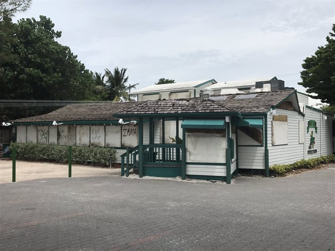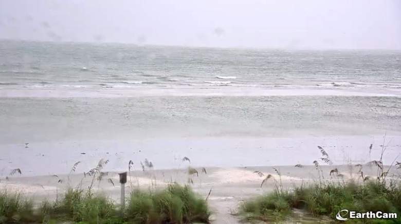
Two island vacation destinations in Southwest Florida are in the path of Hurricane Irma and could be hit by high winds, heavy rain and devastating storm surges.
Captiva and Sanibel Island are both under a hurricane warning and a storm surge warning, the National Weather Service says. Hurricane Irma made landfall in the Florida Keys about 8 a.m. Sunday morning, and it is expected to hit the Captiva and Sanibel area by Sunday evening. As of 12:30 p.m., the storm was about 80 miles south of Naples and “leaving destruction in its wake,” Florida Governor Rick Scott said. Sanibel and Captiva are about 40 miles north of Naples, where Irma is expected to hit about 8 p.m.
Here are some of the latest path projections and other data from the National Hurricane Center:
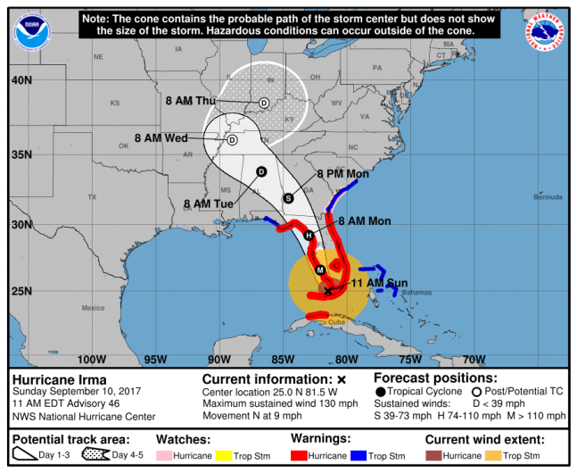
National Weather ServiceThe latest track
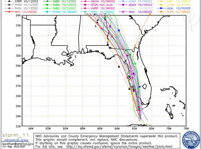
Central Florida Waste Management DistrictSunday morning spaghetti model.
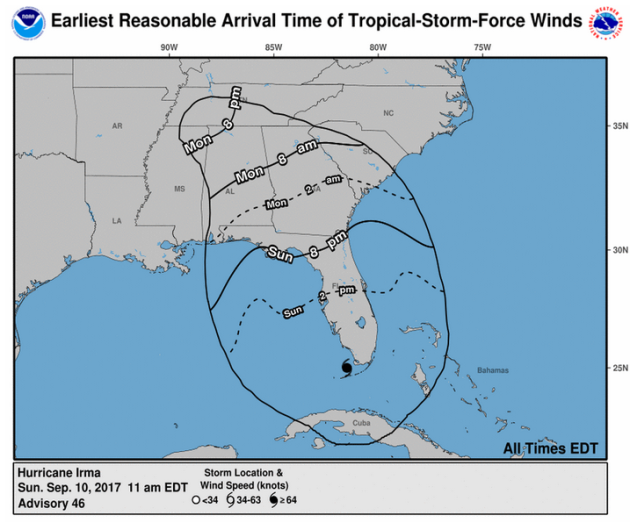
NHCArrival times as of 11 a.m. Sunday for Irma.
According to the National Weather Service, Sanibel and Captiva are expected to be hit by Irma winds between 90 to 110 mph, with gusts up to 135 mph. The biggest risk to the islands is the storm surge, which the National Weather Service says has a “potential for 10-14 feet above ground somewhere within surge prone areas.” The weather service adds that the surge could be “life-threatening” and “historic.”
Winds and rain ahead of the direct impact of the hurricane have already knocked out power to many on the islands, according to The News-Press. A mandatory evacuation order was put in place for Sanibel and Captiva Friday morning, according to the Santiva Chronicle. But some people are riding out the storm. The bridge to the island is expected to close when winds hit 40 mph, and public safety personnel would also cease operations at that time, according to the News-Press.
Margaret Norsworthy is among those staying for the storm. She told the newspaper, “We’ve been watching the predictions and comparing tide carts like mad the past couple hours. Tide is gonna have a lot to do with the surge. We’re staying safe as possible.”
Bridgit Budd, who is also riding out the storm with her husband, told the newspaper, “We think the surge on Irma is gonna be huge.”
According to the National Weather Service:
Dangerous Hurricane Irma is moving slowly northwest away from the north
coast of Cuba and is forecast to approach the southwest Florida coast
as a major hurricane late Sunday morning. Although the amount of
intensification expected from Irma has been decreased with the latest
forecasts through Sunday morning…make no mistake that Irma is still a
dangerous hurricane… and is forecast to move near or over the west
coast of the Florida peninsula Sunday through early Monday morning with
the potential for significant and life threatening impacts from
wind…surge…and rain.Winds will gust to tropical storm force as fast-moving squalls move
across southwest Florida early this morning. These squalls will
increase in frequency and intensity during today as the outer
rainbands of Irma spread north over the Florida peninsula. Given the
current forecast track, a period of damaging winds is expected across
ALL of west- central and southwest Florida between late Sunday morning
and Monday morning.
The weather service says that “life-threatening” wind will hit the islands and cause “structural damage to sturdy buildings, some with complete roof and wall failures. Complete destruction of mobile homes. Damage greatly accentuated by large airborne projectiles. Locations may be uninhabitable for weeks or months,” along with trees being uproated, roadway signs blown over leaving many roads impassible from large debris, along with widespread power and communications outages.
The storm surge will cause:
– Widespread deep inundation, with storm surge flooding greatly
accentuated by powerful battering waves. Structural damage to
buildings, with many washing away. Damage greatly compounded
from considerable floating debris. Locations may be
uninhabitable for an extended period.
– Near-shore escape routes and secondary roads washed out or
severely flooded. Flood control systems and barriers may become
stressed.
– Extreme beach erosion. New shoreline cuts possible.
– Massive damage to marinas, docks, boardwalks, and piers.
Numerous small craft broken away from moorings with many lifted
onshore and stranded.
According to the weather service, flooding rain is also possible:
– Extreme rainfall flooding may prompt numerous evacuations and
rescues.
– Rivers and tributaries may overwhelmingly overflow their banks
in many places with deep moving water. Small streams, creeks,
canals, and ditches may become raging rivers. Flood control
systems and barriers may become stressed.
– Flood waters can enter numerous structures within multiple
communities, some structures becoming uninhabitable or washed
away. Numerous places where flood waters may cover escape
routes. Streets and parking lots become rivers of raging water
with underpasses submerged. Driving conditions become very
dangerous. Numerous road and bridge closures with some weakened
or washed out.
Tornadoes are also possible:
– The occurrence of scattered tornadoes can hinder the execution
of emergency plans during tropical events.
– Several places may experience tornado damage with a few spots
of considerable damage, power loss, and communications failures.
– Locations could realize roofs torn off frame houses, mobile
homes demolished, boxcars overturned, large trees snapped or
uprooted, vehicles tumbled, and small boats tossed about.
Dangerous projectiles can add to the toll.
Check the National Weather Service for updates on the forecast for
