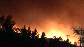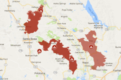
Several majors wildfires were threatening downtown Napa as well as Santa Rosa and other areas in Napa Valley, creating dramatic and frightening scenes that were captured on video. Videos showed patients being evacuated from a hospital in Santa Rosa.
Videos were posted to social media showing people driving near the blaze.
According to the Mercury News, two key fires were causing the greatest concern in the North Bay area. One of those was known as the Atlas Fire and was “about 5 miles northwest of downtown Napa” on October 9.
The other fire, according to ABC 7, is known as the Tubbs fire, “has now burned 20,000 acres” in Santa Rosa. Altogether, reports ABC 7, “At least five brush fires burning in Napa, Sonoma, Lake and Mendocino Counties have ignited structures and forced residents to evacuate.”
The Santa Rosa Press Democrat reported, “Fire destroyed neighborhoods and businesses from north Santa Rosa to the Sonoma Valley early Monday, as an estimated 10 fires burned uncontrolled across the North Coast.”
CalFire provides an updated list of active wildfires. As of the morning of October 9, it listed the following information about the Atlas and Tubbs blazes:
Tubbs Fire: Updated: October 09, 2017 7:33 am
County: Napa County
Location: off of Hwy 128 and Bennett Ln, Calistoga
Acres Burned – Containment: 20,000 acres
Altas Fire: more info… Updated: October 09, 2017 5:57 am
County: Napa County
Location: off of Altas Peak Rd, south of Lake Berryessa
Acres Burned – Containment: 5,000 acres
Evacuation Info: Napa County Sheriff Evacuation Information
https://twitter.com/dmac_one/status/917264334048264192
See Napa County Sheriff evacuation information here. NBC Bay area has a list of evacuations, including for Sonoma County that you can see here.
The Mercury News put the number of fires in the area at almost a dozen, writing, “nearly a dozen different wildfires raged to the north across the state’s famed wine country, destroying homes and business, closing schools, emptying hospitals and forcing the evacuation of thousands of residents to crowded shelters.”
According to NBC Bay Area, a “number of areas in Sonoma County are under evacuation orders including the region west of Highway 101 in the Piner Road area to downtown Forestville, Cloverdale KOA, Palomino Road, Vanoni Road to Gill Creek Road, Arnold Drive to the State Hospital and west of Jack London State Park,” and “Evacuation orders in Napa County include the Wooden Valley area, Montecito area, Old Sonoma Road to Buhman Avenue, Dealy Lane, Henry Road, Coombsville Road and Wild Horse Valley Road.”
