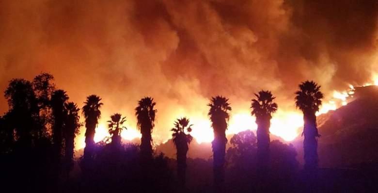
Santa Paula CERT Community Emergency Response Team Santa Paula fire photo posted by the Santa Paula CERT Community Emergency Response Team
Santa Paula, California, a town of about 30,000 people, and other areas of Ventura County were threatened by a fast-moving brush fire on December 4 and 5. The blaze was dubbed the “Thomas Fire.”
State of emergency declared in Ventura County in U.S. state of California, as brush fire explodes to around 45,500 acres, prompts 27,000 people to evacuate

By December 5, the Thomas Fire had burned through 50,000 acres and mandatory evacuations were ordered, according to Cal Fire. By some estimates 26,000 people had evacuated.
The location of the fire was given as “Hwy 150 and Hwy 126, north of Santa Paula.” Heavy winds were growing the fire and threatening a local college.
The #ThomasFire is raging out of control. Viewer Juan Magana sent this photo to our newsroom. Fierce winds are pushing the fire south towards #SantaPaula and the fire is threatening homes!
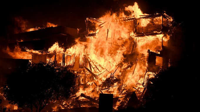
You can see a map below from CalFire for the mandatory evacuations due to the Thomas Fire. CNN reported that thousands of people have been forced to flee their homes because of what the network “called an immense, incredibly fast-moving brush fire pushed by howling Santa Ana winds” that “scorched parts of Ventura County.” CNN reported that some homes were on fire in the City of Ventura.
There are some voluntary evacuations. They are for those “residents in the City of Ventura south of Loma Vista, east of Day Road, West of Victoria Avenue and north of Telegraph Road,” CalFire reports, as well as for “residents in the City of Ventura, east of Victoria north of Loma Vista South of Foothill west of Wells Road.”
The Thomas fire in Ventura has grown to 45,000 acres. There’s a high possibility that even more evacuations could take place.
Live updates: t.co/J30cNxYQ6F


The Ventura County Fire was moving incredibly rapidly. According to CNN, “By early Tuesday (December 5), the fire was burning at a rate of nearly an acre per second. At that speed, it would have covered Manhattan’s Central Park in about 15 minutes.” CalFire lists the following evacuation shelters for what is technically called the Thomas Fire:
Ventura County Fairgrounds at Miners Building (Includes an Animal Shelter for all types of animals.) – 10 W Harbor Blvd, Ventura, CA 93001
Nordhoff High School -1401 Maricopa Hwy, Ojai, CA 93023
Oxnard College Gymnasium – Open 12/5/17, 0700
#ThomasFire [update] Hwy 150 and Hwy 126, north of Santa Paula (Ventura County) is now 50,000 acres. Unified Command: CAL FIRE, VCFD, LosPadresNF and VenturaCityFD t.co/HjNTx55DFr
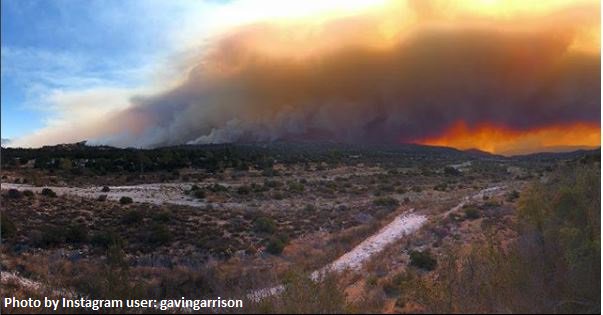
Photos and videos captured the scope of the blaze. Alan Rose, meteorologist for KEYT NewsChannel 3, wrote on Twitter, “The #ThomasFire is raging out of control…Fierce winds are pushing the fire south towards #SantaPaula and the fire is threatening homes!”
Copter 6 & 7 enroute to a large fire in Santa Paula. @VCFD @VCSOVentura @VCSORomanoBassi
The Ventura County Fire Department wrote on Twitter, “#Thomasfire: Due to heavy winds, the fire has grown to approx. 500 acres.” The location of the Thomas Fire was given by CalFire as “Hwy 150 and Hwy 126, north of Santa Paula.”
A few minutes later came the news that the fire had grown to 2,500 acres in a very short time.
Breaking: #ThomasFire has exploded to 2500 acres near Santa Paula in Ventura Co. @Stu_Mundel reporting Thomas Aquinas College evacuating. 150 fwy CLOSED at the 126. #CBSLA
Reporters at the scene described the blaze as “massive.” ABC7 reported on Twitter that the fire had grown to 500 acres and was threatening the community of Santa Paula. According to ABC7, “Firefighters battled a fast-moving brush fire threatening structures along the Santa Paula-Ojai border Monday night” December 4, 2017.
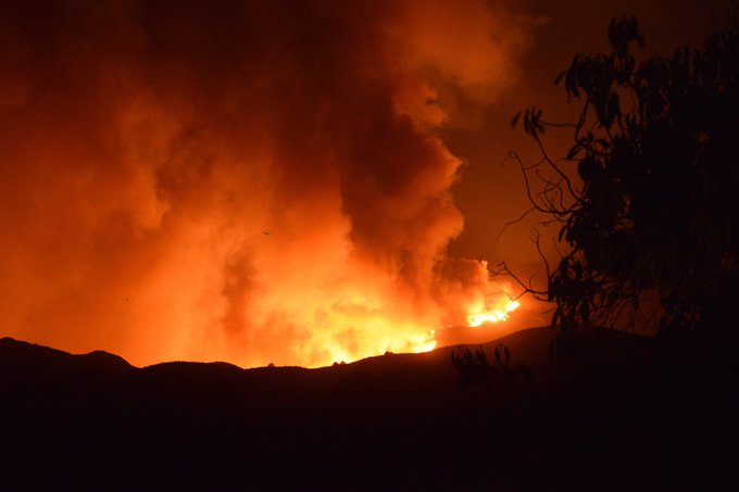
The #ThomasFire is massive.
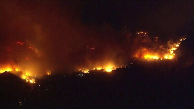


This dramatic photo captures a helicopter navigating over the orange blaze.
Fast-moving brush fire burns 500 acres near Thomas Aquinas College in Santa Paula, triggers evacuations t.co/h2znfxQHTN

KTLA-TV’s helicopter captured images of the fire. “Initial reports indicated the fire, which has been dubbed the Thomas Fire, was about 50 acres and moving at a fast rate of speed as winds as strong as 20 mph whipped through the area. Within an hour, it charred about 500 acres,” ABC 7 reported.
UPDATE: #ThomasFire has grown to about 500 acres as it continues to threaten homes in Santa Paula area
t.co/DMjnUCxz3d

Here’s a map of the fire. The Los Angeles Times reported that the blaze had led to the evacuations of 500 homes, saying it “has burned about 500 acres in the foothills near Thomas Aquinas College in Santa Paula and triggered evacuations.” The fire exploded from 50 to 500 acres in just a short time, the newspaper reported. That took only 30 minutes time, reported Ventura County Star. All students at the college have been removed to a safe location, the newspaper reported. CBS Los Angeles also reported that the college was evacuated.
#Thomasfire plume clearly visible on radar. Heads up in East Ventura/Santa Paula #cawx

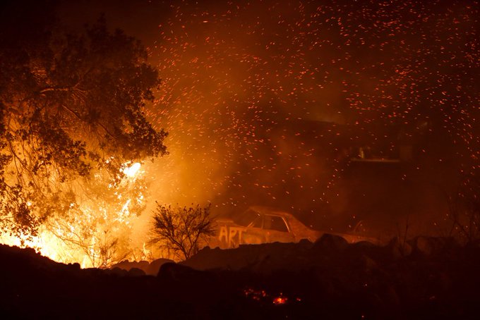
The fire caused an eerie orange glow to emanate from the horizon. KTLA-TV labeled the fire a fast-moving, wind-driven brush fire. According to KTLA, “The Thomas Fire fire ignited above Steckel Park, which is located at 8080 Mistletoe Rd. off of Highway 150.”
According to KTLA, Highway 150 has been shut down in both directions along the Santa Paula and Ojai border, at Stongate Road, according to the California Highway Patrol. Flames appeared to be burning on both sides of the 150, Sky5 aerial video over the scene showed."
The blaze comes as California is still reeling from the massive wildfires that destroyed parts of Santa Rosa and the state’s wine country region. People offered prayers on social media, with one man writing, “Keep the students of Thomas Aquinas College in your prayers as they are being evacuated due to the #ThomasFire #SchoolFire.” Added another, “If you pray, please pray for the folks in the path of this fire and for Thomas Aquinas College. This looks bad.”