
CALFIRE & Google Maps California Fire Maps
A number of fires are growing again in the state of California, after a brief period of calm. One of the most troubling fires right now is the Pawnee Fire. Here is a list, with maps, of the larger fires around the state, their current containment levels, and where they are located. Read on for more details.
General Maps of California Fires
This first map is an interactive map of some of the bigger fires in California right now, provided by CAL FIRE and Google. Fires in red are active and fires in black are contained.
The map above lists 14 active fires, which this article will describe in more detail in the next section. They include the Horse Fire, Flat Fire, Canyon Fire, Creek Fire, Pawnee Fire, Stoll Fire, Lane Fire, Bascom Fire, Yankee Fire, Euclid Fire, Grape Fire, Tumbleweed Fire, Upper Colony Fire, and the Creek Fire.
And here’s another map of wildfires provided by the Bureau of Land Management in California.

6/25 wildfire map of BLM-managed public lands. Follow fire info @inciweb → t.co/IDvGqBylED & @CAL_FIRE → t.co/F2s9h9A5Ld. #PawneeFire #StollFire #CreekFire #BascomFire #LaneFire #SierraFire

List of Active Fires in California as of June 25
Here is a list of the biggest active fires in California as of June 25.
Bascom Fire
This fire is 328 acres and 90 percent contained, almost inactive. It’s located off Bascom Road and Highway 44 in Millville (Shasta County) according to CALFIRE.
Canyon Fire
Canyon Fire (also called the Sardinas Canyon Fire) is 75 acres and burning in steep, rugged terrain. It’s five air miles southeast of Pot Creek in Sardinas Canyon.
Creek Fire
The Creek Fire is 1,300 acres and 30 percent contained, according to CALFIRE. It’s located off Clear Creek Road and American Road, west of Redding in Shasta County.
(Note, CALFIRE also lists another Creek Fire that is just 2.8 acres, located in San Luis Obispo County, at Suey Creek and Crystal Springs Road.)
Euclid Fire
The Euclid Fire is 154 acres and 99 percent contained, according to CALFIRE. It’s off Highway 71 south of Euclid Avenue in Chino (Riverside County.) Although listed as active on the CALFIRE map, this appears to be fully contained.
Flat Fire
#FlatFire is 162 acres and 35% contained. Forward progress has been stopped.
Threats to structures and critical infrastructure has been mitigated.
This fire is 162 acres and 35 percent contained, according to CALFIRE. It’s located off Highway 49 and Marshes Flat Rd. in Moccasin (Tuolumne County.)
Grape Fire
Grape Fire is a wildfire at Black Bennet Road near Grape Creek, eight miles southwest of Burnt Ranch in Humboldt County. It’s 244 acres and the cause is under investigation. The last update for this fire was June 20.
Horse Fire
This fire is 80 acres and 80 percent contained. It’s located off Horseshoe Road and Stagecoach Drive near Copperopolis in Calaveras County, according to CALFIRE.
Lane Fire
Lane Fire is 3,000 acres and 20 percent contained. It’s off Highway 36 in Paynes Creek, in Tehama County. Evacuations were ordered in the community of Ponderosa Sky Ranch and Paynes Creek in the following locations:
- South of Highway 36
- North of Plum Creek Road
- West of Little Giant Mill
- East of Paynes Creek / Plum Creek Road
Here’s a map:
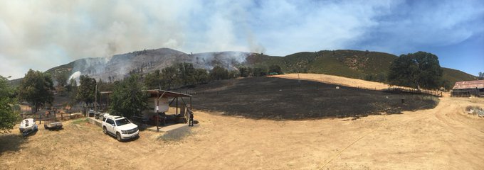
Pawnee Fire
Pawnee Fire is the largest active fire as of the time of publication. It’s 8,200 acres and located off Pawnee Road and New Long Valley in Lake County, northeast of Clearlake Oaks, according to CALFIRE. About 600 structures are threatened from this fire and 22 structures have been destroyed.
While there was expansion of the #PawneeFire over night, the spread was slower. The Fire has now reached 8,200 acres. Firefighters have dug in and are working the blaze hard. Air attack operations will continue throughout the day today. The latest Fire map is below.

According to CALFIRE, mandatory evacuation are in effect for the Spring Valley community. This includes “all roads accessed off of Old Long Valley Road and New Long Valley Road, north of Highway 20. Also, includes Mule Skinner, Long Branch, Watertrough Rd, Flintlock, Muzzleloader, No Guns, Antelope, Cougar, Marianne, Ramrod, and Moccasin.”
Stoll Fire
Stoll Fire is 300 acres and 60 percent contained, according to CALFIRE. It’s located off Stoll Rd. and Baker Rd. in Tehama County, west of Red Bluff.
Tumbleweed Fire
The Tumbleweed Fire is off Highway 395 southeast of Litchfield, east of Susanville, in Lassen County, per CALFIRE. It’s not clear what the current status is for this fire. It’s listed as active on the CALFIRE map but we haven’t seen any updates on it since mid-June.
Upper Colony Fire
This fire was located off Upper Colony Road, Smith Valley, east of Highway 395 in Nevada (Lyon County.) The last update was on June 22 when it was 84 percent contained at 1,202 acres. Although the fire is still listed as active on the CALFIRE map, it’s actually fully contained.
#UpperColonyFire Stats Final Update
1,202 Acres
Personnel: 257
Percent Contained: 100%
Contained: 23 June 2018
Structures Destroyed: 0
Command was passed from Sierra Front Team 2 back to Carson City BLM.
Great Job Folks!
Yankee Fire
Yankee Fire is a 100 acre fire off E. Perimeter Road at the Camp Roberts Military Reservation in San Luis Obispo County.