NIFC Oregon and Washington Fire near me
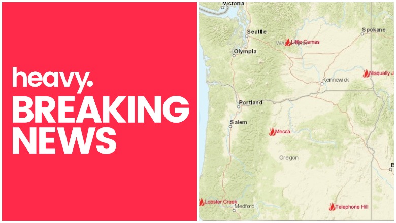
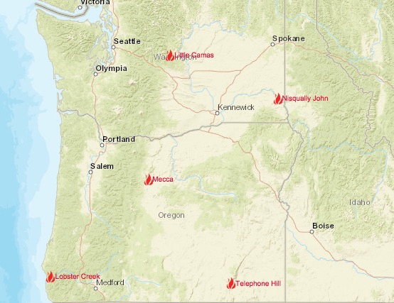
Oregon and Washington are not suffering nearly the fire issues that are seen in other states right now. But the hot summer conditions mean that you should keep a close eye on what’s happening. Right now, there are four active fires in Oregon for a total of 118,446 acres, plus one fire in California that is very close to the border with Oregon. There are also two active fires in Washington.
NIFC.govOregon Fire Map
You can see an interactive map of the Oregon fires here, provided by Oregon.gov, or view an interactive map from NIFC.gov here. Another interactive map is here.
Boxcar Fire
This Oregon fire is 100,207 acres and 90 percent contained. It’s one mile southeast of Maupin. However, Inciweb no longer has this fire listed as active, so it looks like it’s been fully contained.
Jack Knife Fire
This Oregon fire is 15,676 acres and 90 percent contained. It’s 11 miles southeast of Grass Valley. However, Inciweb no longer has this fire listed as active, so it looks like it’s been fully contained.
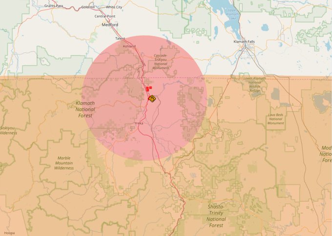
Klamathon Fire
7/6 Friday #KlamathonFire, CA. Map shows latest satellite hotspot data. MODIS (red triangle), VIIRS (orange square). Open online map: t.co/fNhh7dPcTD Want map legend? Want to learn about hotspot data? Need help? Open the map then click “Map tips”. #GeoSpatial
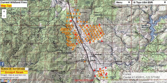
This fire is off Klamathon Road and Copco Road in California, south of Hornbrook (Siskiyou County.) It’s now 9,600 acres and 5 percent contained. Fifteen structures have been destroyed. Evacuations are in effect for this fire, and an evacuation shelter is open at Jackson Street School. A large animal shelter is at Siskiyou Fairgrounds. This fire is near the Oregon border.
State of emergency and evacuations near the California and Oregon border due to wildfire – United States. A3M #GlobalMonitoring Blog ->
t.co/a9eeiK8weJ #KlamathonFire #TravelAlert
For more details on this fire, see Heavy’s story about the California fires here.
Little Camas
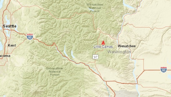
ArcGISLittle Camas Fire map
This Washington fire is 400 acres and 1 percent contained. It’s located six miles southwest of Cashmere. Visit this map to zoom in and learn more about the fire. The cause of this fire is still under investigation. According to NIFC.gov, “The Camas Meadows Bible Camp and three adjacent homes are currently under a level 1 evacuation notice. Due to fire activity in the area, Forest Service Trail Red Hill #1223 and Tronsen Ridge Trail #1204 from Ruby Creek Trail to the 5 Miles Road junction are closed to public access. The remainder of the area is open.”
The coordinates for the fire are 47.424 latitude, -120.561 longitude.
Lobster Creek Fire
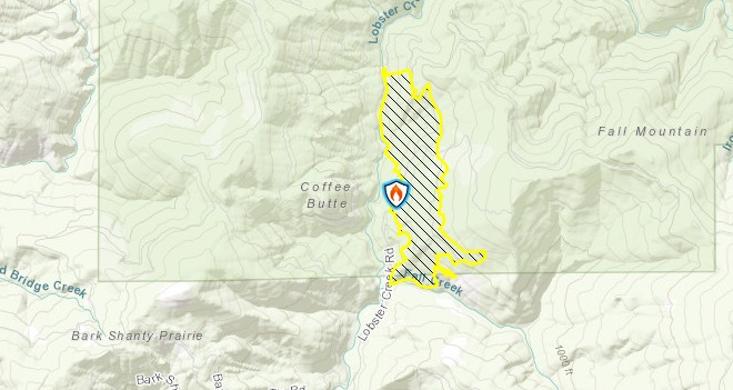
InciwebLobster Creek Fire
This Oregon fire is 397 acres and 55 percent contained. It’s located 10 miles east of Gold Beach. The exact location is at 42.591 latitude, -124.254 longitude. The fire is currently shrinking. The fire’s cause is under investigation.
Nisqually John Fire

ArcGISNisqually John map
This Washington fire is 1,500 acres, 11 miles northwest of Clarkston, Washington. It’s 30 percent contained. Visit this map to zoom in and learn more about the fire. The cause is under investigation.
Telephone Hill Fire
This Oregon fire is 2,166 acres and 0 percent contained. It’s located 15 miles north of Fields. The cause is under investigation.