Go to main menu
Go to search form
Heavy
Sports
Alerts
Hi,
Subscriber
Search
Sports
News, stats, rumors, predictions and roster moves around the NFL, NBA, MLB, NHL and more.
More From Sports
Portugal vs Uzbekistan Results Today: FIFA World Cup 2026 Live Score, Updates, Stats
1 minute ago
Houston Astros Announce Release Of Player During Blue Jays Series
22 seconds ago
Who Are the Best Players on Portugal’s 2026 World Cup Squad?
4 minutes ago
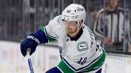
2 Canucks Star Forwards Land On Latest NHL Trade Board
4 minutes ago
Nikola Jokic Offers Brutally Honest Take on Denver Nuggets’ Early Playoff Exit
8 minutes ago
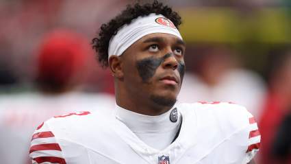
Steelers Given Aaron Rodgers Succession Plan in 49ers QB Trade Idea
11 minutes ago
Oilers Panic Now Official with Babcock Hire
14 minutes ago
Broncos’ 2-Time NFL All-Pro ‘Irritated’ With Lack of Touches
16 minutes ago
Denny Hamlin Not Buying NASCAR 100 Starts Notion: ‘For Losers’
17 minutes ago
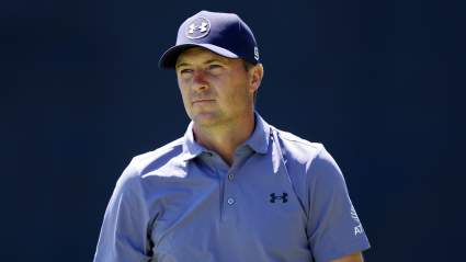
Concerning News Emerges on Jordan Spieth After US Open
18 minutes ago
Bulls Get Intriguing Message About Possible Nic Claxton, Caleb Wilson Duo
22 minutes ago
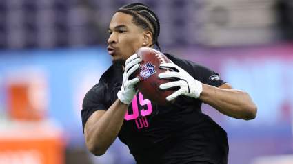
Insider Shares Details of Fernando Mendoza’s Chances of Starting Week 1 for Raiders
23 minutes ago
Bengals’ Joe Burrow Draws Bold MVP Prediction for 2026 Campaign
24 minutes ago
Spurs Have New Jaylen Brown Trade Opening After Celtics’ Failed Giannis Push
19 minutes ago
Ottawa Senators Targeting Former No. 1 Pick as Brady Tkachuk Replacement
28 minutes ago
Blazers Hire New Head Coach Micah Nori to Lame-Duck Contract
31 minutes ago
Buffalo Bills Legend Jim Kelly Reveals Health Update After Stroke
35 minutes ago
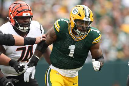
Packers Star Micah Parsons Receives Clear Shade From Cowboys Legend
38 minutes ago
Former UFC Champ Admits to Scripting Viral Clip With Alex Pereira
40 minutes ago
One NASCAR 2026 Winner Is About to Miss the Playoffs. Here’s Why.
40 minutes ago
Oilers Interested in Landing $25 Million Star Defenseman
46 minutes ago
Bills Release 5-foot-6 Rookie RB With Injury Designation After Minicamp
48 minutes ago
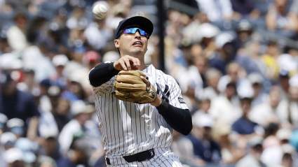
Yankees Make Anthony Volpe Decision Ahead of Tigers Game
19 minutes ago
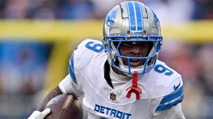
Lions’ Jameson Williams Makes His Feelings Clear on Life After NFL
48 minutes ago
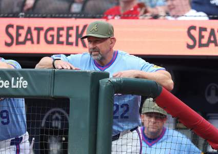
Braves Trade Pitch Lands Pirates’ $77 Million All-Star Starter in Atlanta
32 minutes ago
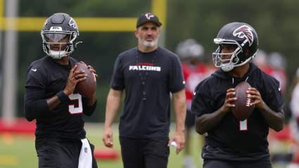
Falcons Give Key Update on Quarterback Competition After Minicamp
53 minutes ago
Cowboys’ ‘Under the Radar’ Trade Addition Predicted to Play Major Role
14 minutes ago
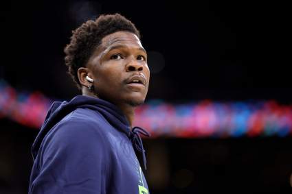
Anthony Edwards Trade Rumors Get Update from Timberwolves Reporter
16 minutes ago
Steelers Rookie Named ‘Biggest Surprise’ After Holding His Own Against DK Metcalf
56 minutes ago
Miami Heat’s 23-Year-Old Vet Tabbed As NBA Trade Candidate
57 minutes ago
More from Sports
Load More Sports ↓
Close sidebar
Home
NFL
Expand sub-menu
Arizona Cardinals
Atlanta Falcons
Baltimore Ravens
Buffalo Bills
Carolina Panthers
Cincinnati Bengals
Cleveland Browns
Chicago Bears
Dallas Cowboys
Denver Broncos
Detroit Lions
Green Bay Packers
Houston Texans
Indianapolis Colts
Jacksonville Jaguars
Kansas City Chiefs
Los Angeles Chargers
Los Angeles Rams
Las Vegas Raiders
Miami Dolphins
Minnesota Vikings
New England Patriots
New Orleans Saints
New York Giants
New York Jets
Philadelphia Eagles
Pittsburgh Steelers
San Francisco 49ers
Seattle Seahawks
Tampa Bay Buccaneers
Tennessee Titans
Washington Commanders
NBA
Expand sub-menu
Atlanta Hawks
Boston Celtics
Brooklyn Nets
Charlotte Hornets
Chicago Bulls
Cleveland Cavaliers
Dallas Mavericks
Denver Nuggets
Detroit Pistons
Golden State Warriors
Houston Rockets
Indiana Pacers
Los Angeles Clippers
Los Angeles Lakers
Memphis Grizzlies
Miami Heat
Milwaukee Bucks
Minnesota Timberwolves
New Orleans Pelicans
New York Knicks
Oklahoma City Thunder
Orlando Magic
Philadelphia 76ers
Phoenix Suns
Portland Trail Blazers
Sacramento Kings
San Antonio Spurs
Toronto Raptors
Utah Jazz
Washington Wizards
MLB
Expand sub-menu
Arizona Diamondbacks
Athletics
Atlanta Braves
Baltimore Orioles
Boston Red Sox
Chicago Cubs
Chicago White Sox
Cincinnati Reds
Cleveland Guardians
Colorado Rockies
Detroit Tigers
Houston Astros
Kansas City Royals
Los Angeles Angels
Los Angeles Dodgers
Miami Marlins
Milwaukee Brewers
Minnesota Twins
New York Mets
New York Yankees
Philadelphia Phillies
Pittsburgh Pirates
San Diego Padres
San Francisco Giants
Seattle Mariners
St. Louis Cardinals
Tampa Bay Rays
Texas Rangers
Toronto Blue Jays
Washington Nationals
NHL
Expand sub-menu
Anaheim Ducks
Boston Bruins
Buffalo Sabres
Calgary Flames
Carolina Hurricanes
Chicago Blackhawks
Colorado Avalanche
Columbus Blue Jackets
Dallas Stars
Detroit Red Wings
Edmonton Oilers
Florida Panthers
Los Angeles Kings
Minnesota Wild
Montreal Canadiens
Nashville Predators
New Jersey Devils
New York Islanders
New York Rangers
Ottawa Senators
Philadelphia Flyers
Pittsburgh Penguins
San Jose Sharks
Seattle Kraken
St. Louis Blues
Tampa Bay Lightning
Toronto Maple Leafs
Utah Mammoth
Vancouver Canucks
Vegas Golden Knights
Washington Capitals
Winnipeg Jets
More Sports
Expand sub-menu
College Basketball
College Football
Cricket
Formula 1
Golf
NASCAR
UFC
WNBA
Olympics
Pro Wrestling
Heavy on Soccer
Tennis