Getty There was a tornado warning in Washington DC but it's now expired.
Washington D.C., Arlington, Virginia, and Hyattsville, Maryland were under a tornado warning for a time on May 23, 2019, but that warning has now expired. The weather forecast for the Washington D.C. area is now a severe thunderstorm watch through 8 p.m. Thursday evening with wind and hail possible threats.
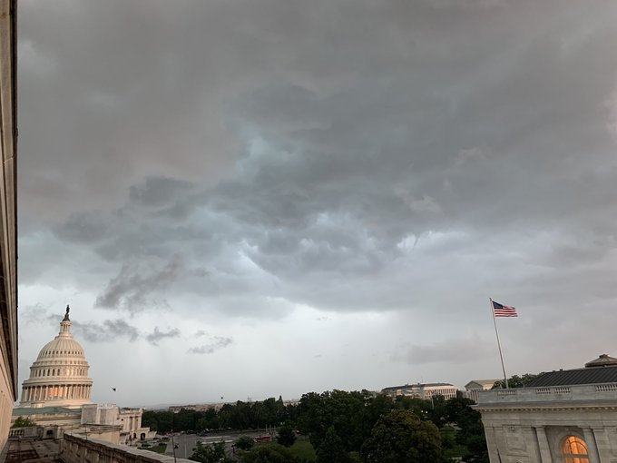
Capitol Cam timelapse from the Washington DC Tornado Warning. Some funnel-looking scud at the beginning then the cam glitched before scud disappeared.

You can see the weather forecast for Washington D.C. here and below, as well as updated warnings and radar. The scare in DC came after tornadoes swept through the State of Missouri the day before, causing severe damage to Jefferson City. There were some scary moments at the U.S. Capitol earlier Thursday as the bad weather loomed and a tornado seemed possible in DC (but didn’t materialize). NWS also posts frequent area weather updates on its Twitter account, which you can find here. See updated radar here.
Tornado warning canceled in Washington DC area:
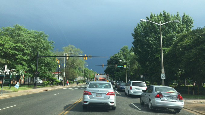
This was my view from Dupont Circle as the center of the storm passed through DC
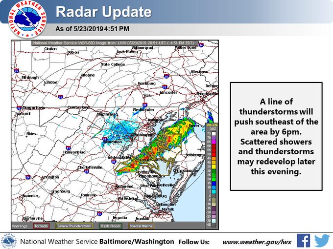
This is how the tornado warning looked when it was issued by the National Weather Service. It expired at 4:15 p.m. without sight of an actual tornado:
Tornado Warning including Washington DC, Arlington VA, Hyattsville MD until 4:15 PM EDT

The severe weather threat later started to diminish.
This afternoon’s severe weather threat diminishing. Skies clearing out for the early evening. A chance of showers and thunderstorms lingers later tonight.
Here’s what you need to know:
People Were Urged to Seek Shelter at the U.S. Capitol
@capitalweather @wtop @WTOPtraffic power and traffic signals out In Arlandria.
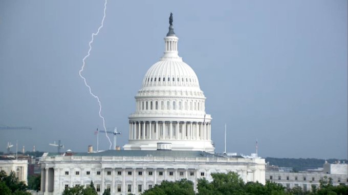
A lightning strike was reported at the Capitol, where alerts went off to warn staff and visitors to seek shelter. According to WTOP-TV, at 3:46 p.m., the National Weather Service said a possible tornado-producing thunderstorm was looming “over the U.S. Capitol, or over Nationals Park.” Downed power lines and high waters were reported.
Lightning strike near the US Capitol in Washington DC #nbc4ny @StormTeam4NY @NBCNewYork @nbclocaldc
There were also reports of fallen trees.
You can check flight information at Reagan Airport here.
Pictures of the tornado-warned storm that moved over the U.S. Capitol this afternoon. #DCwx #tornadowarning

As of 4:30 p.m., the latest hazardous weather outlook from the National Weather Service’s Baltimore, Maryland and Washington DC office read as follows:
“Chesapeake Bay north of Pooles Island MD-
Chesapeake Bay from Pooles Island to Sandy Point MD-
Chesapeake Bay from Sandy Point to North Beach MD-
Chesapeake Bay from North Beach to Drum Point MD-
Chesapeake Bay from Drum Point MD to Smith Point VA-
Tidal Potomac from Key Bridge to Indian Head MD-
Tidal Potomac from Indian Head to Cobb Island MD-
Tidal Potomac from Cobb Island MD to Smith Point VA-
Patapsco River including Baltimore Harbor-
Chester River to Queenstown MD-Eastern Bay-
Choptank River to Cambridge MD and the Little Choptank River-
Patuxent River to Broomes Island MD-
Tangier Sound and the inland waters surrounding Bloodsworth
Island-District of Columbia-Southern Baltimore-Prince Georges-
Anne Arundel-Charles-St. Marys-Calvert-Southeast Harford-
Prince William/Manassas/Manassas Park-Fairfax-
Arlington/Falls Church/Alexandria-Stafford-Spotsylvania-
King George-
104 PM EDT Thu May 23 2019
This Hazardous Weather Outlook is for the Maryland portion of the Chesapeake Bay, Tidal Potomac River, and adjacent counties in central Maryland and northern Virginia as well as the District of Columbia.
.DAY ONE…This Afternoon and Tonight
A Severe Thunderstorm Watch is in effect until 8 pm this evening. Isolated to scattered severe thunderstorms are possible this afternoon and evening. Locally damaging winds and large hail are the primary threats, but an isolated tornado cannot be ruled out as well.
.DAYS TWO THROUGH SEVEN…Friday through Wednesday
No hazardous weather is expected at this time.
.SPOTTER INFORMATION STATEMENT…
Spotter activation may be needed this afternoon and evening.”