Twitter/BLM Arizona Fire White Wing Fire
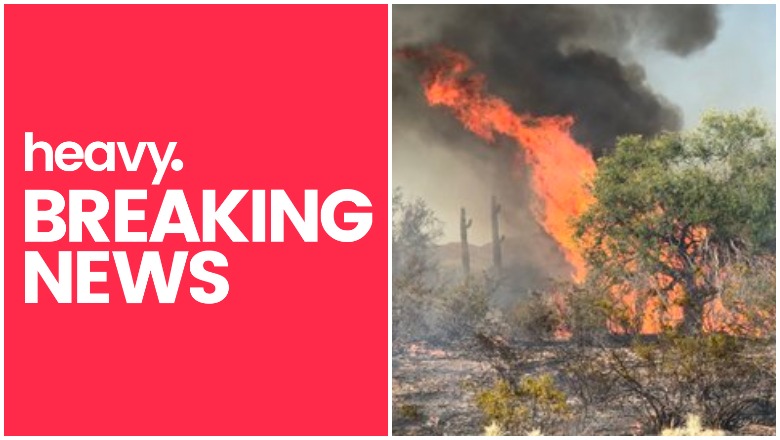
The White Wing fire is the largest fire burning in Arizona currently, located just northwest of Phoenix. Read on for more details about the fire, including photos and maps of its location.
The fire is now about 1,200 acres in size as of Thursday evening, AZ Central shared.

Arizona State ForestryWhite Wing Fire
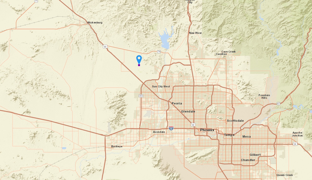
It’s located west of Wittmann and started out at about 60 acres before exploding in size. It’s burning south of State Route 74 and moving north. In the interactive map below, the purple dot indicates the approximate location of the White Wing Fire, provided by NWCG.gov.
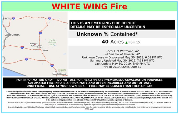
Here’s a screenshot in case the embed above doesn’t work. Note that although the map above shows the approximate location of the fire, the acreage size tends to be outdated. (At the time of publication, it showed the acreage as 40 acres when the fire was actually 1,200 acres in size.)
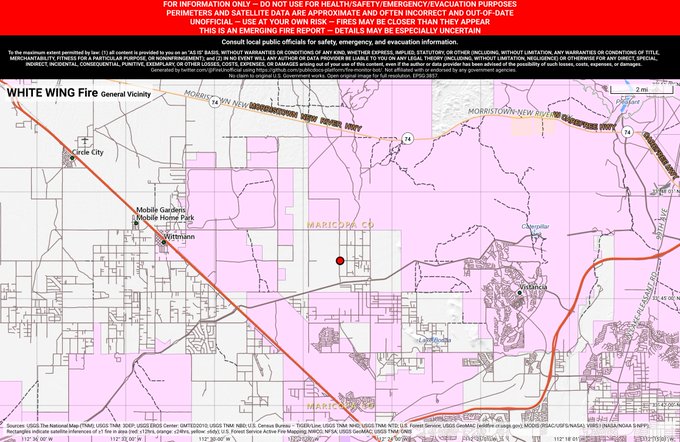
White Wing Fire
Here’s another look at the approximate location of the fire.
#WhiteWingFire 🔥 discovered May 30, 2019, 6:09 PM UTC – unofficial report.
#MaricopaCounty @AZStateForestry; ~5mi E of Wittmann, AZ. ~23mi NW of Phoenix, AZ. See officials for safety info. May be incorrect; disclaimers in images.
So far no evacuations have been issued or road closures. A carpet of dry grass and weeds helps the fire grow.
BLM resources have arrived on scene at the #WhiteWingFire. Multiple resources on scene. Fire being carried by continuous “carpet” of dry grass/weeds. Resources using fire to burn fuels ahead of the fire to reduce fire intensity and build containment around perimeter. #AZFire


The fire grew rapidly today, but higher humidity and lower winds are expected to help decrease fire activity in the coming days.
Arizona State Forestry
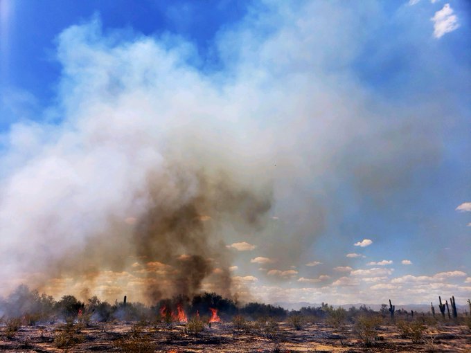
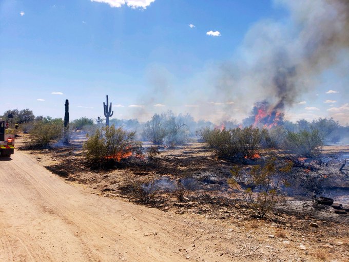
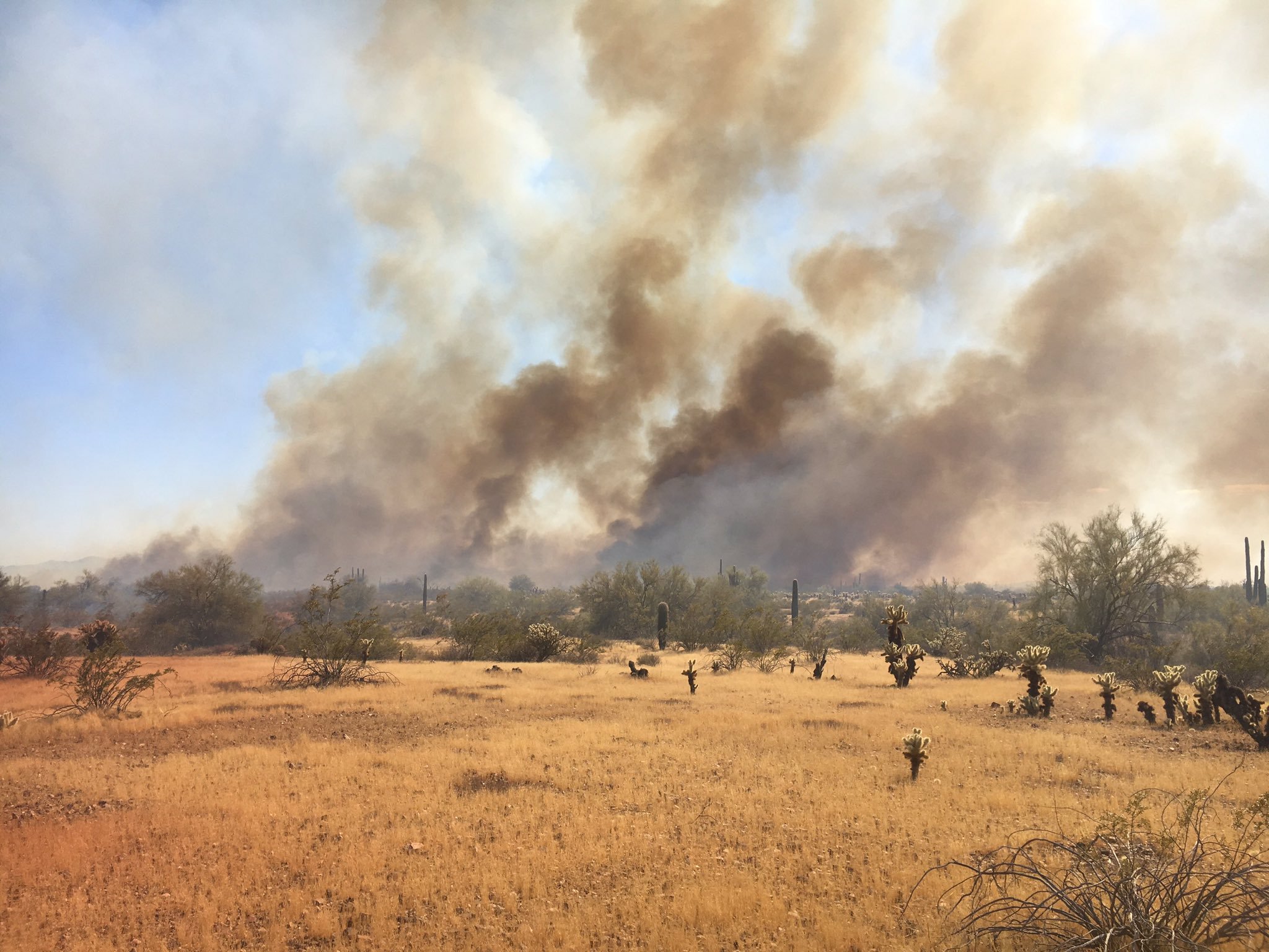
Here are more photos of the fire:
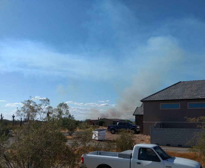
The #WhiteWingFire north of me an hour ago vs 10 minutes ago. Our 3rd fire up here in a week – and the 5th in 6 weeks.

More photos from @azstateforestry and @BLMAZFire of the #WhiteWingFire burning east of Wittmann:


To stay updated on the fire, follow the AZ State Forestry on Twitter or BLM Arizona Fire.
This is a developing story.
READ NEXT: Maps of Arizona Fires Near Me