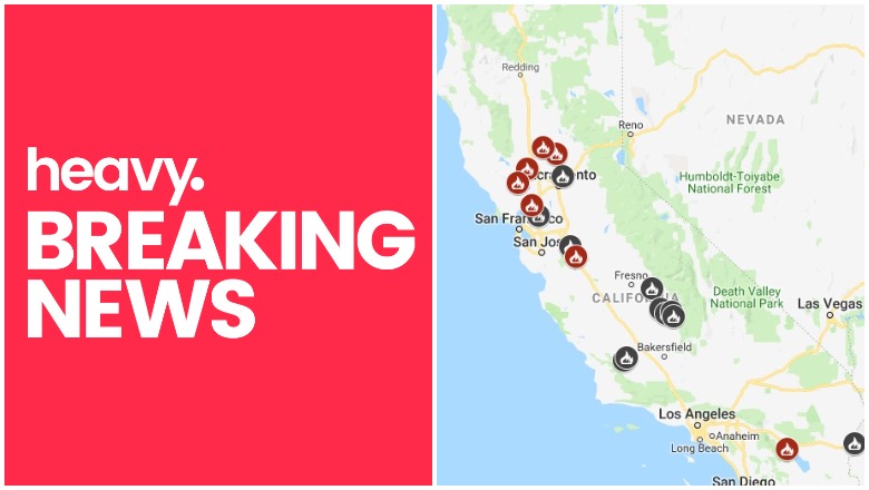
Cal Fire California Fire Map
With red flag conditions especially favorable for fires in California right now, PG&E announced that they will cut electricity during certain times this weekend for places particularly at high risk, affecting at least 27,000 customers. So where are any fires currently in California? Read on for more details about fires around the state. News on the fires is constantly changing, so keep an eye on your local news too.
For the most updated story about California fires, see Heavy’s new article for June 10 here.
This article first includes interactive maps for all of California. Then the second section details specific fires in the region. If you’re looking for a specific fire scroll down or search for the fire’s name or your city’s name.
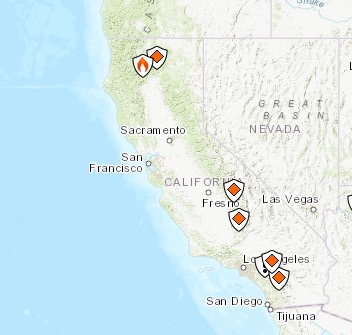
Interactive Map of California Fires
This map below is an interactive map of the more significant fires in California, consistently updated and provided by CAL FIRE and Google. Fires in red are active and fires in black are contained. If the map doesn’t show below, just go here.
Here’s Inciweb’s map. See the full map here.
Inciweb
Next are more specific details on the fires for June 8, 2019. If you are looking for a specific fire, search for the name so you can find it faster, or just scroll down and look at the fires, listed in alphabetical order.
List of Active Fires in California
Here are the active fires and updates about them. Most of these are in alphabetical order, except the Los Angeles fire which is listed first.
66 Fire
The 66 Fire is off Avenue 66 in Thermal in Riverside County. It’s 77 acres as of the end of May. It was first reported on May 29 and was 75 percent contained as of May 30. Forward progression was stopped. On May 31 the fire was transitioned to the Bureau of Indian Affairs.
Bluff Mesa Prescribed Burn
Listed on Inciweb, this is a prescribed fire to help prevent wildfires from getting out of control.
Boulder Fire
#RT @CAL_FIRE: #BoulderFire off Highway 58 and Boulder Creek Road, California Valley in San Luis Obispo County is 1,127 acres and 100% contained. t.co/1UlN4KoCbQ
This fire is listed on NIFC and is 42 miles east of San Luis Obispo. It’s 750 acres and 60 percent contained. (Note: Cal Fire lists this as 1,127 acres and 100 percent contained, which is slightly different than NIFC’s listing.)
Cedar Central Prescribed Burn
Listed on Inciweb, this is a prescribed fire to help prevent wildfires from getting out of control.
Ink Fire
Listed by Cal Fire, this fire is off Pope Valley Road northeast of Calistoga in Napa County. It’s 25 acres and 60 percent contained, with forward spread stopped.
Kern River Ranger District Prescribed Burn
Listed on Inciweb, this is a prescribed fire to help prevent wildfires from getting out of control.
Levee Fire
#RT @CAL_FIRE: New Incident: #LeveeFire off Highway 20 & E 22nd Street, Marysville in Yuba County. Lead agency: @MarysvilleFire

Listed by Cal Fire, this is off Highway 20 and E 22nd Street in Marysville in Yuba County. About seven to eight homes have been evacuated along Simpson Lane and Levee Road, CBS reported.
To stay updated on this fire, you can listen to the Yuba City and Sutter Counties Fire Dispatch or follow on the Yuba County Wildfire Incidents Facebook page.
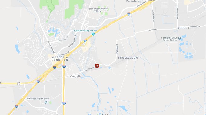
Nelson Fire
#NelsonFire off Cordelia Rd and Link Rd in Fairfield. Burned 25 acres. No reported injuries. @kron4news
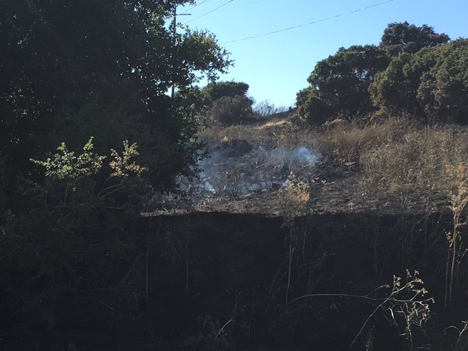


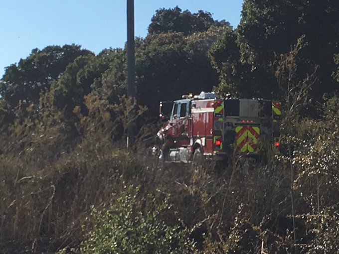
This fire is off Cordelia Road and Link Road in Fairfield in Solano County. It’s 25 acres and 50 percent contained. Here’s the location on a map:
#RT @CAL_FIRE: New Incident: #NelsonFire off of Cordelia Road and Link Road in Fairfield in Solano County is 25 acres and 50% contained. Lead agency: @Fairfieldfire.
Sand Fire
Sand Fire ignites in Rumsey, Yolo County, grows to 125 acres | The Sacramento Bee @farmfreshtoyou 🙏All be safe. We see the smoke. #SandFire #InkFire #YoloCountyFire #LakeCountyFire t.co/LYScz81BYp
Listed by Cal Fire, this fire is off County Road 41 and Highway 16 in Rumsey in western Yolo County. It was 100 acres but has since grown to 125 acres and is threatening some structures, Sacbee reported. It was first reported Saturday at 2:37 p.m. North winds are helping the fire grow. Highway 16 at Guinda was closed off because of the flames.
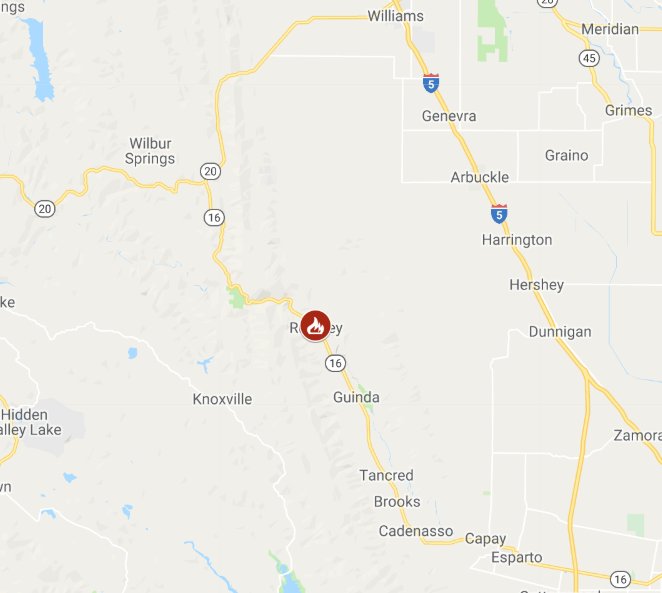
The cause is unknown. It’s several miles north of areas where PG&E shut down power earlier on Saturday. Some mandatory evacuations are in place along Highway 16, including some homes near where the fire started on County Road 41 and some homes north of County Road 45, Sacbee noted.
An evacuation center is at the Boy Scouts Cabin in Esparto at 16980 Yolo Ave.
Shasta Trinity Prescribed Fire
Listed on Inciweb, this is a prescribed fire to help prevent wildfires from getting out of control.
SHF Lightning Fires 2019
A series of small forest fires have ignited in the Shasta-Trinity National Forest area, caused by lightning. Here’s the incident list from Inciweb:
- 06/04/2019 15:13 PORTER Lat, Lon – 41 3.876, -122 38.454 Geographic – S of Bonanza King north of Trinity Lake, 3 acres, Controlled 06/06/19 1450
- 06/03/2019 17:42 GROUSE Lat,Lon – 40 24.882, -123 22.068 Geographic – NW of Forest Glen on the Trinity River Management Unit, .25 acreage, Declared out 06/05/19 0856
- 06/03/2019 17:24 DEVIL Lat,Lon – 40 18.888, -123 17.484 Geographic NW of Horse Ridge on the Trinity River Management Unit, 0.10 acres, Controlled 06/06/19 1422
- 06/03/2019 14:48 PICKETT Lat,Lon – 40 21.486, -123 23.172 Geographic SW of Forest Glen on the Trinity River Management Unit, .34 acreage, Declared out on 06/05/19 at 1230
- 06/02/2019 16:44 RUSH Lat,Lon 40 49.596, -122 51.330, Geographic between Tannery Gulch and Hwy 3 on the Trinity River Management Unit, 01 acreage, Contained 06/03/19 2132
Stuhr Fire
#StuhrFire 🔥 unofficial update: 600 Acres. 75% Contained*.
#StanislausCounty Santa Clara Unit; Near Newman, CA. ~39mi E of San Jose, CA. See officials for safety info. May be incorrect; disclaimers in images.
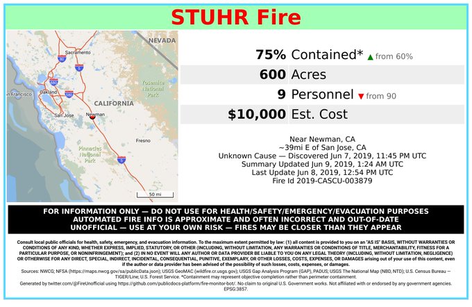
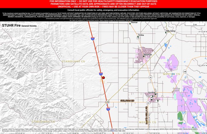
This fire, listed by Cal Fire, is off Interstate 5 and Pete Miller Road. It’s southwest of Newman in Stanislaus County and is 600 acres. It’s 75 percent contained. Updates can be found on the Stanislaus County Wildfire Incidents Facebook page.
Thomas Mountain Prescribed Burn
Listed on Inciweb, this is a prescribed fire to help prevent wildfires from getting out of control.
West Butte Fire
#RT @CAL_FIRE: New Incident: #WestButteFire off North Butte Rd & West Butte Rd, northeast of Colusa in Sutter County. Lead agency: Sutter County Fire Department
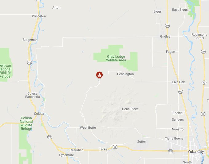
Listed on the Cal Fire map, this fire is off North Butte Road and West Butte Road, northeast of Colusa in Sutter County. It’s a new fire as of June 8, 2019. Follow the Sutter County Facebook page for updates.
This is a developing story.