Inciweb
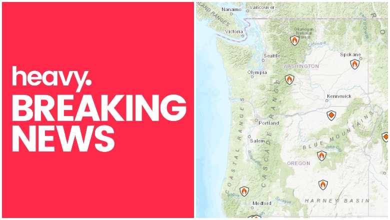
Fires continue to cause issues during the hot, dry summer months in Oregon and Washington. Here are the details about the latest fire and red flag warning information for the states as of July 28, 2019, including the growing Milepost 97 fire. Read on for the latest details about the wildfires’ locations, containment, evacuations, and more for July 28. Remember to also check your local news sources, as fire details can change quickly and with little warning.
Interactive Fire Maps for Oregon & Washington
A great way to keep track of fire activity is by looking at interactive maps. You can see an interactive map of the Oregon and Washington fires here, provided by Oregon.gov, or view details from NIFC.gov here. The same interactive fire map for the two states is also embedded below:
Here’s another real-time fire map via Public RAPTOR for the Oregon area:

You can see Inciweb reported fires in the interactive map below or here. You may need to zoom into the map below to see the fires using the + button within the map, depending on your browser. You may also need to go to the Legend’s Layers Tab and unclick public alerts, traffic condition, and California wildfires, only clicking Inciweb Wildfire Information to see the Oregon and Washington fires.
Red Flag Warnings for Oregon & Washington
Here are current red flag warnings in Washington, provided by MappingSupport.com. You may need to zoom out or zoom in to get more details on the ones issued near your area.
You can also see weather warnings and Inciweb fire notices in Washington and Oregon in Google’s Crisis map at this link or in the map below. Depending on your browser, you may need to click the + sign to zoom into your region.
Here are details on the individual fires for July 28, 2019. Oregon fires are listed first, followed by Washington fires.
Oregon Fires
2019 Umatilla NF Prescribed Fire
These are fires purposefully set by officials in order to mitigate wildfire damage in the future.
Blue Ridge Fire
This fire grew to 667 acres but is now 100 percent contained. It is still listed as active on Inciweb’s map.
Douglas District Fires
The Douglas Forest Protective Association is a good resource for fire updates in the Douglas District. A fire was reported on July 28 near Division Street and South Myrtle Road outside of Myrtle Creek.
Residents are asked to avoid the area.
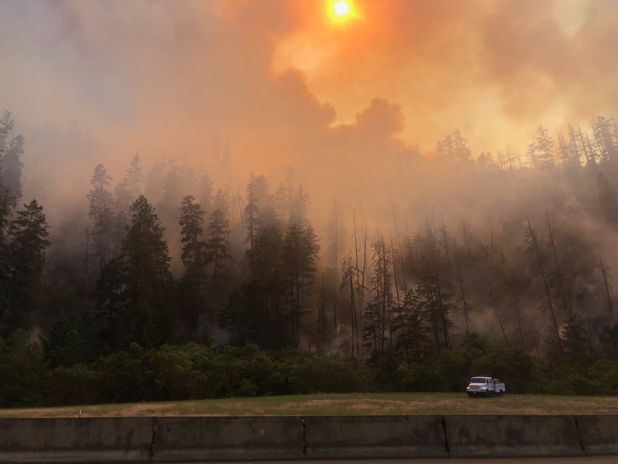
Milepost 97 Fire (MP 97)
Douglas Forest Protective AssociationMilepost 97 fire
This fire is much newer and was just reported on Wednesday evening. The Douglas Forest Protective Association is providing updates about the fire on Facebook. It started about one mile southeast of Canyonville, near milepost 97 on I-5, southbound. It was 1/2 acre when first reported but it is now 8,878 acres as of July 28, according to Inciweb, but other sources place it now at closer to 11,000 acres, according to Oregon Live.
Here’s an interactive map of the Milepost 97 fire, courtesy of MappingSupport.com:
Crews are fighting the blaze from all angles but are focusing on I-5 so it doesn’t cross the freeway. I-5 southbound traffic near Canyonville is down to one lane, Oregon Live noted.
The fire was likely caused by an illegal campfire, officials said.
A Level 2 “get set” order is in place for some areas, and officials are having a community meeting at 7 p.m. on Sunday, July 28, at Glendale High School.
If an evacuation is issued, crews will go door-to-door and let residents know. You can register for alerts here.
Douglas Forest Protective Association also adds updates on Facebook from time to time.
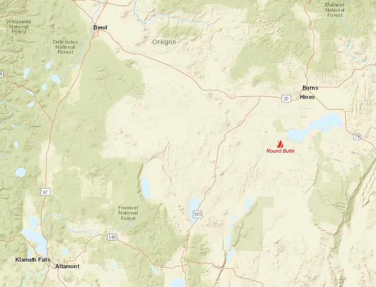
Round Butte Fire
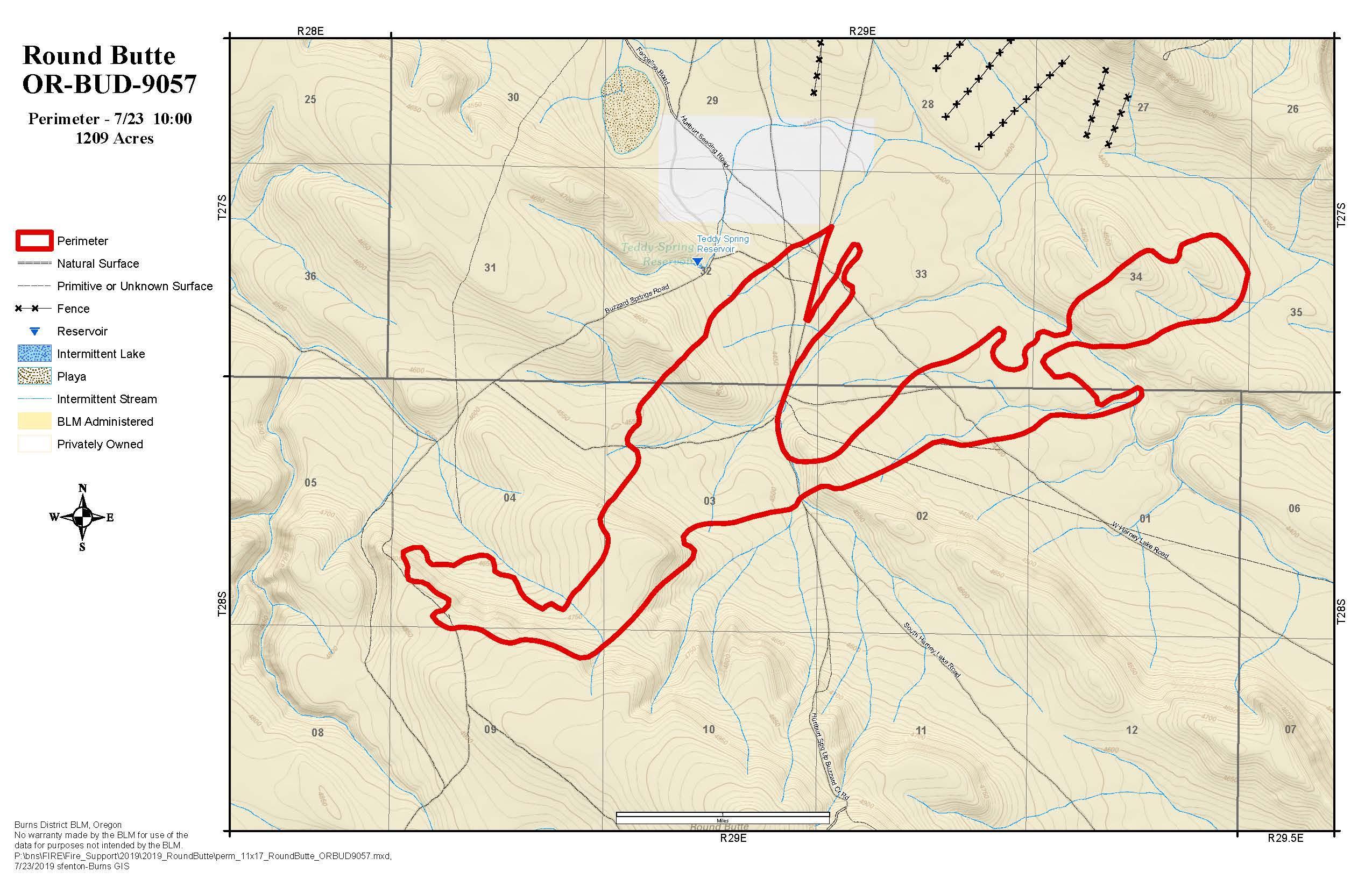
Round Butte Fire Map
This fire was reported on July 22, 2019 and is 85 percent contained as of July 25, the latest update from Inciweb. It’s 30 miles south of Burns, Oregon and nine miles south of Double O Station. It is 1,209 acres in size.
NIFC.govRound Butte FIre
It was caused by lightning. No residences are threatened.
Washington Fires
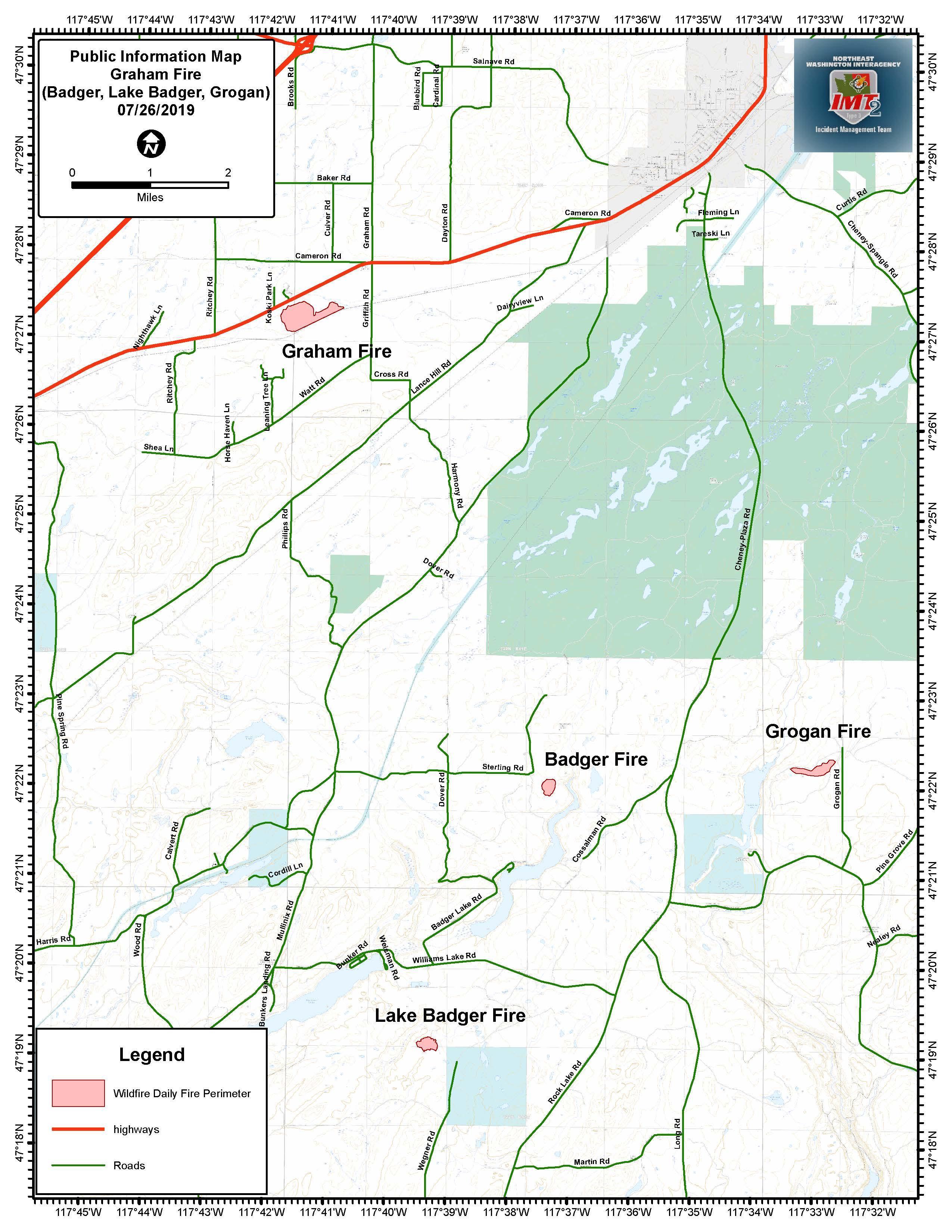
Cheney Complex Fire

Inciweb
The Cheney Complex Fire was actually four separate fires near Cheney, Washington, Inciweb reported. The named fires are: Graham, Badger, Lake Badger, and Grogan. They started the afternoon of July 24.
Cheney Complex Fire fully contained, local districts to take over for final days
The complex fire has been fully contained and crews will monitor the fires over the coming days, KREM 2 News reported.
Desert Canyon Fire

NIFC
This fire was discovered on July 23, NIFC reports. The fire is eight miles northwest of Orondo, Washington. The fire’s moving northeast in the direction of Browns Canyon Road. The fire is now 100 percent contained.
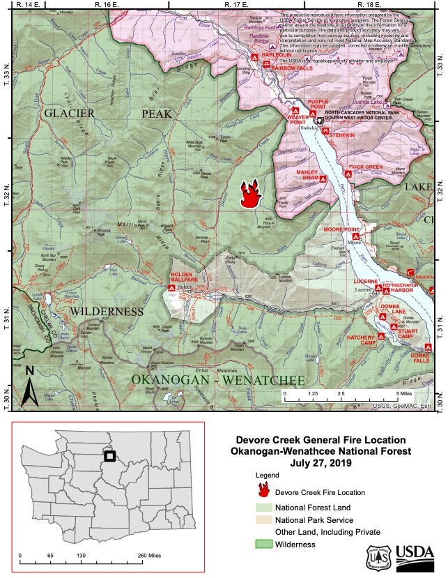
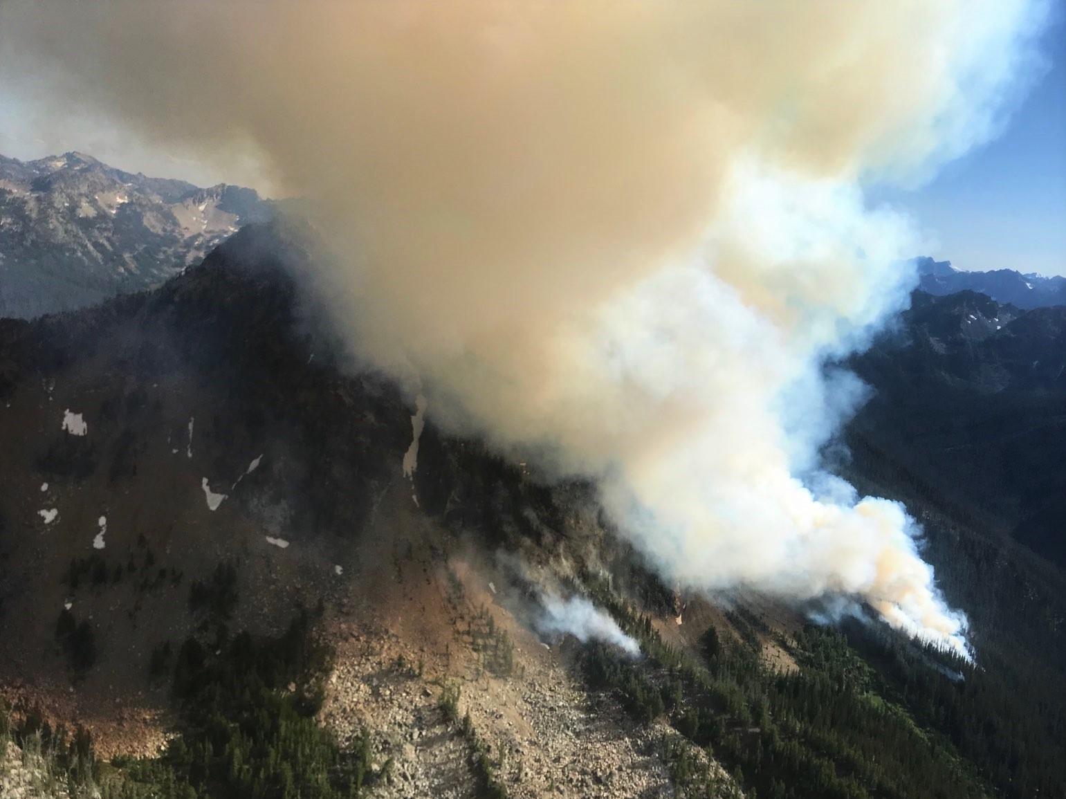
Devore Creek Fire
Inciweb
This fire is 120 acres as of July 28 and was caused by lightning, Inciweb noted. It is three air miles southwest of Stehekin, Washington.
Inciweb
Inciweb reported: “The Devore Creek Fire, a ‘sleeper’ fire from the lightning storms in late July, was first reported at approximately 3:00pm on July 26, 2019 by a trails crew working in the Glacier Peak Wilderness. Aerial reconnaissance arrived over the fire at 4:00pm with a size-up of five acres. Local fire managers immediately ordered rappellers who arrived on scene within two hours of the initial fire report. However, due to the extreme terrain and heavy timber they could not safety engage the fire. By 5:30pm the fire was estimated to be over 75 acres in size with very active fire behavior including spotting and individual tree torching. This naturally ignited fire is burning entirely within the Glacier Peak Wilderness at an estimated elevation of 8,000 ft.”
Graham Fire
Inciweb
This fire was eight miles southwest of Cheney, Washington, NIFC reported. It was caused by lightning on July 24. and is one of four fires that started in the Cheney, Washington area on July 24. The other fires are the Grogan Fire, the Lake Badger Fire, and the Badger Fire. This is part of the Cheney Complex Fire, NIFC noted. According to Inciweb on July 28, the fire is 171 acres and now 100 percent contained.
Kusshi Creek Fire

NIFC
This fire, listed by NIFC, is 37 miles south of Yakima, WA. It’s now 953 acres and 30 percent contained. It was caused by lightning and no residences are currently threatend.
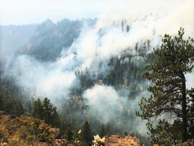
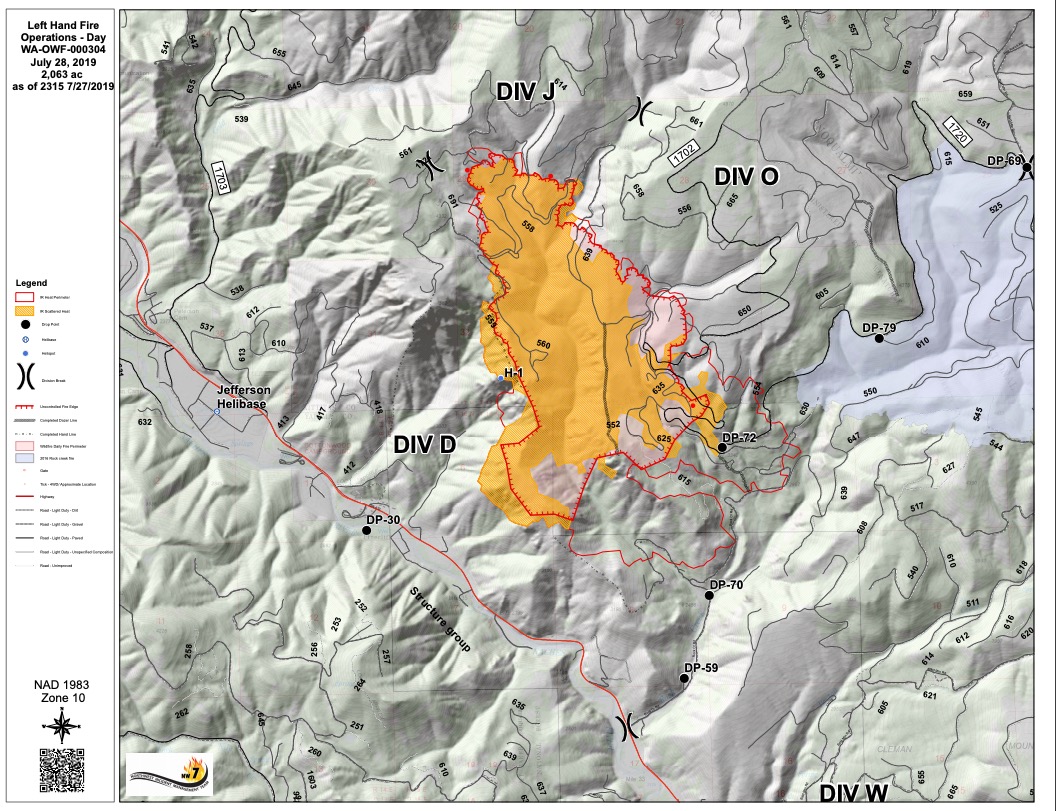
Left Hand Fire
Twitter/Oka-Wen NF
This fire in Washington started on July 23. It’s 32 miles northwest of Yakima and 17 miles northwest of Naches, Inciweb noted, in the Okanogan-Wenatchee National Forest. It’s also about four miles east of Cliffdell. The fire was caused by lightning.
The fire is now 2,063 acres in size, Inciweb noted. A strong cold front brought a lot of wind on Saturday night, helping the fire grow.
Inciweb
Evacuations: On July 28, Inciweb noted that a Level 3 “Go Now” notice was issued for 22 residences in the Rock Creek drainage, and a Level 2 notice remains in place for 250 residents on both sides of SR 410.
Rock Creek Road (FSR 1702) and Bald Mountain Road (FSR 1701) are closed to the public, and 5,000 acres of Oak Creek Wildlife area (in the southwest) are also closed, according to Inciweb.
You can stay updated on the fire’s Facebook page here or on the Yakima Valley Emergency Management page.
Pipeline Fire
NIFC
This fire, listed by NIFC, is seven miles north of SElah, WA. It’s 6,515 acres and 20 percent contained as of the latest update The fire’s cause is under investigation. It was discovered on July 23 when a thunderstorm passed through.
According to Yakima Valley Emergency Management, the Level 2 Get Set evacuation notices have ended. The fire isn’t fully contained, but south and west sides are secure.