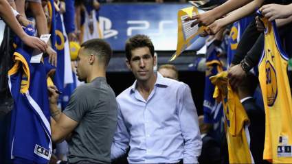
Oregon & Washington Fire Map: Track Fires & Evacuations Near Me

Oregon and Washington Fires Near Me

NIFC Oregon and Washington Fires Near Me

It’s fire season and residents in many states, including Oregon and Washington, need to keep a close eye on current conditions and red flag warnings. This is the latest fire and red flag warning information for the states as of July 25, 2019. Some fires have issued evacuation notices and new fires have started, including the Milepost 97 fire. Read on for the latest details about the wildfires’ locations, containment, evacuations, and more. Remember to also check your local news sources, as fire details can change quickly and with little warning.

To see the latest information for July 26, please see Heavy’s new story here


Interactive Fire Maps for Oregon & Washington

You can see an interactive map of the Oregon and Washington fires here, provided by Oregon.gov, or view details from NIFC.gov here. The same interactive fire map for the two states is also embedded below:

Here’s another real-time fire map via Public RAPTOR for the Oregon area:

You can see Inciweb reported fires in the interactive map below or here. You may need to zoom into the map to see the fires, depending on your browser. You may also need to go to the Legend’s Layers Tab and unclick public alerts, traffic condition, and California wildfires, only clicking Inciweb Wildfire Information to see the Oregon and Washington fires.


Red Flag Warnings for Oregon & Washington

Here are current red flag warnings in Washington, provided by MappingSupport.com. You may need to zoom out or zoom in to get more details on the ones issued near your area.

You can also see weather warnings and Inciweb fire notices in Washington and Oregon in Google’s Crisis map at this link or in the map below. Depending on your browser, you may need to click the + sign to zoom into your region.

Here are details on the individual fires for July 25, 2019. Oregon fires are listed first, followed by Washington fires. 


Oregon Fires

Ben Irving Reservoir Fire

This fire doesn’t have an official name yet, but it started on Thursday night near Ben Irving Reservoir in the Tenmile/Olalle region about 15 miles west of Winston, Oregon, the Douglas Forest Protective Association reported. Forward spread on this fire has stopped and it’s 1/2 acre in size.

Drummond Basin Fire

NIFCDrummond Basin Fire

This fire is 37 miles south-southwest of Jordan Valley, Oregon and is listed on NIFC’s map but not on Inciweb.

It was caused by lightning on July 24, Argus Observer reported.

Milepost 97 Fire (MP 97)

Douglas Forest Protective AssociationMilepost 97 fire

This fire is much newer and was just recently reported on Wednesday evening. The Douglas Forest Protective Association is providing updates about the fire on Facebook. It started about one mile southeast of Canyonville, near milepost 97 on I-5, southbound. It was 1/2 acre when first reported but has grown since then to 150 acres. Firefighters experienced challenges containing the fire because of rolling rocks, strong winds, and falling trees. The cause is under investigation.

A Level 2 “be set” evacuation notice has been issued for this fire as of Thursday around 7 p.m. Pacific. This was set for residents in the 100-300 block of Ritchie Road (three homes.) Level 2 means to be ready to evacuate at a moment’s notice.

As of 6 p.m. Pacific, the fire was estimated to be about 150 acres in size. Most of the fire is spreading up the hillside away from I-5, the Douglas Forest Protective Association noted. Canyonville and Riddle aren’t currently threatened, nor is Azalea. If an evacuation is issued, crews will go door-to-door and let residents know. You can also register for alerts here.

Round Butte Fire

Round Butte Fire Map

This fire was reported on July 22, 2019 and is 85 percent contained. It’s 30 miles south of Burns, Oregon and nine miles south of Double O Station. It is 1,209 acres in size.

NIFC.govRound Butte FIre

It was caused by lightning. No residences are currently threatened.


Washington Fires

Cheney Complex Fire

Inciweb

The Cheney Complex Fire is actually four separate fires near Cheney, Washington, Inciweb reported. It totals 160 acres and was caused by lightning. The named fires are: Graham, Badger, Lake Badger, and Grogan. They started the afternoon of July 24.

Desert Canyon Fire

NIFC

This fire was discovered on July 23, NIFC reports. It’s 1,000 acres and 0 percent contained. Sixteen residences are threatened and the cause is under investigation.

The fire is eight miles northwest of Orondo, Washington. The fire’s moving northeast in the direction of Browns Canyon Road.

So far, two homes have a Level 3 evacuation notice (Get Out Now), while 12 homes are under Level 1 notices in the Aruvil Fruit area, Wenatchee World reported.

Graham Fire

This fire is eight miles southwest of Cheney, Washington, NIFC reports. It’s 104 acres in size and 0 percent contained, caused by lightning on July 24.

Twenty-six residences are threatened. This is part of the Cheney Complex Fire, NIFC noted.

Kussi Creek Fire

NIFC

This fire, listed by NIFC, is 37 miles south of Yakima, WA and is 320 acres and 0 percent contained. It was caused by lightning on July 24. No structures are threatened at this time.

Left Hand Fire

This fire in Washington is 20 acres and caused by lightning. So far it’s 0 percent contained and started on July 23. It’s 32 miles northwest of Yakima, Inciweb noted, in the Okanogan-Wenatchee National Forest.

A Level One “Get Ready” evacuation notice has been issued as of July 24 for areas on Highway 410 including: Elk Ridge Compound and Gold Creek Station.

You can stay updated on the fire’s Facebook page here.

Miller Island Fire

This fire in Washington is listed by NIFC as 100 percent contained as of July 24. It grew to 900 acres and was caused by lightning. It was two miles east of Wishram, WA.

Pipeline Fire

NIFC

This fire, listed by NIFC, is 12 miles north of Yakima, WA and 10 miles northeast of Naches, WA.

It’s 4,000 acres and 0 percent contained. The fire’s cause is under investigation. It was discovered on July 23.

The above tweet was made before it had grown to 4,000 acres, but it gives an idea of the fire’s location. Level 2 “Get Set” evacuations are in place for people in the region. Fire activity might increase today due to low humidity and winds.

Saddle Mountain Fire

NIFC

This fire, listed by NIFC, is three miles north of Mattawa, WA.

It’s 350 acres and 0 percent contained. The cause is under investigation. No structures are threatened at this time.