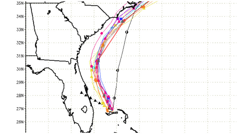
Spaghetti models allow tracking of Hurricane Dorian now.
Spaghetti models, or spaghetti plots as they are sometimes called, are a good way to track the path of Hurricane Dorian as it stalls over the Bahamas. You can find a listing later in this article of the best sites to track Hurricane Dorian’s path now.
The latest spaghetti model plots, as of Sept. 3, 2019, provide potential good news for Floridians and others along the east coast of the United States. They project that Hurricane Dorian will chart north, away from the coastline. However, hurricanes can be unpredictable, so take appropriate caution. They do show that the hurricane will come closest to the North Carolina coast. The concern, though, is that the hurricane is still tracking so close to shore that it could always deviate and change course, imperiling Florida and other states along the eastern seaboard.
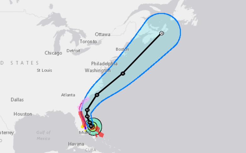
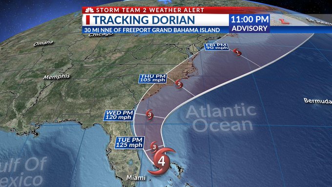
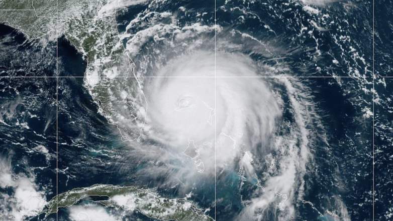
The National Weather Service’s 1 a.m. Sept. 3, 2019 update on Dorian announced, “…DORIAN WON’T BUDGE…” The hurricane was hovering over Grand Bahama Island. “Residents should remain in shelter on Grand Bahama Island as they continue to experience Dorian’s eyewall,” the National Hurricane Center stated. Hurricane Dorian is now a Category 3 storm.
The hurricane had been stalled over the Bahamas for a day, as of Sept. 3.

These hazards were reported by NWS:
– Wind Gusts to 155 mph
– Storm Surge 12 to 18 feet above normal tide levels with higher
destructive waves
“These hazards will continue over Grand Bahama Island through today [Sept. 3],” the Hurricane Center wrote in its update. “Settlement Point on the western tip of Grand Bahama Island recently reported a sustained wind of 61 mph (98 km/h) and a gust to 85 mph (137 km/h). Juno Beach Pier in northern Palm Beach County, Florida, recently reported a sustained wind of 47 mph (76 km/h) and a gust to 58 mph (93 km/h).”
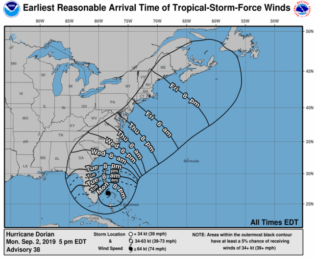
The NWS wrote at 1 a.m. EDT: “SUMMARY OF 100 AM EDT…0500 UTC…INFORMATION
———————————————-
LOCATION…26.8N 78.4W
ABOUT 25 MI…40 KM NE OF FREEPORT GRAND BAHAMA ISLAND
ABOUT 105 MI…170 KM E OF WEST PALM BEACH FLORIDA
MAXIMUM SUSTAINED WINDS…125 MPH…205 KM/H
PRESENT MOVEMENT…STATIONARY
MINIMUM CENTRAL PRESSURE…950 MB…28.05 INCHES.”
Here are some good sites to track the latest spaghetti models:
Cyclocane
11pm Monday Hurricane Dorian Forecast Track UPDATE. Due to excellent agreement with our spaghetti models, the forecast track remains about the same as before, keeping the center of Dorian offshore of FL, GA, and SC. The storm is expected to weaken to a Category 3 on Tuesday.
Cyclocane is a great site to find the latest Hurricane Dorian spaghetti models. The page includes “experimental path data based on weather models.” You can access the Cyclocane spaghetti models for Hurricane Dorian here.
Hurricane Forecast Model Output
NOAA
The University of Wisconsin-Milwaukee has a page that includes updated spaghetti models for Hurricane Dorian. You can access the page here. Once there, click on “display” where it says current tracks on the bottom left of the page under the map. That will bring up Dorian spaghetti plots like this one.
NOAA
1 AM EDT Tropical Cyclone Update for Hurricane #Dorian: Dorian Won’t Budge. t.co/5NyX5TpDaX

NOAA or the National Hurricane Center has various forecast trackers for Hurricane Dorian. You can access its page here.
South Florida Water Management District
Here are the latest #Dorian spaghetti models from UWM. The forecast track has remained consistent but the storm is still stationary.

The South Florida Water Management District publishes a page of updated spaghetti models for hurricanes, including Hurricane Dorian. You can access that page here.
Mike’s Weather Page
NOAA
Mike’s Weather Page has a round up of Hurricane Dorian spaghetti model trackers.
READ NEXT: Hurricane Dorian Live Radar.