Go to main menu
Go to search form
Heavy
Sports
Alerts
Hi,
Subscriber
Search
Sports
News, stats, rumors, predictions and roster moves around the NFL, NBA, MLB, NHL and more.
More From Sports
Giants Rookies Making Strong Impression With John Harbaugh
2 minutes ago
NHL Rumors: 3 Edmonton Oilers Potential Free-Agent Targets
5 minutes ago
Former Atlanta Braves NLCS MVP Is Still An MLB Free Agent
3 seconds ago
Artur Minev Gets Short-Notice Call to Fight Thomas Gantt
13 minutes ago
NBA Draft Prospect Reveals He Could Still Grow 2 More Inches After Combine
14 minutes ago
Knicks OG Anunoby Injury Return Gets Encouraging Update From Sports Doctor
33 minutes ago
Mets Promote Top Prospect Ahead of Tigers Series
35 minutes ago
NBA Mock Draft Links 76ers to Player With Josh Hart Qualities
38 minutes ago
Trailblazing Cowboys Quarterback Dies
38 minutes ago
Deuce McBride Reveals Urgent Coaching Talks Behind Knicks’ 7-Game Win Streak
48 minutes ago
Denny Hamlin Gets Honest About Ryan Preece Appeal — ‘Not a Fair Fight’
27 minutes ago
Report: Bills Pro Bowl Star to Get Hollywood Movie About Incredible Journey to NFL
1 hour ago
Giants QB Jaxson Dart Slighted for Subpar Rookie Season
1 hour ago
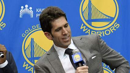
Ex-Warriors GM Bob Myers’ Chances of Returning to NBA Revealed
1 hour ago
2026 Preakness Stakes Post Positions: Full Field, Latest Withdrawals
1 hour ago
Vikings’ Jauan Jennings Brings Big Trait to Annoy NFC North
1 hour ago
Lakers Announce Starting Lineup News Without Luka In Game 4 vs. Thunder
1 hour ago
Lakers Reveal Luka Doncic Injury Update: Is Star Playing Tonight Or Returning This Season
1 hour ago
Blue Jays Ace Achieves Major Career Milestone vs. Rays
2 hours ago
Cowboys NFL Schedule Leak Reveals Thanksgiving Opponent
2 hours ago
Report: Warriors Prepared to Offer 11th Pick in Giannis Antetokounmpo Trade
2 hours ago
Daryl Morey ‘Beyond Life Support’ With Sixers, per Report
2 hours ago
Two Major Silver Linings for Philadelphia 76ers From 2025-26 NBA Season
2 hours ago
Puka Nacua Gets Strong Message From Accuser’s Lawyer Amid News on Lawsuit
2 hours ago
Patriots Catch Favorable 2026 Schedule Break Before NFL Reveal
2 hours ago
Chiefs Urged to Address 1 More Glaring Roster Need
2 hours ago
Ronda Rousey Takes Shots at Hunter Campbell Again
2 hours ago
Eagles A.J. Brown Reportedly Takes Next Step as Patriots Rumors Continue to Grow
2 hours ago
SEC Rival Legacy Turns Down Tennessee for Alabama in Major Recruiting Shock
2 hours ago
Joe Rogan Suggests Reason Khamzat Chimaev Tired at UFC 328
2 hours ago
More from Sports
Load More Sports ↓
Close sidebar
Home
NFL
Expand sub-menu
Arizona Cardinals
Atlanta Falcons
Baltimore Ravens
Buffalo Bills
Carolina Panthers
Cincinnati Bengals
Cleveland Browns
Chicago Bears
Dallas Cowboys
Denver Broncos
Detroit Lions
Green Bay Packers
Houston Texans
Indianapolis Colts
Jacksonville Jaguars
Kansas City Chiefs
Los Angeles Chargers
Los Angeles Rams
Las Vegas Raiders
Miami Dolphins
Minnesota Vikings
New England Patriots
New Orleans Saints
New York Giants
New York Jets
Philadelphia Eagles
Pittsburgh Steelers
San Francisco 49ers
Seattle Seahawks
Tampa Bay Buccaneers
Tennessee Titans
Washington Commanders
NBA
Expand sub-menu
Atlanta Hawks
Boston Celtics
Brooklyn Nets
Charlotte Hornets
Chicago Bulls
Cleveland Cavaliers
Dallas Mavericks
Denver Nuggets
Detroit Pistons
Golden State Warriors
Houston Rockets
Indiana Pacers
Los Angeles Clippers
Los Angeles Lakers
Memphis Grizzlies
Miami Heat
Milwaukee Bucks
Minnesota Timberwolves
New Orleans Pelicans
New York Knicks
Oklahoma City Thunder
Orlando Magic
Philadelphia 76ers
Phoenix Suns
Portland Trail Blazers
Sacramento Kings
San Antonio Spurs
Toronto Raptors
Utah Jazz
Washington Wizards
MLB
Expand sub-menu
Arizona Diamondbacks
Athletics
Atlanta Braves
Baltimore Orioles
Boston Red Sox
Chicago Cubs
Chicago White Sox
Cincinnati Reds
Cleveland Guardians
Colorado Rockies
Detroit Tigers
Houston Astros
Kansas City Royals
Los Angeles Angels
Los Angeles Dodgers
Miami Marlins
Milwaukee Brewers
Minnesota Twins
New York Mets
New York Yankees
Philadelphia Phillies
Pittsburgh Pirates
San Diego Padres
San Francisco Giants
Seattle Mariners
St. Louis Cardinals
Tampa Bay Rays
Texas Rangers
Toronto Blue Jays
Washington Nationals
NHL
Expand sub-menu
Anaheim Ducks
Boston Bruins
Buffalo Sabres
Calgary Flames
Carolina Hurricanes
Chicago Blackhawks
Colorado Avalanche
Columbus Blue Jackets
Dallas Stars
Detroit Red Wings
Edmonton Oilers
Florida Panthers
Los Angeles Kings
Minnesota Wild
Montreal Canadiens
Nashville Predators
New Jersey Devils
New York Islanders
New York Rangers
Ottawa Senators
Philadelphia Flyers
Pittsburgh Penguins
San Jose Sharks
Seattle Kraken
St. Louis Blues
Tampa Bay Lightning
Toronto Maple Leafs
Utah Mammoth
Vancouver Canucks
Vegas Golden Knights
Washington Capitals
Winnipeg Jets
More Sports
Expand sub-menu
College Basketball
College Football
Cricket
Formula 1
Golf
NASCAR
UFC
WNBA
Olympics
Pro Wrestling
Tennis