Go to main menu
Go to search form
Heavy
Sports
Alerts
Hi,
Subscriber
Search
Sports
News, stats, rumors, predictions and roster moves around the NFL, NBA, MLB, NHL and more.
More From Sports
Raiders Receive Blunt Insider Message on Maxx Crosby’s Future
3 minutes ago
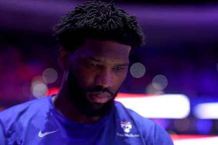
Joel Embiid Injury News Draws Blunt ESPN Criticism Before Knicks Game
3 minutes ago
NASCAR Insider Explains Importance of Blaney, Penske Extension
7 minutes ago
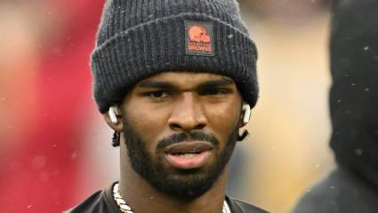
Dillon Gabriel Emerges as Threat to Shedeur Sanders’ Browns Future
5 minutes ago
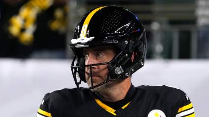
Ian Rapoport Shares Thoughts on Latest Aaron Rodgers Rumor as Steelers Wait
8 minutes ago
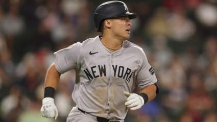
Brian Cashman Breaks Silence on Yankees Decision to Option Anthony Volpe
13 minutes ago
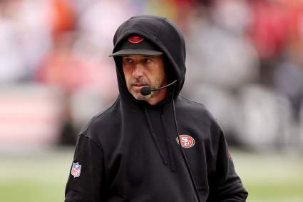
49ers HC Kyle Shanahan Facing Potential Threat of Being Fired
14 minutes ago
Chiefs’ Veteran Starter Named Hot Seat Candidate After NFL Draft
16 minutes ago
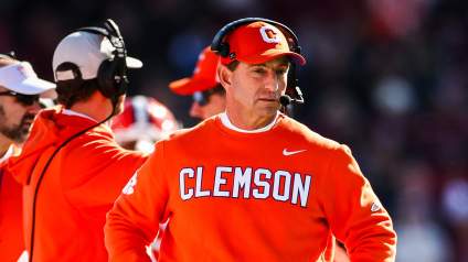
Dan Patrick Calls out Clemson Tigers Coach Dabo Swinney Over Comments
16 minutes ago
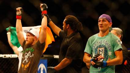
Max Holloway Provides Update On Conor McGregor Rematch
15 minutes ago
‘Jitterbug’ Ravens Rookie Predicted to Replace $120 Million All-Pro
19 minutes ago
Brad Stevens Gives Blunt Warning to Celtics After Playoff Ouster
20 minutes ago
Terrell Owens Takes Brutal Shot at Cowboys Owner Jerry Jones
22 minutes ago
Mets Could Trade This All Star Pitcher At Trade Deadline: Murray
26 minutes ago
Rams Send Message on Matthew Stafford Amid New Wrinkle in Contract Talks
29 minutes ago
Lakers Starter Urged Not To Shoot Too Much Against the Thunder by Ex-NBA Player
36 minutes ago
JJ Redick Reveals Clear Stance on Luka Doncic’s Return Before Game 2
38 minutes ago
Bears’ Former $5.7 Million Bust Signed to Help Replace Pro Bowler
2 minutes ago
Warriors’ Draymond Green Urges Knicks Fans to Pipe Down vs 76ers
40 minutes ago
Insider Shares Bills Exec Near Top of Vikings List in GM Update
42 minutes ago
Mike Vrabel Pushes Patriots Stefon Diggs Move Amid Russini Scandal: Report
41 minutes ago
Colts WR Alec Pierce Spills The Beans About FA Decision on Josh Downs’ Podcast
42 minutes ago
New York Yankees Announce New Roster Decision Before Rangers Game
33 minutes ago
Luka Doncic Injury Update Comes Amid Brutal Lakers Reality Check In Thunder Series
53 minutes ago
Concerns Grow for Ben Rice After Latest Yankees Decision Before Rangers Game
47 minutes ago
Lakers’ Luka Doncic Fires Back at Insider’s Injury Accusation
56 minutes ago
Yankees Mentioned in Possible Mike Trout Trade Speculation
57 minutes ago
Josh Barnett Trashes State of ‘Sloppy’ UFC Heavyweight Division
57 minutes ago
Yankees Former Top Prospect Named Team’s Top Trade Candidate
1 hour ago
NBA Announces Major Jalen Brunson Stat Before Knicks-76ers Game 2
1 hour ago
More from Sports
Load More Sports ↓
Close sidebar
Home
NFL
Expand sub-menu
Arizona Cardinals
Atlanta Falcons
Baltimore Ravens
Buffalo Bills
Carolina Panthers
Cincinnati Bengals
Cleveland Browns
Chicago Bears
Dallas Cowboys
Denver Broncos
Detroit Lions
Green Bay Packers
Houston Texans
Indianapolis Colts
Jacksonville Jaguars
Kansas City Chiefs
Los Angeles Chargers
Los Angeles Rams
Las Vegas Raiders
Miami Dolphins
Minnesota Vikings
New England Patriots
New Orleans Saints
New York Giants
New York Jets
Philadelphia Eagles
Pittsburgh Steelers
San Francisco 49ers
Seattle Seahawks
Tampa Bay Buccaneers
Tennessee Titans
Washington Commanders
NBA
Expand sub-menu
Atlanta Hawks
Boston Celtics
Brooklyn Nets
Charlotte Hornets
Chicago Bulls
Cleveland Cavaliers
Dallas Mavericks
Denver Nuggets
Detroit Pistons
Golden State Warriors
Houston Rockets
Indiana Pacers
Los Angeles Clippers
Los Angeles Lakers
Memphis Grizzlies
Miami Heat
Milwaukee Bucks
Minnesota Timberwolves
New Orleans Pelicans
New York Knicks
Oklahoma City Thunder
Orlando Magic
Philadelphia 76ers
Phoenix Suns
Portland Trail Blazers
Sacramento Kings
San Antonio Spurs
Toronto Raptors
Utah Jazz
Washington Wizards
MLB
Expand sub-menu
Arizona Diamondbacks
Athletics
Atlanta Braves
Baltimore Orioles
Boston Red Sox
Chicago Cubs
Chicago White Sox
Cincinnati Reds
Cleveland Guardians
Colorado Rockies
Detroit Tigers
Houston Astros
Kansas City Royals
Los Angeles Angels
Los Angeles Dodgers
Miami Marlins
Milwaukee Brewers
Minnesota Twins
New York Mets
New York Yankees
Philadelphia Phillies
Pittsburgh Pirates
San Diego Padres
San Francisco Giants
Seattle Mariners
St. Louis Cardinals
Tampa Bay Rays
Texas Rangers
Toronto Blue Jays
Washington Nationals
NHL
Expand sub-menu
Anaheim Ducks
Boston Bruins
Buffalo Sabres
Calgary Flames
Carolina Hurricanes
Chicago Blackhawks
Colorado Avalanche
Columbus Blue Jackets
Dallas Stars
Detroit Red Wings
Edmonton Oilers
Florida Panthers
Los Angeles Kings
Minnesota Wild
Montreal Canadiens
Nashville Predators
New Jersey Devils
New York Islanders
New York Rangers
Ottawa Senators
Philadelphia Flyers
Pittsburgh Penguins
San Jose Sharks
Seattle Kraken
St. Louis Blues
Tampa Bay Lightning
Toronto Maple Leafs
Utah Mammoth
Vancouver Canucks
Vegas Golden Knights
Washington Capitals
Winnipeg Jets
More Sports
Expand sub-menu
College Basketball
College Football
Cricket
Formula 1
Golf
NASCAR
UFC
WNBA
Olympics
Pro Wrestling
Tennis