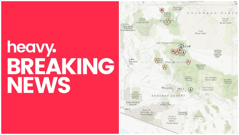
Fires continue to cause issues in Arizona in October, including a new fire reported in the Lave Havasu region. Read on for details about the fires, their locations, containment size, maps, and more. As news can change quickly, be sure to watch your local news for the latest evacuation details.
Interactive Maps of Arizona Fires
One of the best interactive maps available right now is Inciweb’s map. You can see the full map here. There’s an embeddable Google Map that includes Inciweb fires which you can see below in Arizona. Depending on your browser, you may need to zoom in using the + button within the map or change settings to only show Inciweb fires:
You can also see an interactive fire map for the Arizona area, provided by NWCG.gov. An embedded version is below, but click on the link to see a full version.
Here are the fires currently in Arizona as of October 24, 2019. Some of them are prescribed fires that are set purposefully by officials to help prevent bigger wildfires from starting and spreading. Others are wildfires that you’ll want to keep a closer eye on.
2019 Fall Rx Burns for Flagstaff District *
Prescribed fires are purposefully set to help mitigate the effects of unexpected fires later. This one is planned for the region soon.
Elk/Lee Prescribed Fire
This prescribed fire project may cause people near the region to see smoke from the Kaibab National Forest into Prescott, Prescott Valley, and Chino Valley regions.
Ikes Fire

Inciweb
As of October 18, the latest Inciweb update, the fire is 16,416 acres. It was caused by lightning on July 25. It’s ” on the North Rim of Grand Canyon National Park and the North Kaibab Ranger District of the Kaibab National Forest.”
Inciweb notes: “The lightning-caused Ikes Fire is being utilized to fulfill its natural role in a fire-dependent ecosystem on the Kaibab Plateau. The fire is being utilized to achieve a variety of resource objectives including reducing hazardous fuels, promoting forest regeneration, improving wildlife habitat, and restoring more open forest understory with grasses and forbs. Fire is a force of nature that has shaped the vegetation and ecosystems of the Grand Canyon region.”
Johnson Fire
This fire is 166 acres and 96 percent contained as of Inciweb’s last update on October 1. It’s still listed as active on the map. It’s eight miles south of Prescott, Arizona and started on September 22.
Kanab Creek Prescribed Fire
Prescribed fires are purposefully set to help mitigate the effects of unexpected fires later. This one is about 10 acres in size.
Lake Havasu Fire
MCSO Sgt. Kyler Cox brought me closer to the scene. MCSO is assisting Havasu fire & police with detours and possible evacuations.


A fire in Lake Havasu was first reported on October 24 in the Mesquite Bay South region, Havasu News reported. The fire threatened 15 homes near Quail Ridge. Evacuations haven’t been ordered yet, but residents should stay alert for potential evacuations.
At 1 p.m. massive waves 30-40 mph wind a fire in #LakeHavasu City wow hazardous conditions take care! Especially snowbirds driving. Gust of wind nearly lifted my car I’m blowing off the Cap Bay Bridge Bill WilliamsNWR🌬 @NWSPhoenix @NWSVegas #azfamily #abc15wx #azwx #cawx #nvwx

The fire is south of the Sailing Hawks subdivision near Neptune Wash and London Bridge Road, Havasu News noted.
Museum Fire BAER
This fire is 1,961 acres and 100 percent contained, but still listed on Inciweb’s map. It’s a BAER (Burned Area Emergency Response) that is surveying burned areas from the Museum Fire.
Newman Fire BAER
This is a BAER (Burned Area Emergency Response) that is surveying burned areas from the previous Newman Fire that was 4,907 acres in size. This isn’t an active fire but it’s listed on Inciweb’s map.
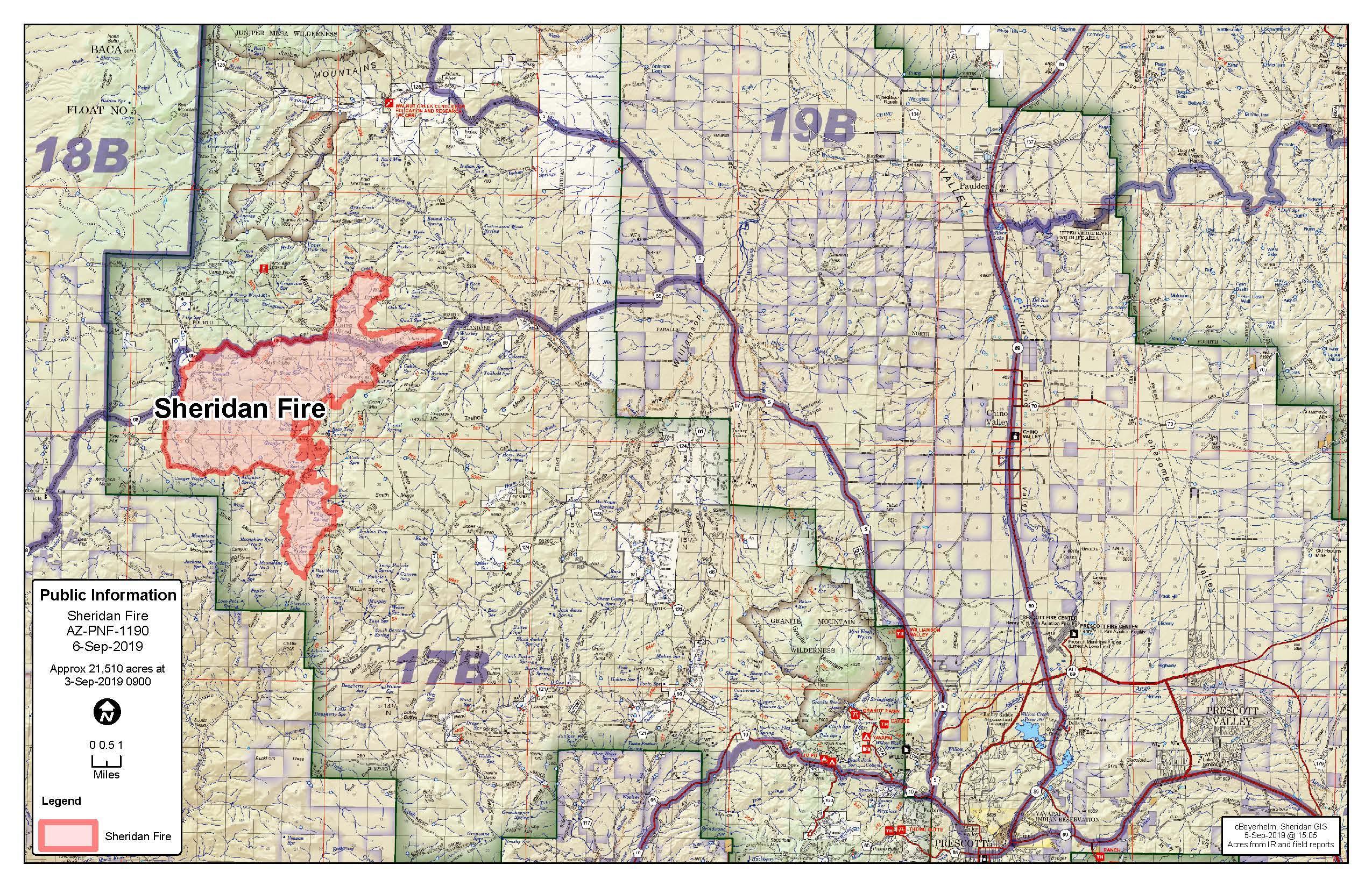
Sheridan Fire
Inciweb
This fire is 21,510 acres and 80 percent contained as of October 1, the latest Inciweb update. It’s in Wood Trap Area, 20 miles northwest of Prescott, Arizona. Decreased fire activity means that regular updates will no longer be issued by Inciweb.
Inciweb notes: “For the protection of the public’s health and safety forest officials are extending the Sheridan Fire Area Closure which will now remain in effect until October 24th, at 6:00 am…The Sheridan Fire is 80% contained and in monitor status; however potential hazards still exist in the fire area. Risks in recently burned areas include burned out stump holes, unstable terrain, falling trees or limbs, and the potential for washed out roads and trails after a significant rain event.’
Woodbury Fire BAER
The Woodbury BAER is an assessment of burned areas and their safety. It’s listed on Inciweb but is not an active fire.