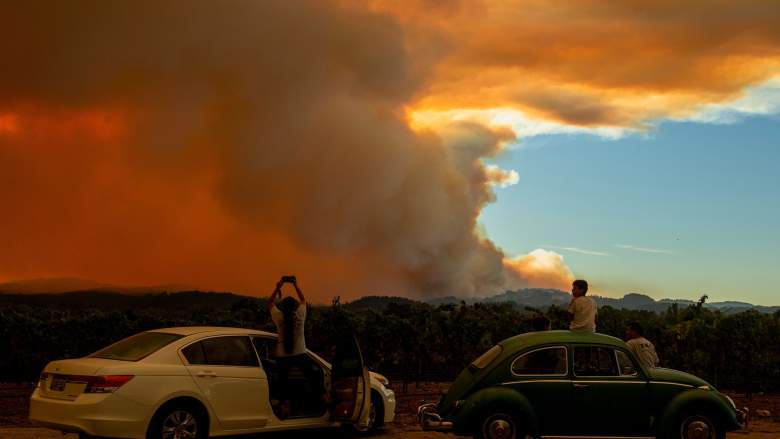
Getty People watch the Walbridge fire, part of the larger LNU Lightning Complex fire, from a vineyard in Healdsburg, California on August 20, 2020.
Many people are now keeping track of air quality reports and red flags warnings in California, now that so many fires are burning in the state. Red flag warnings and watches mean that conditions can be favorable for wildfire development. High winds can also raise the chances of fires developing or of current wildfires growing stronger. That’s why it’s important to know if there are any Red Flag warnings or watches in your area. Read on to see interactive maps that can help you determine what’s going on in areas near where you live.
A Red Flag warning lets fire managers know that conditions are highly unfavorable for prescribed burns and dangerous fire growth could occur, Weather.gov reported. Red Flag warnings require that vegetation in an area hold “ten-hour fuels of 8% or less,” a relative humidity of less than 25% for several hours, and winds of at least 15 mph 20 feet off the ground for several hours. These are typically issued in the spring and fall.
Red Flag warnings also require residents to be cautious too, Weather.gov noted. If you can burn in your area, burn barrels must be covered with a weighted metal cover and holes smaller than 3/4-inch. Residents shouldn’t throw cigarettes or matches out of a moving vehicle. All outdoor fires should be extinguished with care and left cold to the touch. And fires should never be left unattended.
Interactive Maps Showing Red Flag Warnings in California
First, Mapping Support provides a Fire Weather Watch map for California below. They wrote on Twitter: “Open the map, click the map, follow link for official details.” If for any reason your browser doesn’t show the map correctly below, you can view the map here.
This next map is a seven-day significant fire potential map, provided by NWCG.gov. This map allows you to scroll through the coming days and see areas in the United States and their risk levels. Grey means no data, green is little or no risk, yellow is low risk, and beige is moderate risk. Then orange through red indicates higher risk. Depending on your browser, you may need to use the + sign to zoom into the map. A screenshot of the map is below but you can see the full interactive map here.

Finally, Google Maps has a crisis map that provides details about wildfire watches and warnings for the country. To see only the watches and warning, go to “Layers” on the Legend and unclick Traffic Conditions and Unclick InciWeb Wildfire Information. Keep “Public Alerts” clicked, which includes evacuation notices, storm warnings, and the like, if you want. This will show you only the wind advisories and Red Flag warnings that could indicate fire potential.
Click on any of the red shaded areas in the map below to see the specific watch or warning. Then click on that box to get more details about the warning. The map is below. Depending on your browser, you may need to use the + button to zoom into the map and see your state or city’s region. Zoom in for a closer look at California.
Air Quality & Smoke Reports
For air quality and smoke report updates, see the California Smoke Information website here. This is described as “a voluntary effort by city, county, state, tribal and/or federal agencies to coordinate and aggregate information for California communities affected by wildfire smoke.”
AirNow (through the EPA) provides an interactive air quality map of the whole country, including California. An embedded map is below, but you can see the full map here.
Air Now also provides a Fire and Smoke map here. If you allow the map to know your location, it will show you fires near where you are right now.
California smoke and air quality reductions are being felt experienced outside of the state. Denver Post warned that Colorado communities experiencing smoke from their own fires will be dealing with more smoke soon thanks to California’s.
READ NEXT: The latest COVID-19 deaths, cases, and updates