National Hurricane Center Peak storm surge map
The National Hurricane Center has warned that Hurricane Laura’s storm surge might be “unsurvivable” in some areas. This update was a sobering reminder of the storm’s power. It’s now reached Category 4 status. Read on to learn more about the storm surge warning and to see a map of where the peak storm surge is predicted to be.
The Peak Storm Surge Includes Parts of Texas and Lousiana
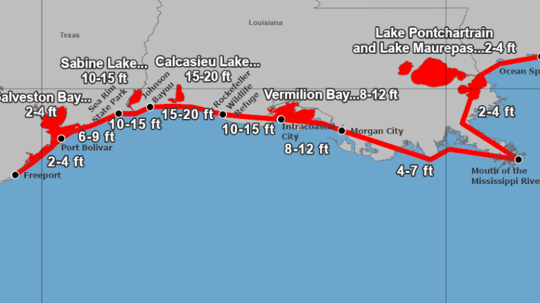
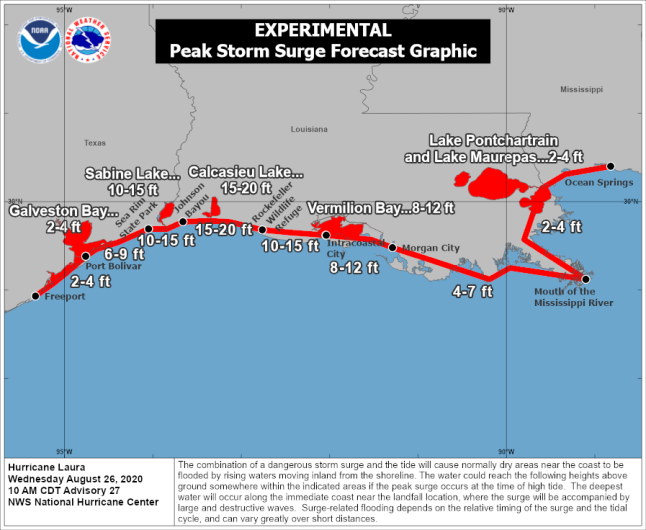
The National Hurricane Center has released an experimental “peak storm surge” forecast. This map was last updated at 10 a.m. on August 26.
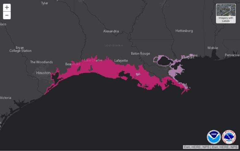
A map of the storm surge watch and warning areas is below, provided by the NHC. An interactive version is here.
The NHC notes:
Storm surge is rising water moving inland from the shoreline, pushed onshore by the force of the wind. This storm surge watch/warning graphic identifies locations most at risk for life-threatening inundation from storm surge, displaying areas that qualify for inclusion under a storm surge watch or warning by the National Weather Service. Due to forecast uncertainty, the actual areas that experience life-threatening inundation may differ from the areas shown on this map. All persons, regardless of whether or not they are in the highlighted areas shown by the graphic, should promptly follow evacuation orders and other instructions from local emergency management officials.”
In the map above, hot pink indicates warning areas and light pink indicates areas under a storm surge watch.
As of 1 p.m. Central, a storm surge watch was in effect for:
- Mouth of the Mississippi River to Ocean Springs Mississippi
- Lake Pontchartrain, Lake Maurepas, and Lake Borgne
And a storm surge warning was in effect for:
- Freeport Texas to the Mouth of the Mississippi River
National Hurricane Center Warns that Storm Surge May Not Be Survivable
To underscore the seriousness of the storm, the National Hurricane Center has warned that the storm surge may not be survivable. In its 1 p.m. Central update, the NHC noted:
Unsurvivable storm surge with large and destructive waves will cause catastrophic damage from Sea Rim State Park, Texas, to Intracoastal City, Louisiana, including Calcasieu and Sabine Lakes. This storm surge could penetrate up to 30 miles inland from the immediate coastline in southwestern Louisiana and far southeastern Texas.
The National Weather Service tweeted a similar warning about the storm surge.
The NHC noted that the deepest water is going to occur on the immediate coast near and just to the right of the hurricane’s landfall location. In that region, the storm will be “accompanied by large and destructive waves.”
Here is the NHC’s current prediction for storm surge levels:
- Johnson Bayou LA to Rockefeller Wildlife Refuge including Calcasieu Lake…15-20 ft
- Sea Rim State Park TX to Johnson Bayou LA including Sabine Lake…10-15 ft
- Rockefeller Wildlife Refuge to Intracoastal City LA…10-15 ft
- Intracoastal City LA to Morgan City including Vermilion Bay…8-12 ft
- Port Bolivar TX to Sea Rim State Park…6-9 ft
- Morgan City LA to Mouth of the Mississippi River…4-7 ft
- Freeport TX to Port Bolivar including Galveston Bay…2-4 ft
- Mouth of the Mississippi River to Ocean Springs MS including Lake Borgne…2-4 ft
- Lake Pontchartrain and Lake Maurepas…2-4 ft
To learn more about the storm’s forecast and where it is right now, see Heavy’s story here.
READ NEXT: The latest COVID-19 deaths, cases, and updates

