
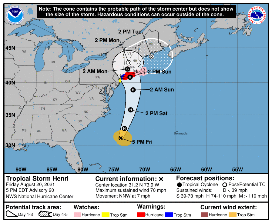
NHC A projected path for Henri.
Tropical Storm Henri is expected to strengthen to hurricane strength before making landfall in New England this weekend. A hurricane watch has already been issued for parts of the country. As of 5 p.m. Eastern, the storm was clocking in with 70 mph winds, and a storm becomes a hurricane when it has sustained winds of 74 mph. The storm’s projected landfall includes New York and Connecticut regions.
Henri Is Expected to Make Landfall on Sunday Afternoon
NHC
Henri is currently projected to make landfall sometime on Sunday afternoon. Most projections have it landing somewhere near Connecticut, Rhode Island, and New York. It’s expected to be a Category 1 hurricane when it makes landfall, the NHC reported. It’s important to keep in mind that hurricanes can change their paths over time, so stay tuned to local news for the latest storm projections.
Here’s another map, as shared by the NHC, which shows a projected cone including New York. Keep in mind that this map has an interactive component that you can view here.
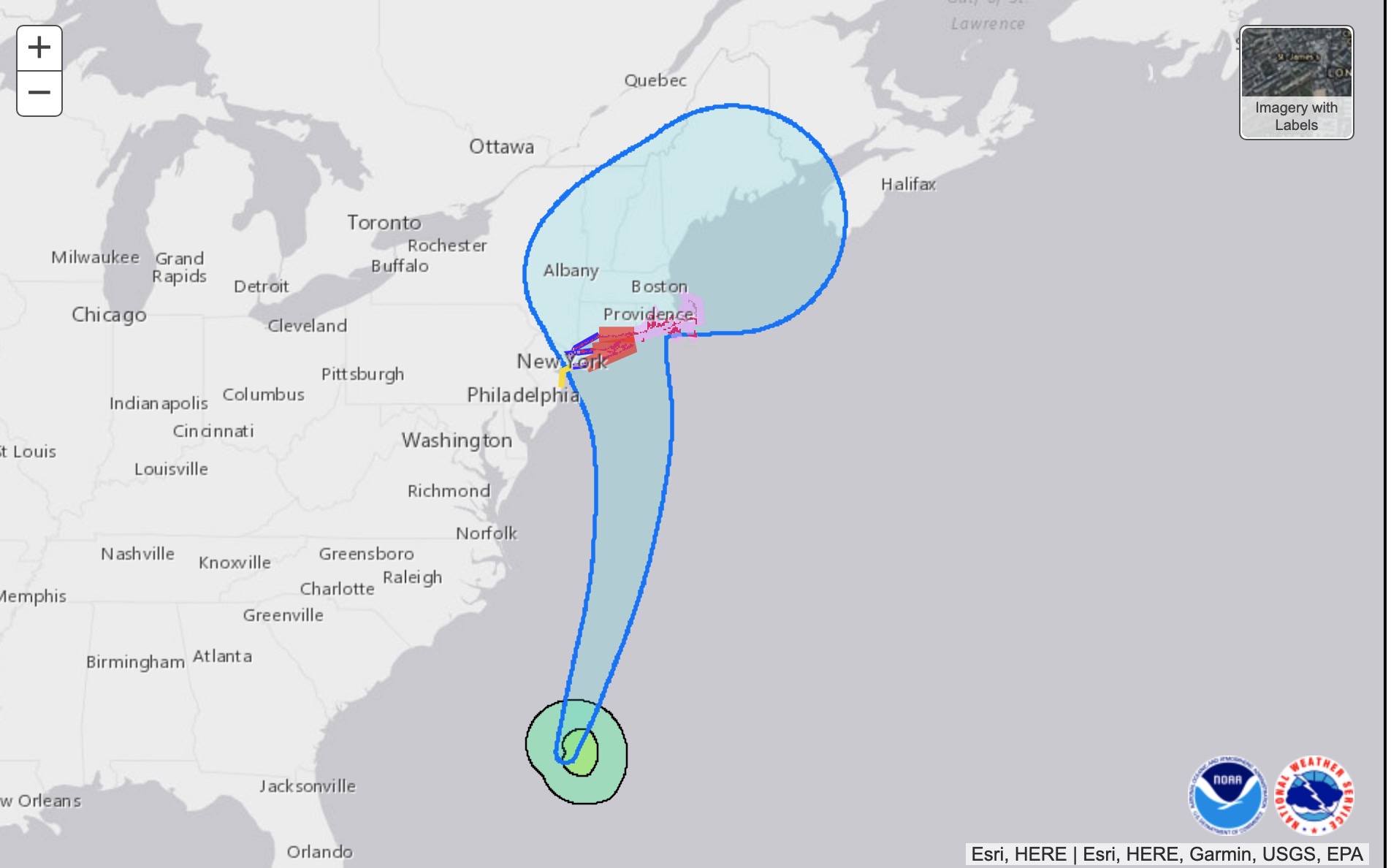
NHC

This next map may give you a better idea of when to first expect to feel the effects of the hurricane. This map shows the estimated arrival time of tropical storm-force winds. Some areas on the coast may feel tropical storm winds as early as Saturday afternoon or evening.
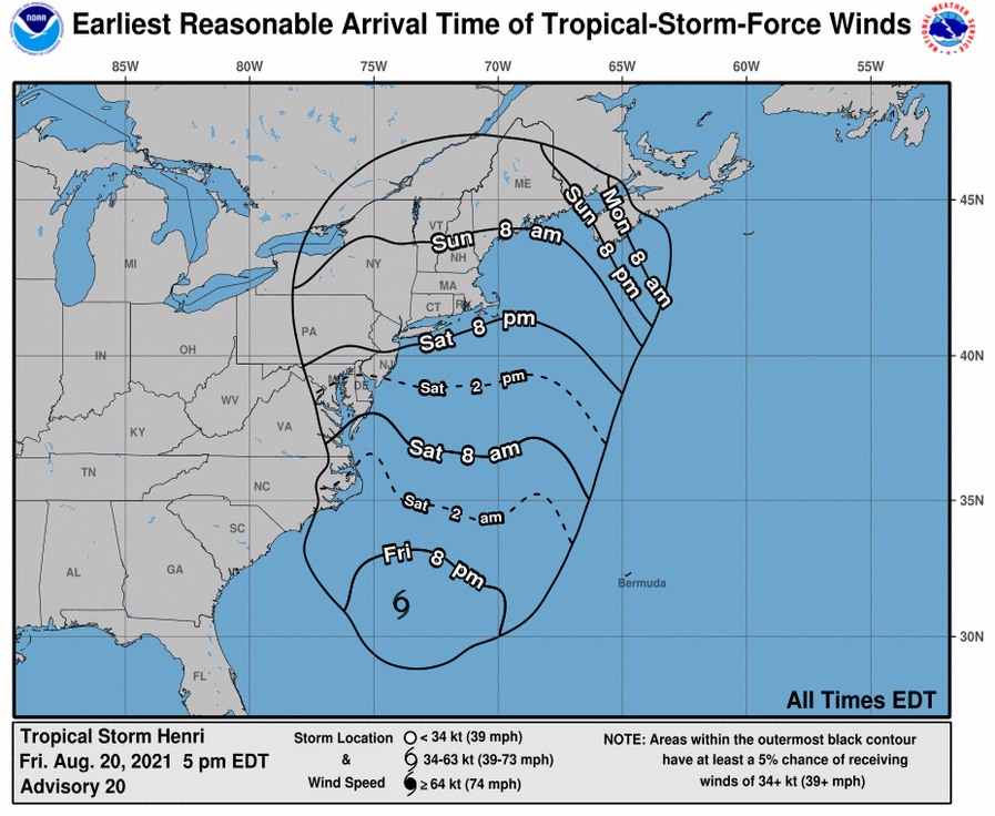
NHC
The Navy has a tracking map for storms too. This is the Navy’s tracking map, provided by ATCF – Naval Research Laboratory: Marine Meteorology Division:

As of 5 p.m. Eastern, however, Henri was still hundreds of miles away from the Georgia coast, but was expected to make a turn from north-northwest to north, NPR reported.
Wind, Rain & Storm Surge Projection Maps of Henri for August 20
Next up is another wind-speed probability map from NHC. This one shows the probability of tropical storm force winds, as predicted on August 20.
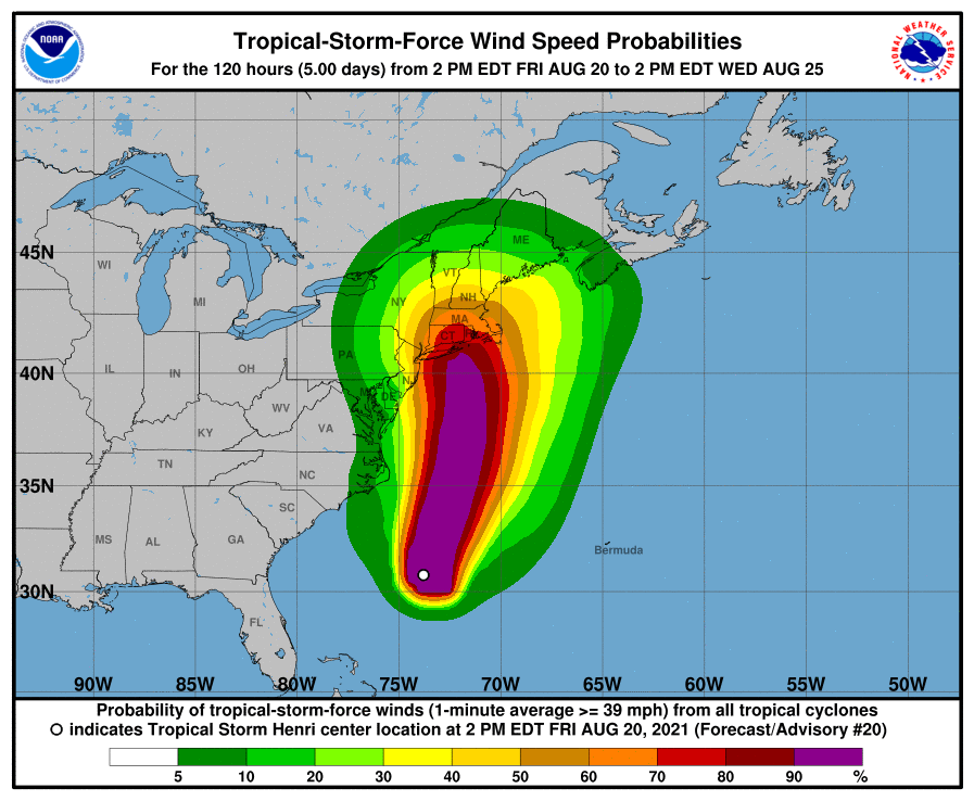
NHC
Below you can see a flash flooding potential map. Keep in mind that these projections can change as the storm moves. Hartford and the Connecticut region are currently expected to have the greatest flash flooding potential, as of the time of this story’s publication. This map below, as of the time of publication, was created at 5:49 p.m. Eastern on August 20 and is valid for 8 a.m. Eastern Sunday, August 22, through 8 a.m. Eastern Monday, August 23.
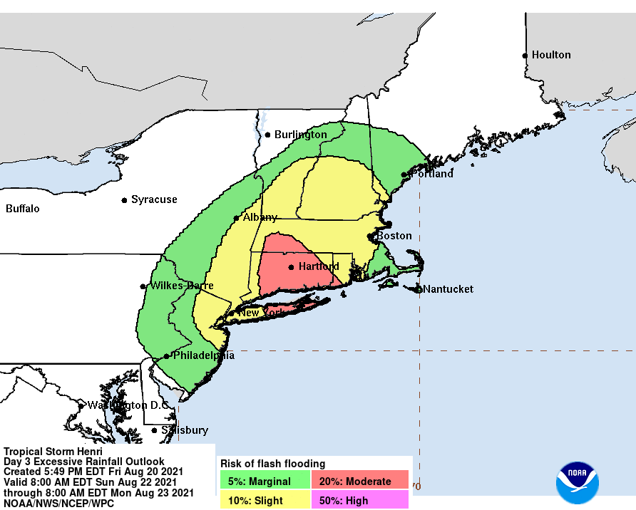
NHC
You can also see a U.S. rainfall potential map below, from NHC, or at this link. This is valid for 8 p.m. Eastern Friday, August 20, through 8 a.m. Eastern Wednesday, August 25. As the storm moves, this projection may change. This map was created at 5:49 p.m. Eastern on August 20.

NHCRainfall potential.
According to the National Hurricane Center, as of August 20 at 5 p.m., Henri was located at 31.2N, 73.9W about 290 miles south-southeast of Cape Hatteras, North Carolina, and about 695 miles south of Montauk Point, New York.
The storm was moving north/northwest (340 degrees) at 7 mph.
As of 5 p.m., the storm’s maximum sustained winds were 70 mph, with higher gusts. Strengthening is expected, and the storm will likely become a hurricane sometime on Friday night or Saturday.
The storm may produce rainfall of three to six inches, with isolated areas near 10 inches. In addition, NHC warned: “The combination of a dangerous storm surge and the tide will cause normally dry areas near the coast to be flooded by rising waters moving inland from the shoreline.”
READ NEXT: The latest COVID-19 variant details, cases, and vaccine updates