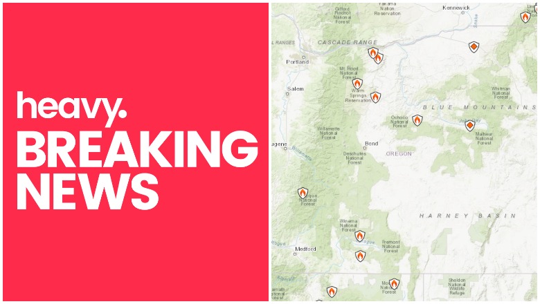
Inciweb Oregon fires near me
As the summer months heat up, wildfires are also being seen on the West Coast, including in Oregon. Here are the details about the latest fires as of July 9, 2021. Read on for the latest details about the wildfires’ locations, containment and evacuations. Remember to also check your local news sources, as fire details can change quickly and with little warning.
Interactive Fire Maps for Oregon
One helpful way to keep track of fire activity is by looking at interactive maps. You can see an interactive map of both Oregon and Washington fires here, provided by NIFC.gov. You can also see the map below. Just click “OK” to get past the flash screen. Note that due to server traffic, it may take a while for the map below to load. You can zoom in on the flame icon or click on the flame to learn more about the fire.
Another helpful interactive map for locating Oregon fires is run by Inciweb. You can see the full map here. Inciweb is “an interagency all-risk incident information management system.”
Firemappers has a another map below or here, which you can use to see both Oregon and Washington fires. This is a wildfire map, not an evacuation map. You may need to click “OK” to see the full map. You can go to your county to see evacuation maps for Oregon, Washington, or California here or here.
ESRI provides a wildfire live feed update for 2021.
Another fire map can be viewed here.
Next are details on the individual fires, in alphabetical order. Some fires that are 100% contained may not be included, and this list is focusing mostly on major fires in the region. (For fires in Washington state, see Heavy’s story here.)
Individual Fires
Note that since evacuation details can change rapidly, it’s also good to stay tuned to local news, including local city and county Facebook and Twitter pages.
These are the biggest fires currently in Oregon as of the time of publication. For a complete list of fires, see Inciweb’s map here.
Bootleg Fire

The Bootleg Fire is 38,900 acres and 1% contained. It started July 6 about 15 miles northwest of Beatty, Oregon. The cause is under investigation. About 3,100 residences are threatened by the fire, NIFC reported.
According to Inciweb: “The fire will continue to move unchecked in all directions, with unstable air conditions and extremely dry fuels. Energy release components in fuels are at an all-time high. The potential for a pyro-cumulus is likely and spread will be dictated by its effects. Continued persistent drought and dry conditions will encourage spotting and increase resistance to control.”
The fire is about 11 miles northeast of Sprague River, as of July 9, and smoke is visible on Highway 140 and in the surrounding area. A community meeting is taking place at 7 p.m. on Friday night at the Chiloquin Community Center.
Current evacuations are listed below (as of late afternoon July 9) and include Level 3 and Level 2 evacuations. The Klamath County Fairgrounds is serving as an evacuation center. See the Klamath County Facebook page for new evacuation updates.
Evacuations as of the afternoon of July 9 included Level 3 for:
- The town of Beatty, north end of Godawa Springs Road, north of the rock quarry
- Near the town of Sprague River. Upper Tableland north of Oregon Pines Road.
- North of Beatty, Sycan Estates area.
Level 2:
- North of Beatty, in the area north of Highway 140 on both sides of Godowa Springs Road, south of the rock quarry.
- North of Sprague River town. Klamath Forest Estates/Moccasin Hills region.
Remember: see the Klamath County Facebook page for new evacuation updates.
Dixie Creek Fire
This fire is 541 acres and was caused by lightning on July 3, according to NIFC. It’s not listed on Inciweb. It’s now 99% contained as of Thursday. It started three miles northwest of Prairie City.
Jack Fire
This fire started July 5, 20 miles east of Glide, Oregon. It’s 5,477 acres in size with 0% containment, and the cause is under investigation.
According to NIFC, 131 single residences are threatened and 41 commercial properties are threatened by the fire, along with 71 minor structures. The fire’s burning on the east side of Glide.

NIFC noted: “Fire fighter and public safety is a concern and access to fire areas is limited at this time. A Level 3 evacuation GO order is still in effect for all recreation areas, homes and businesses located between mile marker 43 east to Eagle Rock Campground. Please visit Douglas County Sheriff’s Office interactive evacuation map:
www.dcso.com/evacuations.
An information page on the fire with updates is here.
Douglas County’s evacuation page is here and ” target=”_blank”>their map is below.
Lewis Rock Fire

The Lewis Rock Fire started on June 30 and is 368 acres and 45% contained. No structures are currently threatened, according to NIFC, and it was caused by lightning. The fire started 4.5 miles south of Mitchell, Oregon.
READ NEXT: The latest COVID-19 variant details, cases, and vaccine updates