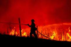
Getty The Detwiler Fire burns in the hills above town on July 18, 2017 in Mariposa, California.
The Detwiler fire continues to grow and is now threatening Mariposa, California, with residents in other regions also being called to evacuate. As of Wednesday, the fire was only seven percent contained. Where and how did this fire begin? Do we have any clue yet about what caused it?
Here’s everything we know so far. This story will be updated as more information is available.
The fire was first reported on Sunday, July 16. It began near Detwiler Road and Hunters Valley Road at 3:56 p.m. Pacific time, two miles east of Lake McClure. The fire quickly grew to over 1,000 acres in just a few hours and spread northeast. By that night, it had grown to 2,500 acres.
At this time, the cause of the fire is not known. However, we do know what conditions came together to help it grow and spread so fast.
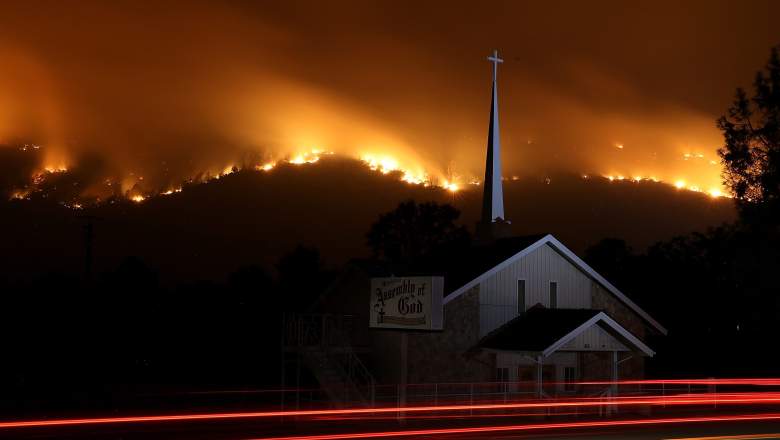
By Monday morning, July 17, the fire had spread to 7,100 acres and was growing fast. The fire was spreading so quickly because conditions seemed to create a “perfect storm” for its growth: high winds, intense heat, and limited resources. Dense brush and dead trees also gave added fuel to the fire. Two days ago, resources were being stretched thin when the fire was smaller, Sierra News reported. This is why on July 18, Gov. Jerry Brown declared a state of emergency. In just a day, the Detwiler Fire had grown to 25,000 acres and Mariposa was put under an evacuation order.

By Wednesday, July 19, the fire had spread to 45,000 acres with only seven percent contained.
When asked on Wednesday if Mariposa could be saved, CalFire Capt. Steve Kaufmann said, “I really can’t answer that. Right now we are working one day at a time.”
He added that the fire was behaving strangely and was very volatile and erratic. Some firefighters, he said, had never seen fire behavior like this before. But crews were working around the clock to fight the flames and putting in as many resources as possible.
As of the time of publication, evacuation orders have been placed for the following, according to Cal Fire:
Mount Bullion Ridge Road from HWY 49N to HWY 140 and ALL feeder roads; Old Toll Road between Corbett Creek Road and HWY 49N, including Corbett Creek Road.; Mount Gaines Road to No.9 Road including No.9 Road; HWY 140 from Hornitos Rd. to Hwy 49S and ALL feeder roads both sides. Yaqui Gulch Rd. from HWY 140 to Old HWY ALL feeder roads on both sides. Old HWY from 49S to School House Rd. and ALL feeder roads on both sides. Buckeye Rd. to Benhur Rd. both sides of the road and feeder roads. Benhur from Buckeye to Hwy 49S. Mariposa Town HWY 140 from 49N to East Whitlock Rd. and ALL feeder roads. East Whitlock Rd from HWY 140 to Mosher Rd. and All feeder roads to the West. Hornitos Rd. from HWY 140 to Mount Gaines Rd. and ALL feeder roads. Including the community of Whispering Oaks. West Whitlock from 49N to Mosher Rd. and ALL feeder roads and all areas north of the Merced River
Meanwhile, many other regions are under evacuation warnings.
Read more about the fire below: