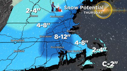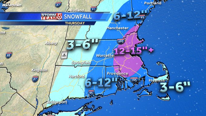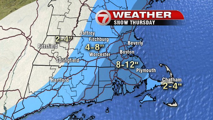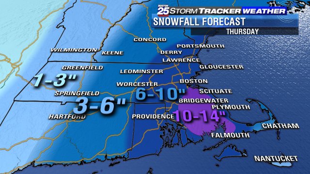
Snow is in the forecast for Massachusetts as a weather system riding the east coast approaches New England. According to the National Weather Service, areas in Massachusetts could see upwards of a foot of snow in this Nor’easter, which will begin on Thursday (January 4) morning and will wind down later on that same evening.
When the storm was first reported, weather outlets predicted a fairly classic snow event, with the National Weather Service predicting 4 to 8 inches of blanket coverage. Now, however, those predictions have increased in certain areas, bumping the potential snow totals to well over a foot.
This “major winter storm” has the potential to bring blizzard-like conditions to much of Massachusetts, with the worst bands from Boston to Worcester, south to Attleboro, and north to Amesbury. These areas are all in the “sweet spot,” which is a term used to describe the areas that see the most precipitation in a given storm.
Below are maps from four major stations in Massachusetts. As you can see, local meteorologists are all in agreement about one thing: Boston is going to get their first real dose of plowable snow this season.
It is quite possible that this storm will end up being a blizzard. In order for that to happen, however, a few things need to come together.
The National Weather Service defines a blizzard as a storm that drops several inches of snow which may or may not be “blowing snow,” coupled with winds exceeding 35 mph, visibility of less than 1/4 of a mile, and a duration of at least 3 hours.
If all of these factors are expected to occur simultaneously, the National Weather Service will issue a “Blizzard Warning.” A snowstorm, no matter how intense it might be, will not be dubbed a “blizzard” until all of these factors actually occur. Once the three-hour mark has been reached, the National Weather Service will release blizzard confirmation.
If one or two of these factors are expected to happen during a storm, the National Weather Service will issue a “Winter Storm Warning.”
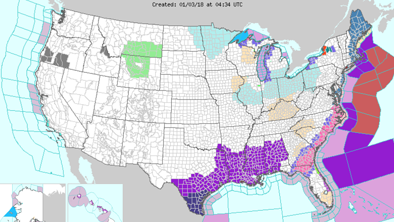
A Winter Storm Watch is in effect from now through Friday, January 5, for Central Middlesex County, Eastern Essex, Eastern Norfolk, Northern Bristol, Northern Worcester, Northwest Middlesex County, Southeast Middlesex, Southern Bristol, Southern Plymouth, Southern Worcester, Suffolk, Western Essex, Western Norfolk, Barnstable, Dukes, Eastern Plymouth, and Western Plymouth.
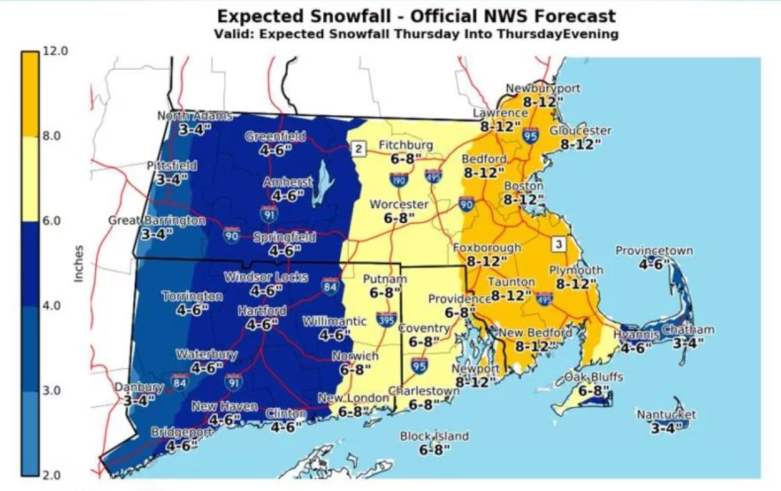
Below is a map of snow totals expected in each town in Massachusetts, Rhode Island, and Connecticut per the National Weather Service.
As Thursday approaches, that watch will turn into a warning. Below is an explanation from Weather Works that explains the difference between these two types of weather alerts.
“A watch means that the potential exists for the development of severe [weather]… While no immediate action on the part of the general public is required for the issuance of a watch, citizens should keep up to date on the current weather situation and be prepared to seek shelter if necessary.”
“A warning, on the other hand, requires more immediate action and should be taken seriously. A warning indicates that severe weather is imminent in your area or is already occurring (based on either human observation or doppler radar).”
