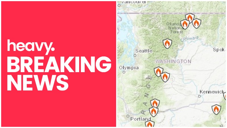
Fires continue to burn in Washington this month. And although the state may not be suffering from fires as badly as California, you’ll still want to watch the latest developments closely. Here are the details about the latest fire and red flag warning information for the states as of September 9, 2020. Read on for the details about the wildfires’ locations, containment, evacuations. Remember to also check your local news sources, as fire details can change quickly and with little warning.
For the latest map, see Heavy’s story here.
Interactive Fire Maps for Washington
A great way to keep track of fire activity is by looking at interactive maps. You can see an interactive map of the Oregon and Washington fires here, provided by NIFC.gov. You can also see the map below. Just click “OK” to get past the flash screen.
One of the best interactive maps available right now is Inciweb’s map. You can see the full map here. Inciweb is “an interagency all-risk incident information management system.” There’s an embeddable Google Map that includes Inciweb fires, which you can see below and also here. Depending on your browser, you may need to zoom into the map below using the + button within the map or go to the “Layers” dropdown box and turn off everything but Wildfire Preparedness and Inciweb Wildfire Information.
You can see weather warnings and Inciweb fire notices in Washington and Oregon in Google’s Crisis map at this link or on the map below. Depending on your browser, you may need to click the + sign to zoom into your region.
Firemappers has a statewide map below or here.
Another map of the fires in the region is here or below. You may need to move the map to see the fires in your region.
KREM 2 is providing live updates on all fires in the region.
Next are details on the individual fires for September 9, 2020, in alphabetical order. Some fires that are 100% contained may not be included, and this list is focusing mostly on major fires in the region.
Individual Washington Fires
Note that since evacuation details can change rapidly, it’s also good to stay tuned to local news, including local city and county Facebook and Twitter pages.
Apple Acres Fire
This fire is 6,300 acres, located three miles northeast of Chelan, WA. Some evacuation notices are in effect. It started September 7. Wenatchee World reported the fire is now 75% contained, although NIFC reports that it is 36% contained. No one was hurt in the fire.
Chelan Fire and Rescue says it is 35% contained.
Find an interactive map for the Apple Acres and Cold Springs Fires here:
Here’s an evacuation map.
Chelan Fire and Rescue is reporting evacuation updates here.
Babb Fire
This fire is at least 8,000 acres in size and 0% contained. (KREM 2 reports it as being 17,781 acres and combined with the Malden Fire.) It started five miles northwest of Rosalia on September 7. Spokesman reported that on September 7, the fire destroyed about 70% of the homes in Malden. It started in Spokane County and then crossed county lines into Whitman County, including Malden and Pine City.
Whitman County is also providing updates.
The Whitman County Sheriff’s Office’s Facebook page is a good source for updates about this devastating fire.
Spokesman reported that many places were destroyed by the fire.
People displaced by the fire should call the Red Cross at 509-670-5531, Spokesman reported.
Beverly Burke Fire
This fire is 920 acres and seven miles southeast of Vantage, Washington. It’s 30% contained and the cause is unknown. Structures are threatened but firefighters are gaining control according to the latest updates.
The fire burned three square miles near Beverly, KXLY reported.
Evacuation notices in Grant County were reduced. The Grant County Sheriff’s Twitter account is providing updates.
This map includes the Bev Burke Fire.
Big Hollow Fire
This fire is 6,000 acres and 0% contained, having started nine miles north of Stabler.
The Big Hollow fire is currently burning east and north of the Trapper Creek Wilderness on the Mt. Adams Ranger District and is estimated to be about 5,000 to 10,000 acres in size and growing.
Gifford Pinchot National Forest crews are assessing the situation and assisting with evacuations and clearing road corridors of downed trees resulting from recent heavy winds…
It is important to note that the local area remains under threat of dangerous fire conditions with a combination of extreme heat, significant wind events, dry conditions, and firefighting resources that are stretched thin across the region and nation. Due to these conditions, the Gifford Pinchot National Forest is developing closure orders for the southwestern portions of the forest to ensure public safety near the Big Hollow incident. This closure area will include developed campgrounds, dispersed camping, day use areas, wilderness areas, and all forest roads and trails within the area. If you have plans to be in this area of the forest, please consider making alternate arrangements.
Chikamin Fire
This fire is 1,200 acres and 90% contained as of September 7. It was caused by lightning about 11 miles northeast of Lake Wenatchee.
Christensen Road Fire
This fire is now contained, KERM 2 reported on September 9.
Cold Springs Fire
This fire is 163,000 acres and 0% contained, located three miles south of Omak. About 110 residences are threatened and 75 structures.
NIFC notes:
Firefighting efforts overnight focused on structure protection and working on containment lines. Additional personnel arrived overnight and will be on the fire line today. Structure protection is a primary focus and will continue throughout the day. Air resources will be in over the fire again to assist with the firefighting efforts on the
ground. Aircraft were used on the fire yesterday and were highly effective. Firefighters will be assessing properties that were lost as well as damaged infrastructure while on the line today. Temperatures today will be back in the 90’s with low relative humidity levels and light winds. There are approximately 200 firefighters engaged in firefighting operations.
Inciweb provided more details on the morning of September 8, including this map:

Cold Springs Evacuation map for Okanogan County is below.
Here’s an update shared Wednesday:
Find an interactive map for the Apple Acres and Cold Springs Fires here:
For updates including evacuation details, see the following:
- The fire information line is 509-822-8125.
- Get emergency alerts from Okanogan County here.
- Get county notifications here.
- Text OKCOUNTY to 888777 for non-emergency notifications.
- Cold Springs Fire webpage
- Cold Springs Evacuation map for Okanogan County
- Okanogan County Facebook page
- See Northeast Washington Fire Information
Customs Road Fire
This fire is 600 acres and 0% contained, located 1 mile west of Curlew. Some evacuations are in place.
Evans Canyon Fire
This fire is 75,817 acres and 90% contained. The fire started eight miles northwest of Naches. The cause is under investigation, Inciweb noted.
Inciweb noted:
The Evans Canyon Fire started in the afternoon on Aug 31, 2020 and is located in Yakima and Kittitas Counties in the Evans Canyon area. Air resources from around the Pacific Northwest are being used to combat the fire. Level 2 and level 3 “GO” evacuations remain in effect on the fire.

NIFC noted on September 8:
Safety Message: Existing Yakima and Kittitas County level 2 and 3 evacuation levels remain unchanged. For the latest evacuation updates, visit the YakimaCountyOEM Facebook page and the Kittitas County Sheriff’s Office web page. Please be aware and stay out of fire closure areas due to firefighters moving heavy equipment and finishing up work across the fire area. Air quality information can be found at https://wasmoke.blogspot.com/.
Fruit Valley Fire
This fire is 166 acres and now 100% contained.
Inchelium Complex Fire
This fire is composed of a number of fires. It started one mile north of Inchelium and evacuation notices are in place. It’s 8,000 acres as of the latest update from NIFC and 20% contained.
NIFC reported that the fire consisted of:
- Fry Fire (500 acres near Moon Mountain with Level 2 evacuations)
- Inchelium Highway Fire (2,500 acres with Level 2 evacuations)
- Kewa Field Fire (5,000 acres with Level 2 evacuations)
You can see another update below.
See Northeast Washington Fire Information for updates.
Manning Road Fire / Colfax Fire
This fire is 3,063 acres and 25% contained, located northeast of Colfax, Washington, KREM 2 reported. Evacuations are in place. The Manning covered bridge was destroyed in the fire, Pullman Radio reported.
Only eight homes in Pine City are still standing out of 20.
Palmer Fire
This fire is 17,988 acres and 95% contained, according to NIFC. It started seven miles southwest of Oroville and the cause is under investigation.
The fire grew because of high winds and many evacuations had been issued, but fire activity has decreased significantly.
The Palmer Fire’s county information page is here.
Pearl Hill Fire
This fire is 174,000 acres and 0% contained, having started nine miles east of Bridgeport, KERM 2 reported on September 9. The cause is not known and some evacuations are in place.
Wenatchee World reported that the fire started when the Cold Springs Fire jumped the Columbia River at Bridgeport, but they are reporting the fire is now 10% contained. There have been some evacuation notices issued in Douglas County as a result of the fire. See updates at Douglas County WA’s Facebook page, but more frequent updates are at the Douglas County Sheriff’s Office’s Facebook page.
You can also find updates at the Southeast Washington Interagency Incident Management Team on Facebook.
The NCW Fairgrounds are open for residents and livestock evacuating, Spokesman reported. Call 509-745-8480 if you need shelter.
Whitney Fire
This fire is listed as 100,000 acres and 5% contained, KREM 2 reported. It’s in Lincoln County between Davenport and Creston.
A number of evacuations have been issued and could still be issued.
See Northeast Washington Fire Information and Lincoln County Sheriff’s Office for evacuation updates, along with your local news.
Remember that evacuation details can change rapidly so stay tuned to your local news and local city and county officials for updates. KREM 2 is providing live updates on all fires in the region.
READ NEXT: The latest COVID-19 deaths, cases, and updates


