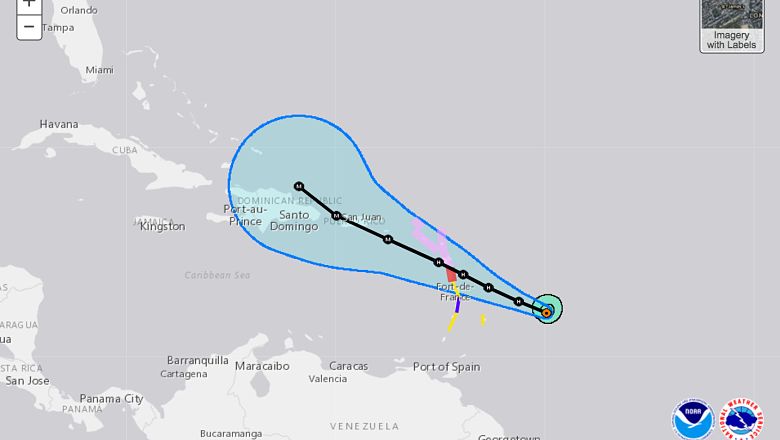
Hurricane Maria is currently a Category 1 storm. She is moving west northwest at 15 mph, with her immediate sights set on Antigua and Barbuda. Maria is expected to strengthen even more as she coasts over the warm waters of the Caribbean. She will be impacting Puerto Rico as a Category 3 storm by Wednesday, according to the National Hurricane Center, before heading to the Dominican Republic, maintaining her strength.
At this time, the National Hurricane Center has not issued a tropical storm or hurricane watch or warning for Hispaniola. It is unknown if Maria will make landfall in the Dominican Republic, as the eye of the storm could stay to the north of the island. However, inclement weather is expected from the outer bands of the storm either way.
“Conditions may begin to deteriorate starting Tuesday in the Virgin Islands and then spread west towards Puerto Rico by Wednesday. Portions of the Dominican Republic and Haiti could see impacts from Maria begin as early as Thursday. The extent of any wind or storm surge impacts will be dictated by the exact strength and path of Maria at that time. Heavy rain will also be a threat and could contribute to flooding and mudslides,” reports The Weather Channel.
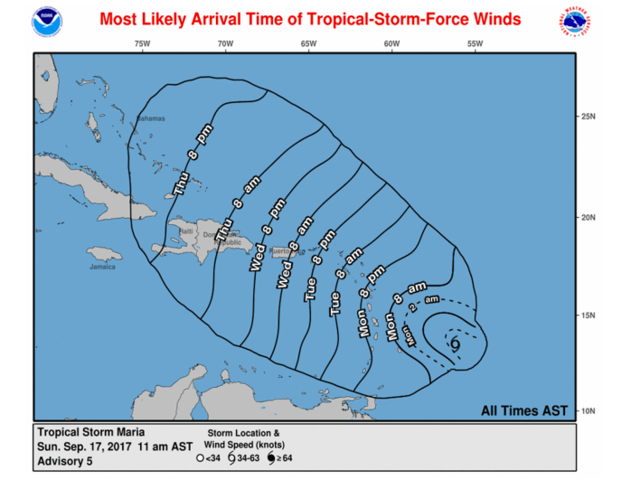
The map below shows when tropical-storm-force winds are expected to arrive in the Dominican Republic. This will be the very first thing that residents will notice; the winds are expected to pick up in the overnight hours between Wednesday and Thursday, according to the National Hurricane Center.

National Hurricane Center
As far as rainfall totals, that is going to heavily depend on Maria’s direct track. As of today, The Weather Channel shows about 3 to 5 inches of rainfall in the Dominican Republic by Thursday, but those numbers could rise as Maria’s track becomes more clear in the coming days.
Below is a video of Hurricane Maria’s projected path.