The latest Hurricane Irma “spaghetti models” showed better news for much of Florida on September 7, but not such great news for South Carolina.
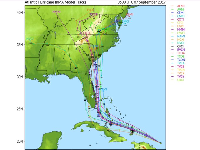
The September 7 spaghetti models show the massive storm continuing to shift to the east, running up the eastern coast of Florida (as opposed to, say, right through the middle of it), and then making landfall in South Carolina. Georgia is also in peril in some of the models.
An important admonition on spaghetti models; they’re just projections. The storm remains very unpredictable. Take caution and prepare. However, taken together they show the thrust of the projections – to the east. They’re all pretty much showing the same thing right now. The South Carolina governor has taken heed and declared a state of emergency, following on the heels of Florida. Georgia’s governor declared a state of emergency in some coastal counties.
The South Florida Water Management District has an updated Hurricane Irma spaghetti model page.
Here’s the spaghetti model for the morning of September 7:
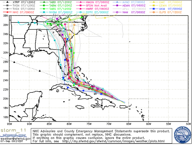
South Florida Waste Management DistrictThursday morning spaghetti model.
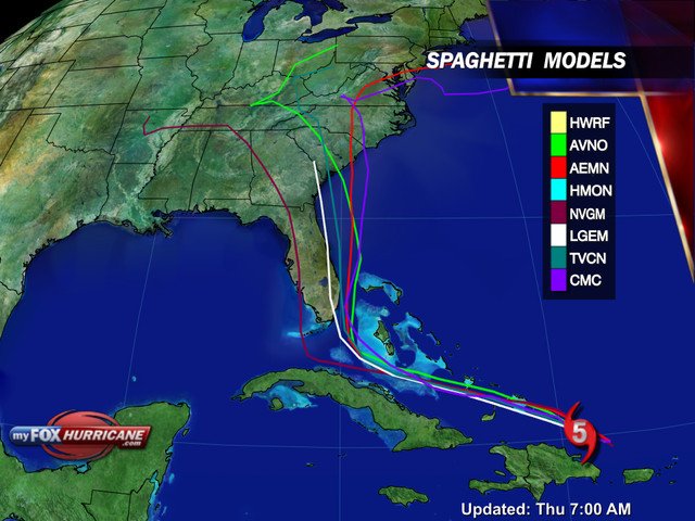
Here’s what it showed on the evening of September 6: The eastward trend had already started.
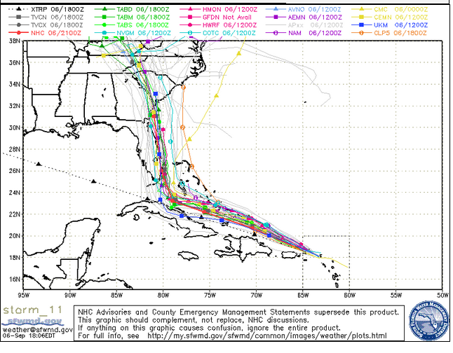
A spaghetti model of the Hurricane Irma path for September 6 in the evening.
Check out the shift in the storm since the September 6 morning spaghetti model:
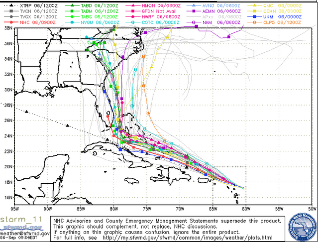
South Florida Water Management DistrictSpaghetti model from the morning of September 6.
Cyclocane has a page of updated spaghetti models for Hurricane Irma that show a similar trend. You can see them here.
See a slideshow of recent spaghetti models for Irma.
The National Center for Atmospheric Research (NCAR) also has Hurricane Irma spaghetti models.
See some of the latest for September 7 here and here.
Some people point out that caution should be used when relying on spaghetti models; in contrast, the other cone approach contains a cone of uncertainty, whereas spaghetti models don’t always capture a storm’s incredible unpredictability.
What are spaghetti models? “Spaghetti models (also called spaghetti plots) is the nickname given to the computer models that show potential tropical cyclone paths. When shown together, the individual model tracks can somewhat resemble strands of spaghetti,” reports Cyclocane.
Explained The Washington Post: “Usually, each ‘strand of spaghetti’ is not representative of a unique model. Instead, the entire bowl of noodles is data churned out by the same weather model. Each noodle is called an ensemble member. When a weather model produces a forecast, it has to initialize the data, taking in current conditions to get an idea of what the atmosphere is already doing on a three-dimensional grid.” The Post notes that the models require estimates that are not always accurate.
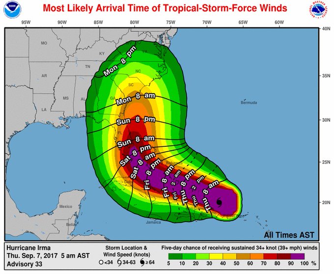
Spaghetti models are not the only orecasting approach being used to track Irma. The National Oceanic & Atmospheric Administration (NOAA) uses a forecast cone. Here’s the morning cone for September 7:
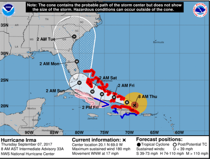
NWSThe Irma forecast cone as of the morning of September 7.
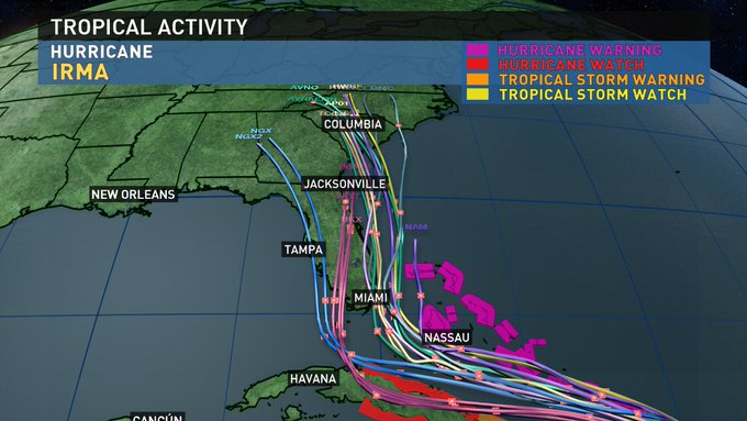
This spaghetti model shows the storm as less focused.
Here are more recent spaghetti models for Irma:
https://twitter.com/TLNKansasCity/status/905605321342648320
