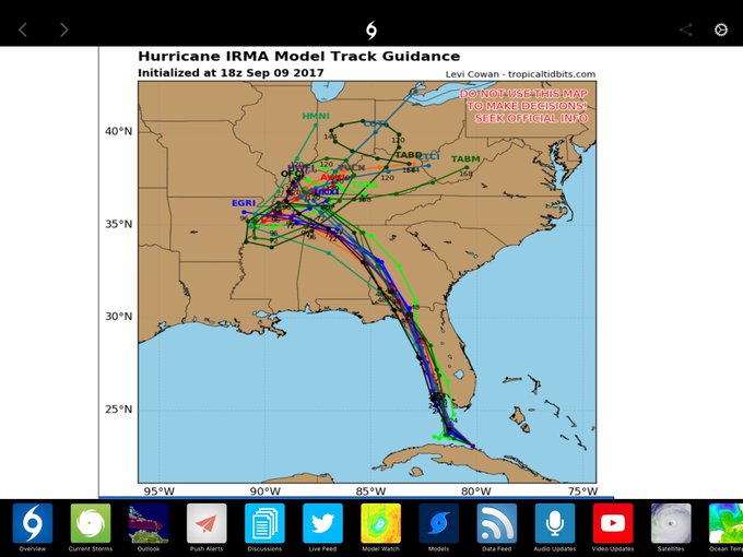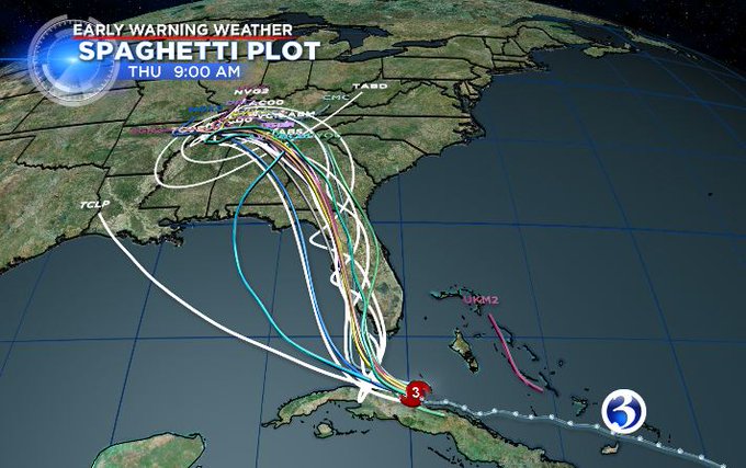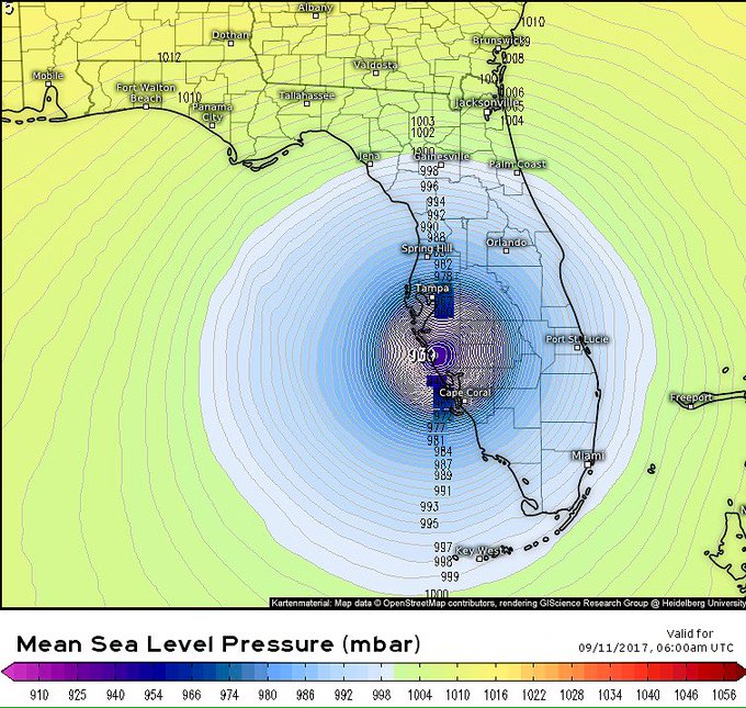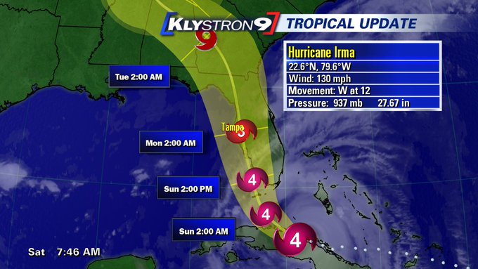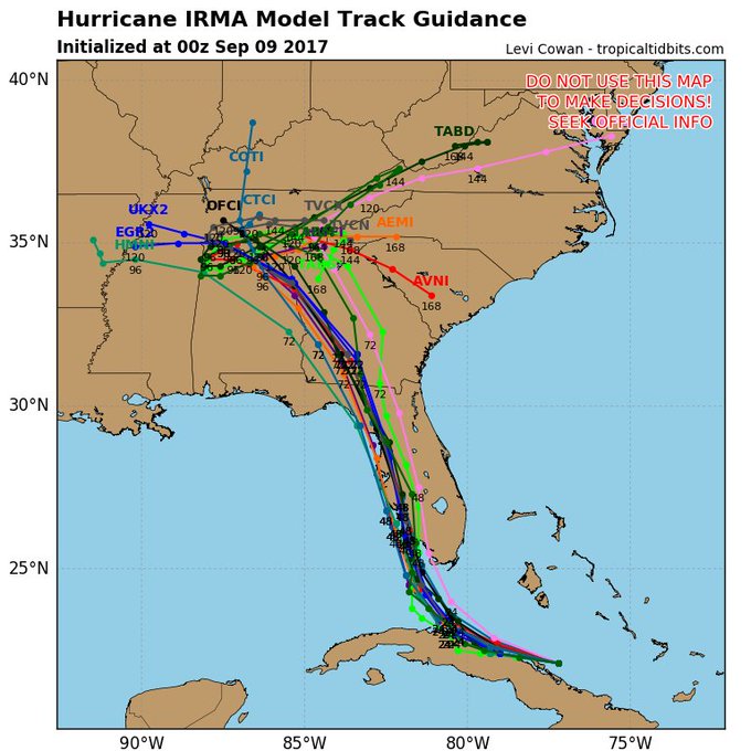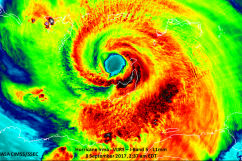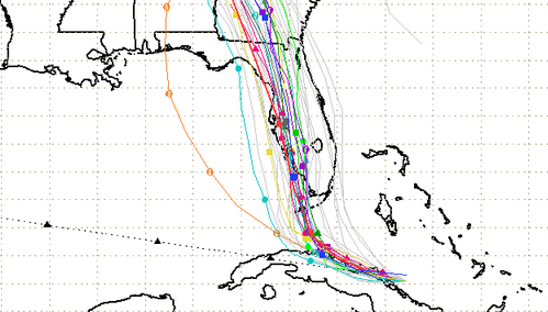
The latest Hurricane spaghetti models on Saturday, September 9 show that the hurricane has continued shifting west, which is frightening news for people on Florida’s west coast, especially in the coastal communities between Naples and Sarasota, where many experts believe the hurricane will make landfall.
For days, models were showing that the hurricane was shifting east, even raising hopes it could head out to sea. The newer westward trends could be bad news for people in West Coastal cities like Tampa, Naples, Port Charlotte, and Fort Myers, although the models are simply projections, and the monstrous storm remains unpredictable. However, expert opinion has now clustered around the believe that western Florida is going to see the direct hit.
The stretch of coastal communities along southwestern Florida are clearly in the most peril. “Florida’s southwest coast from Cape Sable to Captiva could see ‘catastrophic’ storm surge flooding of 10 to 15 feet,” CNN reported.
You can see continually updating spaghetti models at this page run by the South Florida Waste Management District. Here’s their spaghetti model for September 9 in the evening.
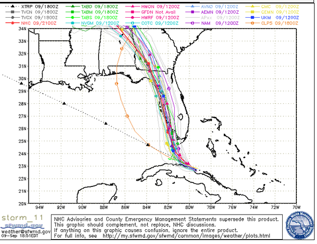
Saturday evening spaghetti model.
Their Saturday afternoon spaghetti model for September 9 already showed the western Florida peril (as well as the peril to the south).
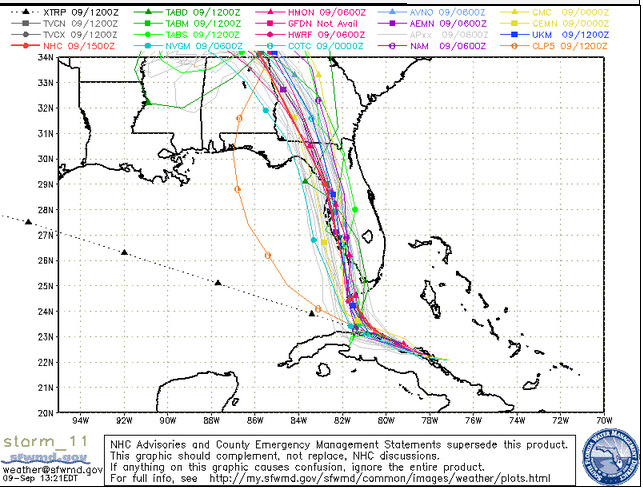
South Florida Waste Management DistrictSpaghetti model for the afternoon of September 9.
Here’s their model for Saturday morning.
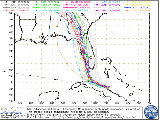
Saturday morning spaghetti model.
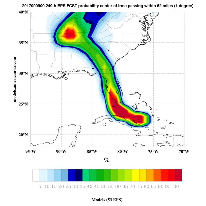
The European model is projecting the hurricane could make landfall between Naples and Port Charlotte, Florida.
Others are also predicting the same.
Tampa’s office of the National Weather Service says that landfall is expected between Sarasota and Naples. According to the Associated Press, “Meteorologists predicted its center would blow ashore Sunday in the perilously low-lying Florida Keys, then hit southwestern Florida and move north, plowing into the Tampa Bay area.” Others are projecting landfall between Port Charlotte, a small unincorporated community, and Naples.
This spaghetti model shows how Miami may now be missed:
Here is a city map of Florida so you can see the other communities in that area. Before the westward trend, it had been projected the hurricane might make landfall in Miami, but most experts aren’t saying that anymore.
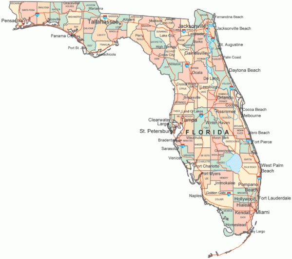
Florida DMVFlorida city map.
That’s a pretty pronounced difference since September 6. For comparison purposes, this was the spaghetti model from the South Florida website on the 6th.
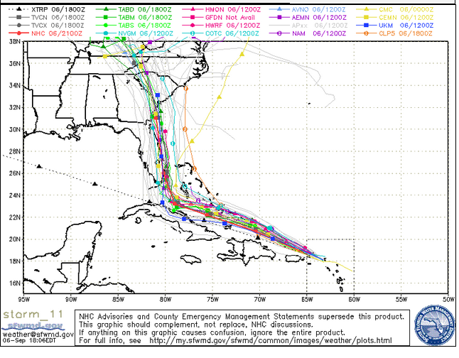
South Florida Water Management DistrictA September 6 evening spaghetti model.
Cyclocane is another good site to check updated spaghetti models. You can see a map with a continually updating model here. The September 9 model also shows the massive hurricane making landfall in Florida in the southwest before crawling up the western coast of Florida.
Another agency that runs updated spaghetti models is the National Center for Atmospheric Research. You can see some of their September 9 spaghetti plots here and here.
A few miles difference could make all of the difference for some areas of Florida, and the storm remains unpredictable. Here’s another look:
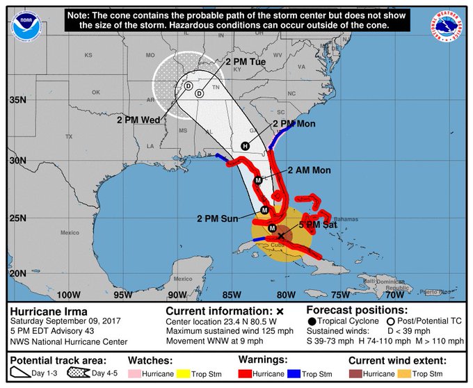
Other agencies use cone forecast maps. Here’s the National Hurricane Center’s Saturday evening map:
The European model, which many consider to be the more accurate one, shows the same westward trend.
See wind arrival times for the hurricane here:
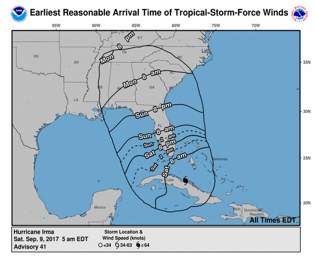
Wind arrival times for Irma – Saturday, September 9 projection.
Of course, spaghetti models are only one way to track the story. You can go here for a list that includes some other ways to track the storm.
Despite the seriousness of the storm, many people had had enough of spaghetti models – and Irma.
