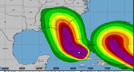
NWS Irma wind speeds for Saturday.
With Hurricane Irma increasingly threatening western Florida, a lot of people are wondering: When will Irma hit Naples, Florida?
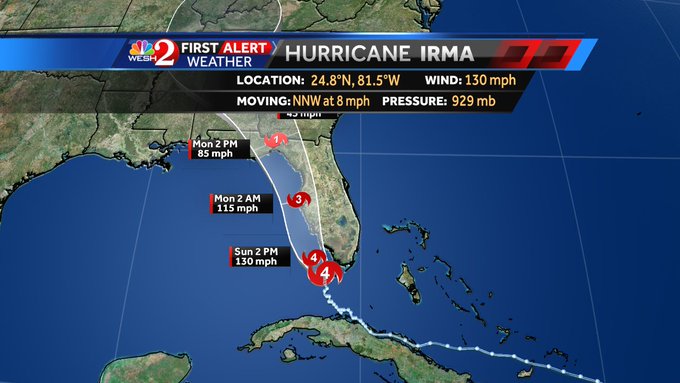
By 5 p.m., the hurricane had made its second landfall along Marco Island and was five miles from Naples.
The hurricane, at 2 p.m., was 5 miles from Marco island off Florida’s southwest coast and only 19 miles from Naples.
The September 10 weather forecast for Naples projects that hurricane conditions are “expected” for Naples later in the day on September 10 and also Sunday evening. The eye of the hurricane, at 8 a.m. on the east coast, was just moving over Key West. The storm strengthened overnight into a Category 4 storm.
This is the Sunday morning forecast for Naples.
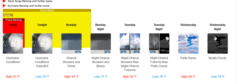
The forecast of Naples on Sunday morning September 10.
There is a hurricane warning for Naples, as recent forecast models showed the storm shifting to the west.
Here is a time arrival map for tropical force winds from the storm:
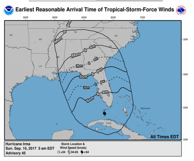
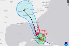
See how the storm has shifted to the west, and then retained that path:
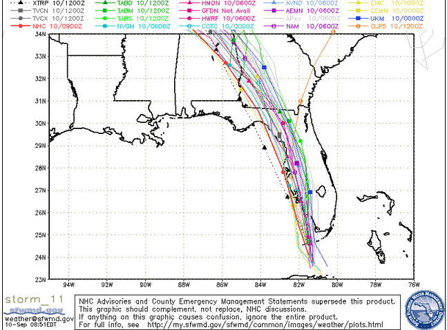
Sunday morning spaghetti model.
According to Weather.com, this is the September 9 projection for Irma arrival time in Naples:
Naples/Ft. Myers, Florida
Peak storm surge forecast: 8 to 12 feet
High tide times (Naples): Sunday 3:02 a.m., 4:07 p.m.; Monday 3:40 a.m.
Tropical storm-force winds begin: Saturday evening (Note that NWS now says it’s possible hurricane conditions could exist Saturday evening)
Hurricane-force winds begin: Late Sunday morning
Strongest winds, timing: Sunday night
Naples is advising residents of Collier County: “Mandatory evacuations are now in place for parts of Collier County west and south of US 41.
Marco Island announced a mandatory evacuation effectively immediately Friday.
Mandatory evacuations for Goodland, Everglades City and Chokoloskee.
Deputies advise residents to voluntarily evacuate town especially if you live in a flood-prone area or your home can’t withstand Cat-3 storm winds
Those who plan to use the shelters should bring medications, cell phone chargers, toiletries, favorite snacks and anything else you need to be comfortable.”
Collier County provided this shelter information on shelters as of September 8:
“The following shelters are accepting new evacuees:
• Corkscrew Middle School 1165 County Road 858, Naples, FL 34120 (no pets)
• Cypress Palm Middle School 4255 18th Ave. NE, Naples, Florida 34120 (pets allowed)
• North Collier Regional Park 15000 Livingston Road, Naples, Florida 34109 (pets
allowed)
The following emergency shelters are at capacity and are not accepting any new evacuees:
• Mike Davis Elementary School, 3215 Magnolia Pond Drive, Naples, Florida 34116 (no
pets)
• North Naples Middle School, 16165 Learning Lane, Naples, Florida, 34110 (no pets)
• Eden Park Elementary School, 3650 Westclox Street, Immokalee, Florida 34142 (no
pets)
• Gulf Coast High School, 7878 Shark Way, Naples, Florida 34119 (no pets)
• Golden Gate High School, 2925 Titan Way, Naples, Florida 34116 (no pets)
• Immokalee High School, 701 Immokalee Drive, Immokalee, Florida 34142 (no pets)
• Immokalee Middle School, 401 N. 9th St., Immokalee, Florida 34142 (pets allowed)
• Oak Ridge Middle School, 14975 Collier Blvd., Naples, Florida 34119 (no pets)
• Lely High School, 1 Lely High School Blvd., Naples, Florida 34113 (no pets).”
The hazardous weather forecast for Naples said on September 9:
“Major Hurricane Irma remains an extremely dangerous threat for all of South Florida, with a direct major hurricane impact likely over Southwest Florida. The main concern will be the potential for catastrophic and life-threatening storm surge inundation in Southwest Florida. The storm surge threat is not only limited to the immediate coast but also extends further inland. If you are ordered to evacuate, PLEASE DO SO NOW! Time is running out to leave areas under evacuation orders. Devastating major hurricane force winds across large portions of South Florida is another significant concern with Irma.
Hurricane Irma is slowing down ahead of its expected turn to the northwest. The outer bands of Hurricane Irma will move across South Florida this afternoon and evening. The threat of tornadoes and strong wind gusts will continue to increase through the day. Tropical Storm force winds will begin to overtake South Florida this afternoon and tonight, with hurricane conditions as soon as pre-dawn hours on Sunday.
Preparations to protect life and property should be complete! All persons in South Florida should take shelter and be prepared for dangerous conditions through Monday. Hurricane Irma is a potentially deadly situation and should not be taken lightly. Everyone is urged to exercise extreme caution in order to protect their lives.”
