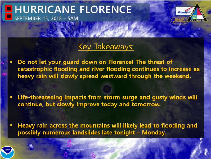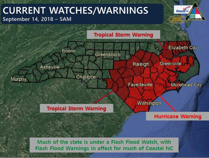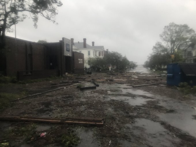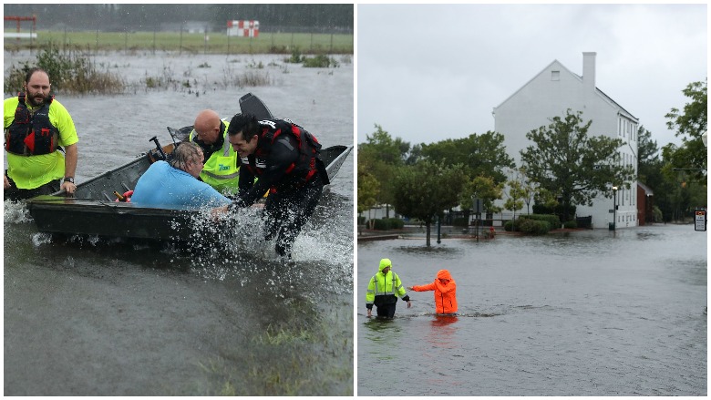
With 10 to 25 inches of rain having already fallen in eastern North Carolina, Tropical Storm Florence is not yet finished. Continuing heavy rain of as much as two to three inches per hour means deadly flash floods, land and mud slides.
State emergency officials warn people not to “let their guard down.”
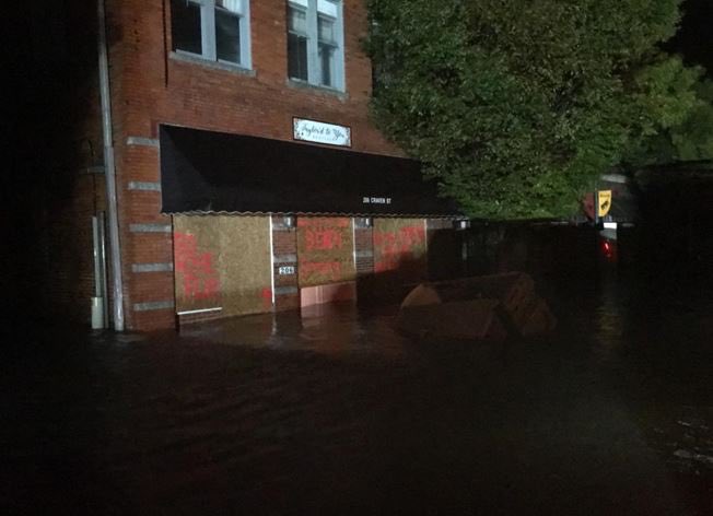
North Carolina Gov. Roy Cooper described Hurricane Florence in a briefing Friday as “…powerful, slow and relentless. It is an uninvited brute, who doesn’t want to leave. The storm surge alone has overwhelmed the city of New Bern. There have been over 100 swift water rescues there over the night.” Cooper said there have been wind gusts of over 100 MPH in Wilmington and the “situation is getting worse. The storm is going to continue its grind over our state for days. For those in the storms path: please stay indoors.”
And with the torrential downpours from the storm, Cooper said, “Roads across NC are underwater. Rivers will have significant flooding. Rivers will keep on rising for days after the rain stops. Be sure to leave if you are told to. Otherwise, stay indoors and off of the roads.”
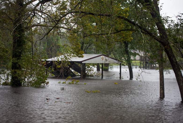
Flood waters from the Trent River inundate a park in Pollocksville, North Carolina on September 14, 2018 during Hurricane Florence. – Forecasters warned of catastrophic flooding.
As has been reported by the National Weather Service, which includes the National Hurricane Center, the potential for “catastrophic” flooding to include inland rivers and lakes in the Carolinas means some may be “under water for days and possibly a week or more.”
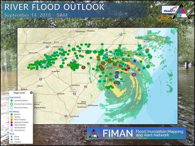
Cooper said, ” Relentless rains will continue throughout the weekend. Rescue crews are working in dangerous conditions. Do not put yourself and them in danger. Remember to not fly drones in a rescue area. Rescue helicopters will have a hard time flying if you do.” It was added that “Flood mapping information is being shared so that local officials can determine where the next rescue area will be. Dial 211 for more information.”
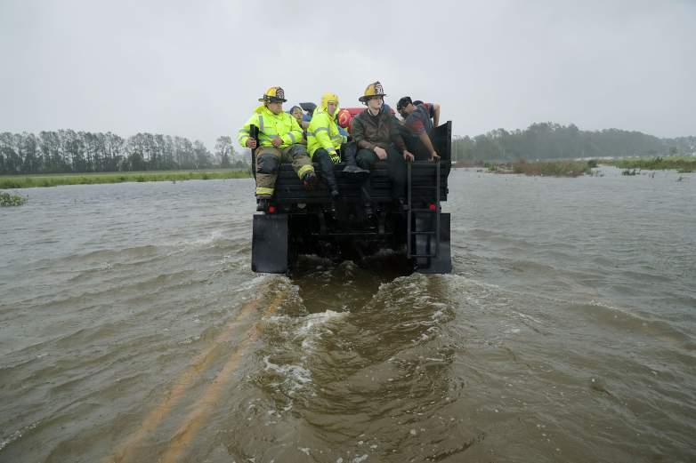
Rescue workers from Township No. 7 Fire Department and volunteers from the Civilian Crisis Response Team use a truck to move people rescued from their flooded homes during Hurricane Florence .
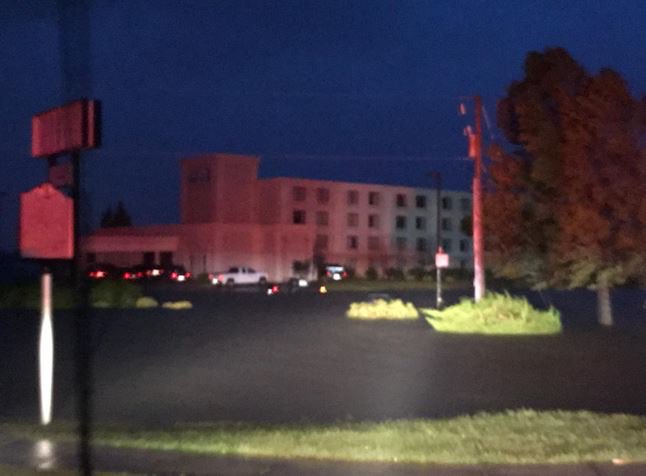
At noon on Thursday, when landfall was not expected for another 12 hours, ocean surge had already inundated coastal communities including New Bern and Top Sail Beach, where evacuations were mandatory, though many did not leave.
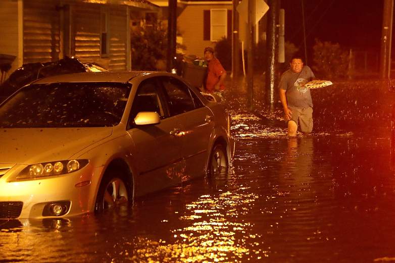
Men pack their belongings after evacuating their house after the Neuse River went over its banks and flooded their street during Hurricane Florence September 13, 2018 in New Bern,.
The surge by late Thursday night means hundreds were stranded and called for rescue.
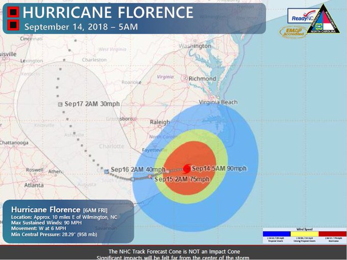
Meanwhile, it had been cautioned for days that with a storm of its size, some 300 to 500 miles across, not to mention its near-stalling and now, slowly approaching land, Florence will dump feet of rain.
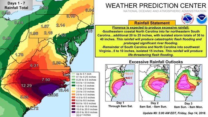
“Life-threatening, catastrophic flash flooding and prolonged significant river flooding are likely over portions of the Carolinas and the southern and central Appalachians through early next week,” the NWC said.
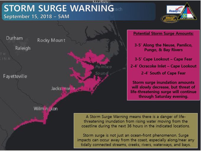
In its bulletin and public advisory Friday morning, the NHC says that the “combination of a dangerous storm surge and the tide will cause normally dry areas near the coast to be flooded by rising waters moving inland from the shoreline.”
From Cape Fear to Cape Lookout the water will rise to 7 to 11 feet with higher amounts in the Neuse, Pamlico, Pungo, and Bay rivers. From Cape Lookout to Ocracoke Inlet waters will rise up to 9 feet and other coastal areas and rivers will see water rising anywhere from 2 to 6 feet, the NHC says.
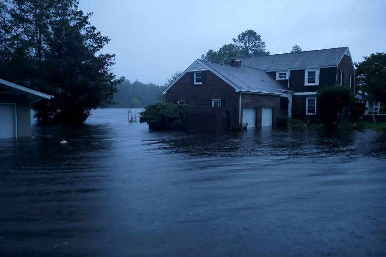
The Trent River overflows its banks and floods a neighborhood on Thursday, a half day before Florence made landfall at Wrightsville Beach at around 8 a.m. Friday. Catastrophic flooding is certain for the coastal Carolinas.
“The deepest water will occur along the immediate coast in areas of onshore winds, where the surge will be accompanied by large and destructive waves. Surge-related flooding can vary greatly over short distances,” the advisory reads.
The rainfall from Florence will only make matters far worse as it’s expected to be “heavy and excessive” in southeastern coastal North Carolina into far northeastern South Carolina (with) an additional 20 to 25 inches, with isolated storm totals of 30 to 40 inches. This rainfall will produce catastrophic flash flooding and prolonged significant river flooding.”
The key takeaway is that the flooding from Florence will not only be record-breaking or close, it will be life threatening and prolonged.
And flooded roads are dangerous at best and deadly at worst. State law enforcement is telling people to stay off the roads.
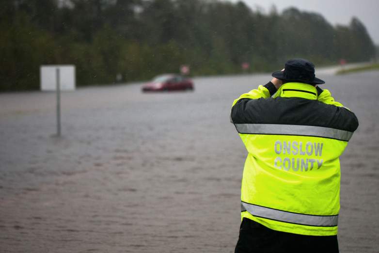
Members of Onslow County emergency look to see if a passenger was still in a car that was overtaken by flooding on US Route 17 outside of Jacksonville, NC Saturday Sept. 15 during Tropical Storm Florence.
“With flooding conditions worsening, roadway conditions are deteriorating. Overnight respondents have responded to 108 calls for service and 30 collisions. Do not drive through barricades or drive through floodwaters and look out for debris in the road,” North Carolina State Highway Patrol Col. Glenn McNeill said.
This story will be updated.
READ NEXT: When’s my Power Coming Back On?

