Evacuations are underway in parts of California due to the Camp Fire in Paradise, which was first spotted this morning and quickly grew to 20,000 acres by the evening. By this evening, the Hill Fire in the Ventura County area had also grown to nearly 8,000 acres. With these fires grabbing headlines, it’s time to get updated on the fires in California today. Here are the latest updates on all the fires in California as of November 8, with a roundup of maps of the larger fires around the state. News on the fires is constantly changing, so call your local officials if you are concerned about evacuations near you.
For an updated story about California fires near you on November 9, see Heavy’s newest story here.
There are currently multiple active fires in California. This article first includes interactive maps for all of California. Then the second section details specific fires in the region. If you’re looking for a specific fire, such as the growing Camp Fire, scroll down or search for the fire’s name or your city’s name. This is a developing story.
Interactive Maps of California Fires
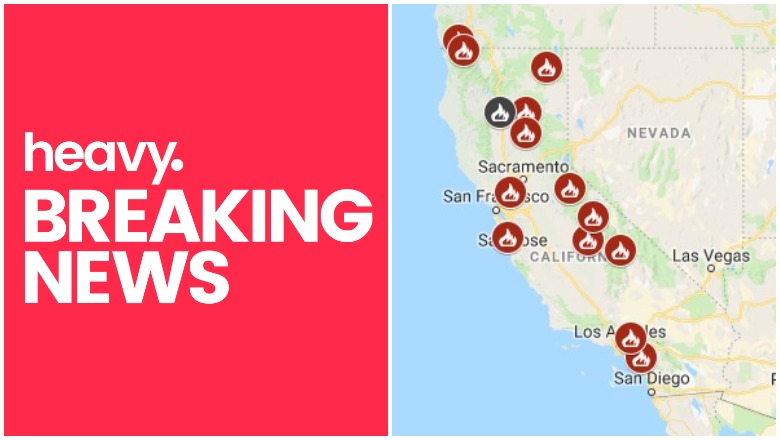
This map below is an interactive map of the more significant fires in California, consistently updated and provided by CAL FIRE and Google. Fires in red are active and fires in black are contained. Read the next section for details about the fires listed on the map. You may need to zoom into this map to see California up close.
Below is another active fire map from Google’s Crisis Map. Zoom in to see areas of interest. This map also includes fires in other states.
Next are more specific details on the fires for November 8. The details are extensive, so if you are looking for a specific fire, search for the name so you can find it faster, or just scroll down and look at the fires, listed in alphabetical order.
List of Active Fires in California
Here are the active fires and updates about them, per CAL FIRE. Most of these are in alphabetical order. Note that many of these fires are still listed on CAL FIRE’s map as active, but they are no longer listed as active by Inciweb or other sources. We will note that in the fires’ descriptions below. The most active fire right now is the Camp Fire, with the Miller Fire and Rincon Fire mostly under control. There is also a newer fire in Suisun City, and a fire in Ventura County called the Hill Fire. The Woolsey Fire has also been reported today.
Note that many regions, like Vacaville and Marin County, are seeing smoke from the Camp Fire, which is extending far into other areas. But multiple new fires have also cropped up today, in addition to the Camp Fire.
Branscombe Fire
What started out as two small fires led to one fire that grew to 4,000 acres in early October. Smoke from the fires could be seen in Danville and in many other areas, causing people to wonder if the fires were closer than they were. When the fires were at their greatest, smoke could be seen in Napa County, Alameda County, Contra Costa County, Fremont, Cupertino (where apartment smoke alarms were triggered,) Santa Clara County, and more.
The fire is now 4,500 acres and 98 percent contained as of October 30, according to CAL FIRE.
Brushy Fire
The Brushy Fire in Mendocino County is near Dos Rios, off Highway 162, east of Highway 101 and west of Covelo, CAL FIRE reported. It’s 20 acres and 25 percent contained. Mendocino County is also seeing drift smoke from the Camp Fire.
Camp Fire in Paradise
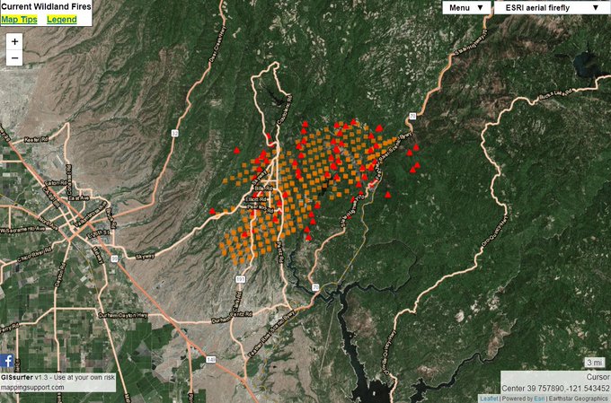
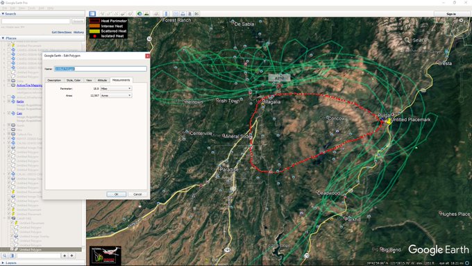
This fire was first spotted at 6:30 a.m. on November 8, and quickly grew to 5,000 acres. Around 2 p.m. Pacific, KTVU reported that it had grown to 8,000 acres, and by 8 p.m. it had ballooned to 20,000 acres. It was 0 percent contained as of late afternoon on Thursday.
Numerous evacuations have been issued for this fire. Here are some maps of the fire:
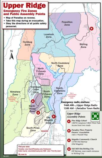
Evacuations have been ordered in the Centerville and Butte Creek areas. These include, but may not be limited to, evacuation orders for:
- Carnegie Zone in Paradise
- North Pines Zone in Paradise
- North Fir Haven Zone in Paradise
- Old Magalia Zone in Paradise
- South Coutelenc Zone in Paradise
- South Fir Haven Zone in Paradise
- South Pine Zone in Paradise
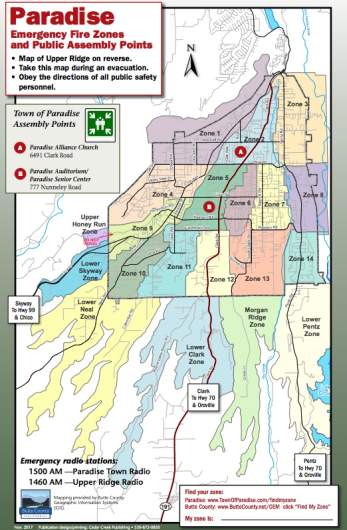
- Zones 2, 6, 7, 11, 12, and 13 in Paradise (per KCRA)
- The town of Pulga
- The community of Concow (per Oroville MR.)
- Butte College
- Centerville and Butte Creek areas (per KCRA)
- The area of Pentz and 70 South to 149, including Butte College
- The area of Highway 70 from Concow South, including all of Yankee Hill on both sides of 70
- The Lower Clark and Lower Skyway zones as of 1:40 p.m. Pacific.
- The Nimshew Zone as of 1:49 p.m.
- The area of Cherokee from Highway 70 to the lake south to Table Mountain Blvd. as of 8 p.m.
- The area on both sides of Oro Chico Highway from Durham Dayton north to Estates Drive, as of Thursday night.
- The Nelson Shippee Road has been added to evacuation orders.
Here is a map of the evacuation zones in Paradise, in case you’re not sure where your zone is. Click here to look up your zone by address. Or see a larger version of the Paradise Evacuation Zone map here. Here are some evacuation zone maps:
Here are some evacuation centers in the area:
- Large animals can be evacuated to the Butte County Fairgrounds at 199 E. Hazel St. in Gridley, California.
- Oroville Nazarene Church at 2238 Monte Vista Ave. in Oroville is an evacuation center. (As of 9 p.m. Pacific on Thursday, Butte County California reported that this shelter was full.)
- Neighborhood Church on 2801 Notre Dame Blvd. is an evacuation center.
- Small animals can be evacuated to the Old County Hospital at 2279 Del Oro and Mo, Suite E.
- The Butte County Fairgrounds (199 E. Hazel St. in Gridley) has been opened as a general evacuation center.
- A shelter is now open at the Yuba-Sutter Fairgrounds (442 Franklin Ave., Yuba City)
- The Chico Elks Lodge (1705 Manzanita Ave in Chico, California) opened as a shelter at 8:30 p.m. on Thursday.
- A second small animal shelter has been opened at Chico Airport.
Camp Fire evacuations can change rapidly. Follow the Butte County Sheriff’s Twitter account and the Butte County’s Twitter for the latest updates.Emergency radio stations for the Paradise area include 1500 AM (Paradise Town Radio) and 1460 AM (Upper Ridge Radio.) See Heavy’s story about the Camp Fire here for more details.
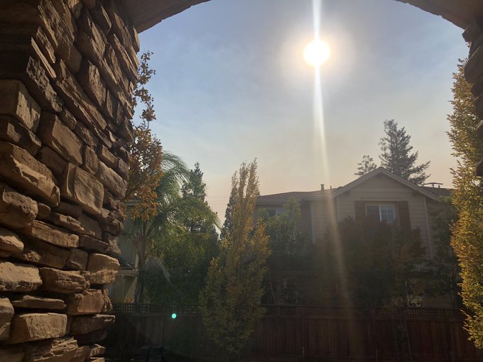
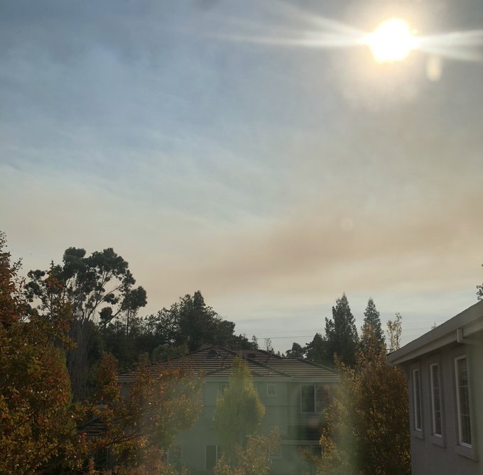
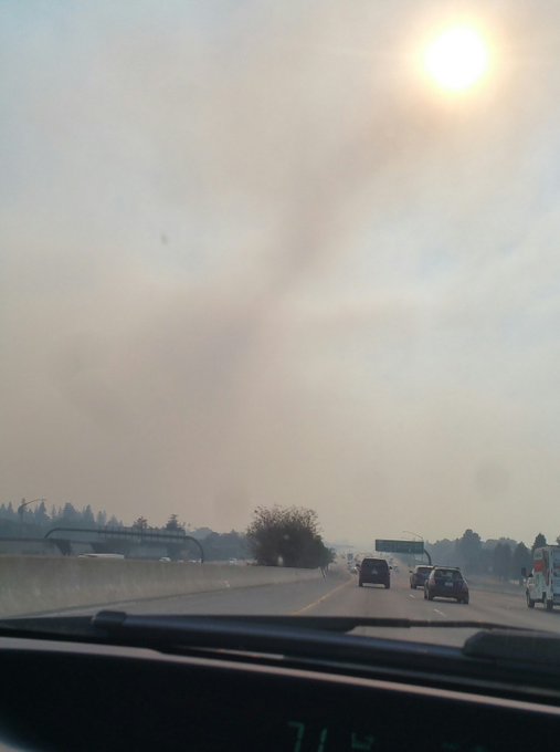
Many counties and cities are seeing smoke from this fire and wondering if it’s near their area. Marin County areas have noted seeing smoke, for example.
Smoke from the fire can also be seen in Suisun City, but a smaller fire is in Suisun City too.
If you’re in Vacaville and see smoke, that is also from the Camp Fire.
You can also see smoke from the fire in the Walnut Creek, Berkeley and East Bay area.
You can also see the smoke from the Camp Fire in Ukiah:
And you can see the smoke from Concord too:
Donnell Fire
This fire is in the Stanislaus National Forest and is 36,450 acres with 90 percent containment, as of October 1. This fire is no longer considered active, although CAL FIRE still has it listed as active on its map. Inciweb is no longer updating the fire page.
Eagle Fire
This fire is listed as active on CAL FIRE’s map, but updates haven’t been issued since early October. CAL FIRE notes: “CAL FIRE is assisting the Sierra National Forest with a fire off Bobs Flat Trail, 3 miles north of Trimmer (Fresno County).” The fire’s current status isn’t known. The most recent information is from October 2.
Essex Fire
CAL FIRE is helping Modoc National Forest with this fire, which is located east of Essex Reservoir and northeast of Canby in Modoc County. The fire is still listed as active on CAL FIRE’s map as of September 19, but CAL FIRE hasn’t released any updates on the fire since September 4.
Fork Fire
“CAL FIRE is assisting the Angeles National Forest with a wildfire off East Fork Rd & San Gabriel Canyon Rd, Azusa (Los Angeles County),” according to CAL FIRE’s map listing. According to Inciweb, the fire was 166 acres and 98 percent contained as of October 4. This fire is no longer considered active and is not being updated by Inciweb daily.
Garner Complex Fire
Although still listed on CAL FIRE’s map as active, it is no longer considered an active fire by Inciweb, which is no longer updating details about it. It’s 8,886 acres and 85 percent contained as of August 9.
Georges Fire
This fire has been inactive for several weeks and is 95 percent contained, per Inciweb on August 24. It is still listed on CAL FIRE’s map, but Inciweb no longer considers it active and CAL FIRE stopped issuing updates on September 4.
Hill Fire in Ventura County & Camarillo Springs
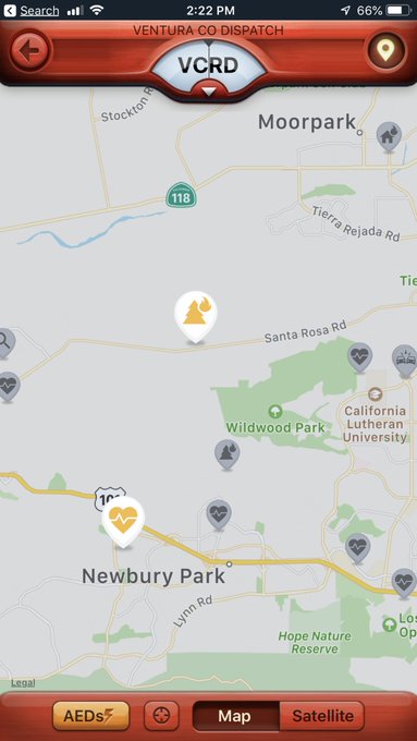
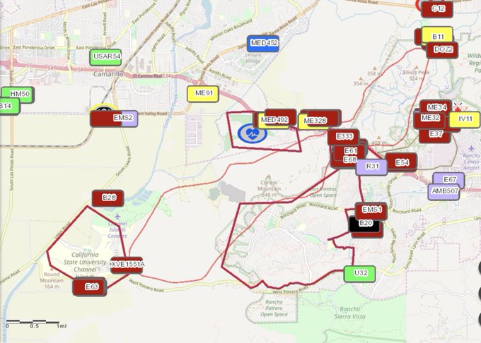
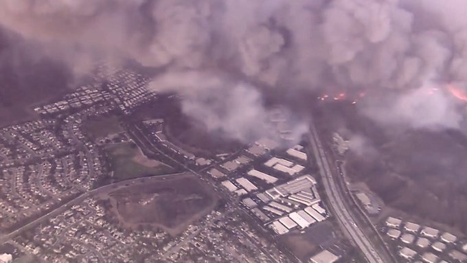
A newer fire, dubbed the Hill Fire, is in Ventura County in Santa Rosa Valley, near Camarillo. This fire has grown fast and CAL FIRE reported at 7:49 p.m. that it was 10,000 acres in size.
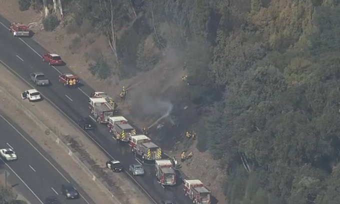
The fire started out being about 100 acres in size and quickly grew after it jumped Highway 101.
As of Thursday night, mandatory evacuations have been issued for:
- Point Magu Naval Base
- Camarillo Springs (all areas)
- Vallecito Trailer Park (all areas)
- Callifornia State University Channel Islands (all areas)
- Dos Vientos (the entire region)
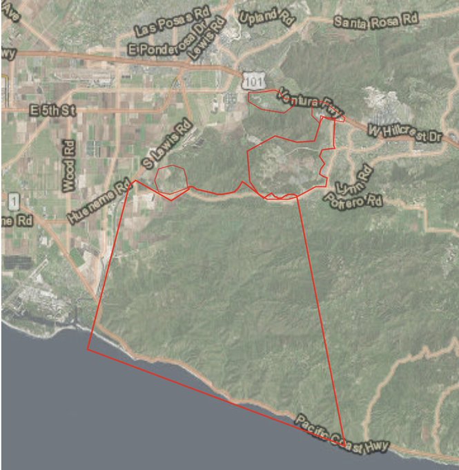
- Areas on the south coast outlined on VCEmergency.com’s map.
Here are more details on the mandatory evacuations:
You can get emergency alerts about Ventura County by texting VCALERT to 313131 or visiting vcalert.org. You can also call 805-465-6650 or visit VCEmergency.com for the latest updates.
Strong winds are helping the fire spread.
This is a serious fire. Stay tuned to local news sources to stay updated on evacuations.
Evacuation centers for this and the Woolsey Fire include:
- Pierce College is open for evacuations of large animals. (@CHPWestValley)
- The Rancho Santa Susana Recreation Center at 5005 Unit C Los Angeles Ave. in Simi Valley is an evacuation center, but it is not accepting animals. (@VCFD_PIO)
- Borchard Community Center is a Red Cross Shelter for Woolsey and the Hill Fire (190 Reino Road in Newbury Park)
- Camarillo Community Center at 1605 Weast Burnley St. in Camarillo, CA is a Red Cross shelter. This shelter is accepting small animals.
Animal shelters include:
- Ventura County Fair Grounds –
- Ventura County Animal Services (805) 388-4258. Accepting large animals.
- Pierce College – 7100 El Rancho Drive Woodland Hills, CA 91371 (Entrance off Desoto Ave.)
- Los Angeles County Animal Services, Accepting large animals.
- Ventura County Animal Shelter –
- Ventura County Animal Services (805) 388-4258, Accepting small animals
Holy Fire
The Holy Fire formed on August 6 in the afternoon and quickly grew. The Holy Fire was in Orange County, off Holy Jim Canyon Road, west of the North Main Divide. As of September 13, the fire is 23,136 acres according to Inciweb and 93 percent contained.The fire is no longer considered active by Inciweb (although it’s listed as active on CAL FIRE’s map) and Inciweb is no longer updating details about the fire. CAL FIRE stopped issuing updates on August 27.
The cause is under investigation, but authorities have arrested Forrest Gordon Clark on suspicion of felony arson. Read more about Clark in Heavy’s story here.
Lions Fire
This fire is listed on the CAL FIRE map as active, but Inciweb no longer considers it active. It’s 13,347 acres and 85 percent contained as of October 1. It’s located seven miles southwest of Mammoth Lakes. It was caused by lightning. Most of the fire is on the Sierra National Forest, but about 1,600 acres are on the Inyo National Forest. The fire is now in monitoring status and is no longer considered active.
Miller Fire in Oakland Hills
The Miller Fire is a brush fire seen in Oakland Hills but not listed on CAL FIRE’s map or on Inciweb. It’s at Joaquin Miller Road and Highway 13. Recent news sources say that the forward progress is under control.
The fire appears to have been extinguished.
Natchez Fire
This Oregon fire falls under the jurisdiction of the Oregon Department of Forestry Fire, but is also listed on the CAL FIRE map. It’s 38,134 acres according to Inciweb as of October 7, and 89 percent contained. It was caused by lightning. It’s located 15 miles southeast of Cave Junction, Oregon, located on the Oregon/California border between Happy Camp, California and Cave Junction, Oregon.
Inciweb issued its final update for the fire on October 7, unless conditions change. Inciweb no longer considers this fire active.
Rincon Fire
This fire is off Highway 9 and Rincon Crossing north of Santa Cruz in Santa Cruz County, according to CAL FIRE. It was 17 acres and 90 percent contained as of November 8.
Suisun City Fire (Nurse Fire)
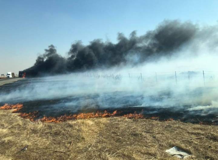
A vegetation fire was spotted in Suisun City today near Highway 12 and Nurse Slough Road. A big rig caught fire and the fire spread to nearby vegetation. Smoke from the Camp Fire can also be seen in parts of Suisun City.
No evacuations have been issued as of 12:40 p.m. Pacific.
The Suisun City Fire Department noted on Facebook that this is a four-alarm fire, and fire officials are seeking to head it off at Grizzly Island Road. They said the fire is not a threat to Suisun City, and it’s located two miles east of Suisun City on Highway 12.
The Suisun City Police Department closed eastbound Highway 12 at Walters Road because of the fire. Police have also closed westbound Highway 12 at Highway 113.
The fire has reportedly grown to 2,500 acres, according to CAL FIRE. By 7:19 p.m., however, CAL FIRE had readjusted the size down to 1,500 acres and reported that it was 50 percent contained.
Wilson Fire
This fire was at Wilson Lake Road and Lost Creek Road, 10 miles northwest of Chester in Tehama County. It’s 261 acres and 95 percent contained as of October 4. Inciweb no longer considers this fire active, although it’s still listed as active on CAL FIRE’s map.
Woolsey Fire in Ventura County
The Woolsey Fire also was just spotted on Thursday afternoon and by 7:51 p.m. it was 2,000 acres in size. It’s also located in Ventura County, not too far from the Hill Fire. It was first noted on November 8. This fire is very new and was just recently added to CAL FIRE’s list late Thursday afternoon.
The Woolsey Fire is a smaller fire in Simi Valley near the Rocketdyne facility in Santa Susana Pass, ABC 7 reported.
The Woolsey Fire is close enough that you can see it in arial photos of the Hill Fire:
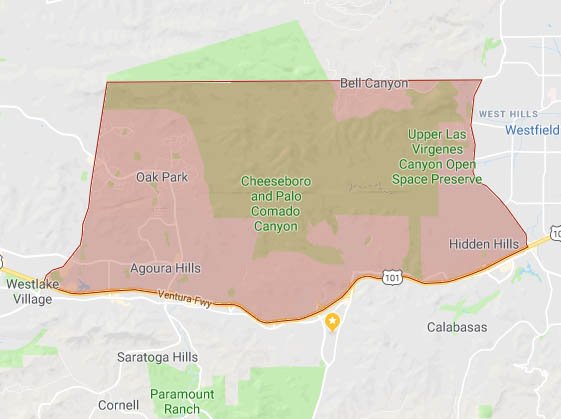
Some evacuations have been ordered for the fire. Here is an evacuation map for the city of Calabasas.
Some evacuation areas and road closures include:
- North of the 101 Freeway from Valley Circle to Lindero Canyon (@CHPWestValley)
- US 101 is closed in both directions for an unknown duration. (@CHPWestValley)
Evacuation centers include:
- Pierce College is open for evacuations of large animals. (@CHPWestValley)
- The Rancho Santa Susana Recreation Center at 5005 Unit C Los Angeles Ave. in Simi Valley is an evacuation center, but it is not accepting animals. (@VCFD_PIO)
- Borchard Community Center is a Red Cross Shelter for Woolsey and the Hill Fire (190 Reino Road in Newbury Park)
- Camarillo Community Center at 1605 Weast Burnley St. in Camarillo, CA is a Red Cross shelter. This shelter is accepting small animals.
Some sources for staying updated on this fire include @CHPWestValley and @VCFD_PIO.
This is a developing story.
READ NEXT: Forrest Gordon Clark accused of starting a California fire
