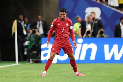
Montana Fires Near Me: Maps, Smoke Details & Air Quality

Heavy Breaking news

If you’re seeing smoke in Montana, it’s not because there’s a big fire raging. It’s because fires in Canada are so large that the smoke can be seen by residents in the Montana region.

According to both Inciweb and NIFC, there are no major fires in the Montana region. The smoke that you’re seeing is from Canada’s Chuckegg Creek Fire.

Here’s a map of the Chuckegg Creek Fire in Alberta:

Chuckegg Creek Fire

Alberta.caChuckegg Creek Fire Map as of May 30, 2019

And here’s where the fires are all located in the Alberta region right now, as of May 30:

Alberta Fire Map

Alberta WildfireAlberta Fire Map

As you can see, this is near Montana but is not currently affecting Montana. However, the smoke is traveling far.

Despite all the smoke, the air quality in southwest Montana is currently measured as safe (at PM 2.5) and it’s expected to stay that way.

Many are saying that despite the smoke, Montana still looks quite beautiful today.

As for the Alberta wildfires that you’re hearing about, they’re pretty bad right now. The Chuckegg Creek Fire (known unofficially by some as the High Level Fire) is now 230,000 hectares in size (that’s about 321,000 acres), up from 127,000 hectares yesterday. The cause of the fire is under investigation. Thousands are evacuating because of this fire in particular. This isn’t the only fire in the Alberta region, but it’s certainly the largest fire right now in that area. You can learn more about the Alberta fires in Heavy’s story here.

The smoke is moving into parts of the northern Rockies today, including Missoula, Seeley Lake, Frenchtown, and Libby.

More than 5,000 people have evacuated so far from the Alberta fires, Great Falls Tribune noted.

Dry and windy conditions are fueling the fires and making containment more difficult in those regions.

But for now, Montana’s air quality seems to be in good shape, despite the smoke from the Canada wildfires.

READ NEXT: Alberta Fires: Maps & Locations