New York City braced for a possible tornado after a tornado warning was issued for Staten Island and parts of New Jersey through 10:15 p.m. EDT. People should “immediately take shelter on lower floors. Stay away from windows,” New York City’s Office of Emergency Management advised earlier in the evening.
(Note: There was the possibility of an isolated tornado, but no tornado warning, on May 29, 2019 too. You can see that forecast here.)
However, the warnings have now passed. “Per @NWSNewYorkNY, as of 10:30 PM the threat of a tornado has passed in the area of Staten Island. Expect residual thunderstorms,” the Emergency Management Office wrote, referring to the National Weather Service.
The possible peril to populous New York City – Staten Island alone has almost half a million people – came the day after tornadoes devastated areas of Dayton, Ohio.
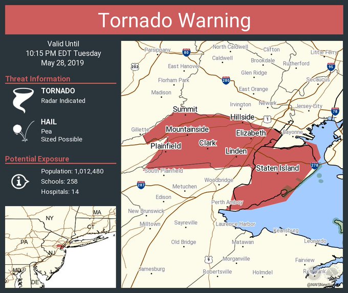
The latest update from New York City’s National Weather Service Office: “Tornado Warning including Staten Island NY, Elizabeth NJ, Plainfield NJ until 10:15 PM EDT.” According to PIX11, the affected areas are home to more than 1.2 million people.
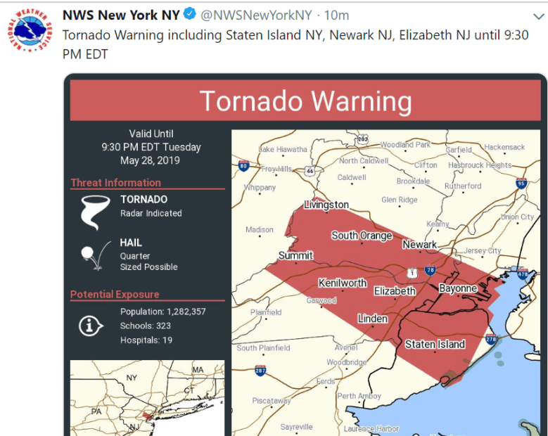
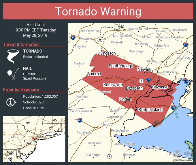
That extended an earlier warning, which read: “Tornado Warning including Staten Island NY, Newark NJ, Elizabeth NJ until 9:30 PM EDT.” Shortly thereafter, the NWS repeated the warning for parts of New York City and New Jersey but added another New Jersey community to the warning. “Tornado Warning continues for Staten Island NY, Elizabeth NJ, Bayonne NJ until 9:30 PM EDT,” NWS New York City wrote.
The Office of Emergency Management initially wrote on Twitter, “Tornado Warning issued for Staten Island until 9:30 PM. Immediately take shelter on lower floors. Stay away from windows.” Again, that’s now been extended until 10:15 p.m.
The office further noted: “Severe Thunderstorm Warning issued for Brooklyn, Manhattan and Staten Island until 9:45 PM. Strong winds & heavy rain expected.” You can see local radar here.
Kennedy airport reported flight disruptions, writing on Twitter, “Weather conditions at #JFK have caused flight disruptions. Please check with your airline to determine the status of your flight.” The New York City tornado warning first hit around 9 p.m.
According to NBC New York, a tornado warning means that “radar indicates conditions that would make a tornado likely, or one has been spotted.” NWS also reported severe thunderstorm warnings until 10 p.m. EDT for Hampton Bays NY, Riverhead NY, and East Quogue NY.
A weather update indicated: “This dangerous storm will be near…
Plainfield and Summit around 945 PM EDT.
Clark and Union around 955 PM EDT.
Linden around 1000 PM EDT.
Elizabeth around 1005 PM EDT.
Todt Hill and Huguenot around 1010 PM EDT.
Oakwood and Tompkinsville around 1015 PM EDT.”
New York Was Threatened by the Same Storm System That Hit the Midwest
Earlier in the evening, there were tornado warnings in Pennsylvania, with some expressing fear on social media that the tornado’s path charted directly for New York City. Tornadoes also struck Kansas. It was a week of destructive tornadoes as twisters hit Jefferson City, Missouri, the Dayton Ohio area, and El Reno, Oklahoma. Areas of Connecticut were also under severe thunderstorm warnings on the evening of May 28, 2019.
According to NBC New York, the storm imperiling New York City is the same system that created the tornadoes that devastated parts of the Midwest. There were 52 tornadoes Monday in eight states, NBC New York reported.
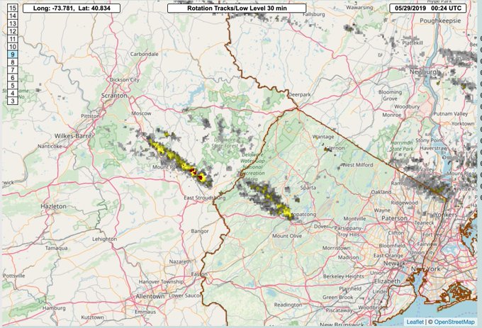
But New York City? “Two supercells in NE PA/NW NJ heading toward the NYC Metro. Worth watching these over the next hour or so,” wrote Ryan Hanrahan of NBC Connecticut.
The storm that was threatening NYC was located “in central New Jersey” and headed east, according to SiLive.com.
You Can Follow the National Weather Service’s Updates for New York City
You can follow the National Weather Service updates on Twitter for the New York City, New York office here. You can see detailed weather forecasts, including radar, for New York City here.
Those who follow treacherous weather reminded people that tall buildings do not ward off tornadoes, and precautions should be taken.
Although it was a serious situation, some people couldn’t help expressing surprise that a tornado could be headed toward NYC of all places.
There had been hazardous weather predicted for the area earlier in the day, with the NWS writing, “This Hazardous Weather Outlook is for Atlantic coastal waters, southern Connecticut, northeast New Jersey and southeast New York.”
“There is a chance of strong to severe thunderstorms developing late this afternoon into this evening along a warm front. The main threat will be damaging winds and large hail, however, an isolated tornado is possible,” NWS wrote earlier in the day. “The threat is highest just west of the NYC metro. Monitor subsequent NWS forecasts for the latest information on this severe threat.” As noted, parts of New York City were later subjected to an actual tornado warning.


