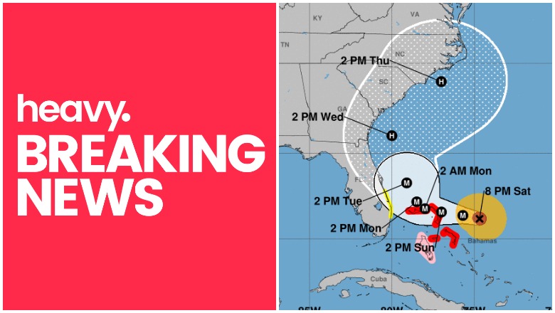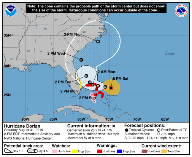
The National Hurricane Center has released weather updates for Hurricane Dorian on August 31, 2019 as of 8 p.m. These updates include new predictions for the storm that is slowly moving to the U.S. coast. You can read the full updates on the NOAA’s website here. Here’s a summary of the latest updates for the afternoon of August 31 at 8 p.m.
Hurricane Dorian’s Location, Coordinates & Movement
As of 8 p.m. on August 31, Dorian was located at 26.2 N, 74.7 W about 155 miles east of Great Abaco Island and 335 miles east of West Palm Beach, Florida. The storm was moving west (275 degrees) at 8 mph.
The National Hurricane Center noted the following: “Dorian is moving toward the west near 8 mph (13 km/h), and a slower westward motion should continue for the next day or two, followed by a gradual turn toward the northwest. On this track, the core of Dorian
should be near or over portions of the northwestern Bahamas on Sunday, and move closer to the Florida east coast late Monday through Tuesday. Data from NOAA and Air Force Hurricane Hunter aircraft indicate that the maximum sustained winds remain near 150 mph (240 km/h) with higher gusts. Dorian remains a category 4 hurricane on the
Saffir-Simpson Hurricane Wind Scale. Some fluctuations in intensity are likely, but Dorian is expected to remain a powerful hurricane during the next few days.”
Hurricane Dorian’s Wind Strength, Pressure, & Rainfall
The storm’s maximum sustained winds as of 8 p.m. are 150 mph, with some higher gusts.
The minimum central pressure is 941 mb (27.79 inches.)
Rainfall is expected to be 10 to 15 inches (isolated 25 inches) in the northwestern Bahamas. It could bring 4 to 8 inches (isolated 12 inches) to coastal sections of the United States.
Current Watches & Warnings
According to the National Hurricane Center, the following warnings and watches are in effect as of 2 p.m.
Hurricane Warning
- Northwestern Bahamas excluding Andros Island
Hurricane Watch
- Andros Island
Tropical Storm Watch
- Deerfield Beach to Sebastian Inlet
Additional watches and warnings may be issued, so stay tuned to local news for updates in your region.
Additional Hurricane Discussions
The NOAA’s 5 p.m. discussion included some more details.
“Dorian’s satellite presentation continues to be outstanding. The eye has remained very distinct and is surrounded by a ring of very deep convection. The latest information from the Air Force plane before it departed Dorian supports keeping an initial intensity of 130 kt. Dorian is forecast to move over a deep layer of very warm waters, and with the prevailing low shear along the hurricane’s path, some additional strengthening is possible during the next day or so. Most likely, however, the hurricane will experience some fluctuations in intensity due to eyewall replacement cycles that are difficult to predict. Beyond 3 days, as the hurricane begins to gain latitude and encounters increasing shear, gradual weakening is anticipated, but Dorian will remain a dangerous hurricane through 5 days.
“The best estimate of the initial motion is toward the west or 280 degrees at 8 kt. The hurricane is being steered by the weak flow to the south of the ridge of high pressure over the western Atlantic. In about a day or two, most of the global models shift the high eastward and deepen a trough over the eastern United States. Consequently, the steering currents should collapse and Dorian is anticipated to drift toward the northwest and north-northwest while is moving over the northwestern Bahamas and near the east coast of Florida. After that time, the hurricane should begin to move a little faster northward as the trough over the eastern U.S deepens and should then steer the hurricane toward the northeast by the end of the forecast period.
“The guidance has not changed significantly since the earlier run, so it has not been necessary to adjust the NHC forecast in this advisory. The uncertainty in the track is high while the hurricane is moving slowly across the northwestern Bahamas and near the east coast of Florida. Any deviation of Dorian’s core to the left would result in an increase in the winds along the east coast of Florida.
“Given that the area of tropical storm force winds could expand, and taking into account the uncertainty in the track forecast, a tropical storm watch was issued for the east of Florida from Deerfield Beach to Sebastian Inlet.”
READ NEXT: WATCH: Man with TV on Head Leaves CRT TVs on Porches in Virginia
