NWS An isolated New York City tornado is possible.
An “isolated tornado” was possible in New York City today on May 29, 2019, according to the National Weather Service. Even if a tornado doesn’t develop, be prepared for severe weather that could include damaging hail and strong winds. The weather system is part of the same one imperiling areas of the Midwest.
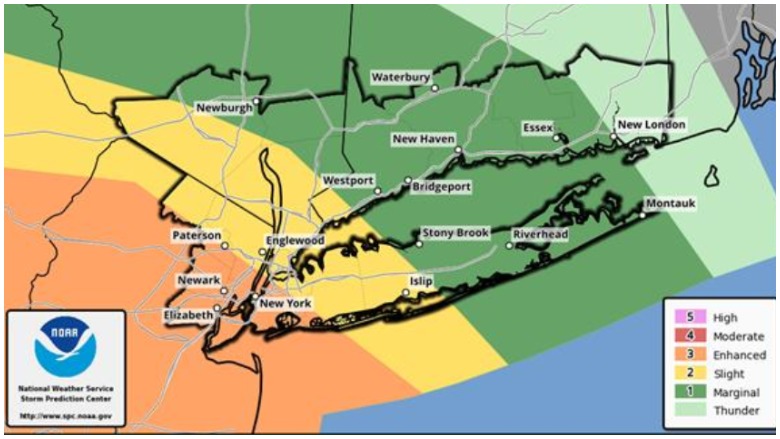
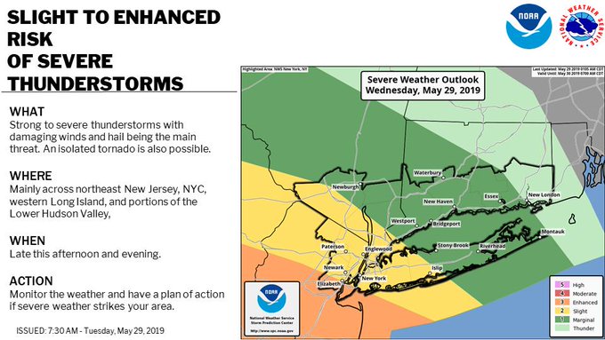
NYC is not under a tornado warning or watch, however, as Staten Island was the day before. Instead, the city faces the possibility of severe thunderstorms on Wednesday, NWS’s New York office reported. At 9:30 a.m. Wednesday, NWS wrote, “Storm Prediction Center increased the potential for severe thunderstorms today. There is now an enhanced threat for severe thunderstorms across much of NYC and NE NJ.”
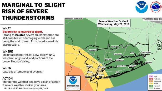
However, the office later downgraded the alert, writing, “[5/29/19 1250 PM] SPC has lowered the risk for severe t-storms today. Best chances still across NE NJ, NYC, W LI & portions of the Lower Hudson Valley. Any severe storms will be isolated in nature.”
Around 7:30 a.m. on Wednesday, NWS wrote that an isolated tornado was also possible, adding: “Strong to severe thunderstorms are possible once again this afternoon into the evening. Damaging winds (58 mph or greater) and/or hail (greater than 1″ in diameter).”
You can follow the NWS office for New York City here. Get updated radar and storm maps and forecasts here.
“Scattered severe storms are likely from portions of the southern Plains through the Ozarks, and across the Ohio Valley to the north-central Appalachians and Mid-Atlantic States today and tonight,” the National Weather Service’s Storm Prediction Center reports.
Here’s what you need to know
New York City Could See an Isolated Tornado & Other Severe Weather
The National Weather Service alert for New York City reads: “SLIGHT TO ENHANCED RISK OF SEVERE THUNDERSTORMS.”
The alert describes the possibility of “strong to severe thunderstorms with damaging winds and hail being the main threat. An isolated tornado is also possible.”
Where? “Mainly across northeast New Jersey, NYC, western Long Island, and portions of the Lower Hudson Valley.”
When? “Late this afternoon and evening” (of May 29, 2019.) The suggested action: “Monitor the weather and have a plan of action if severe weather strikes your area.”
The warning comes after a frightening weather system produced a short-lived tornado warning the night before for Staten Island, Newark, New Jersey, and other New Jersey communities. The weather is part of a system that has caused devastation in communities such as Dayton, Ohio, and Linwood, Kansas.
Why are there more tornadoes right now? That’s a complicated question. You can read an analysis here.
How do tornadoes form? “Globally, the middle latitudes, between about 30° and 50° North or South, provide the most favorable environment for tornadogenesis. This is the region where cold, polar air meets against warmer, subtropical air, often generating convective precipitation along the collision boundaries,” the National Centers for Environmental Information explains. The United States has by far the most tornadoes in the world, according to the agency.
The National Centers for Environmental Information reports that an average of 1,253 tornadoes occurred in the United States each year from 1991 to 2010. “Because a tornado is part of a severe convective storm, and these storms occur all over the Earth, tornadoes are not limited to any specific geographic location,” the agency explained.
The agency reports that an average of 1,253 tornadoes occurred in the United States each year from 1991 to 2010. “Because a tornado is part of a severe convective storm, and these storms occur all over the Earth, tornadoes are not limited to any specific geographic location,” the agency explained.


