UPDATE: FIND THE LATEST HURRICANE SANDY INFO HERE
Look out, Florida! Hurricane Sandy is a late-season tropical storm that has already impacted Jamaica, Cuba, the Bahamas, Haiti and will be crashing Florida this Friday. She’s the 18th storm of the 2012 Atlantic Hurricane Season and packs some punch.
1. Sandy’s Roots Were in Jamaica

Sandy arrived October 22nd which developed from an elongated tropical wave near the Caribbean sea. Today Hurricane Sandy has been upgraded to as a Category 2 storm.
Sandy hit Jamaica on Wednesday and rumbled across eastern Cuba on Thursday as a Category 2 storm. Her heavy winds damaged houses and fragile coffee and tomato crops, but caused no known fatalities on the island of Cuba. But, there are reports of two people who died elsewhere. Even as it began to hit Cuba’s rural eastern half, Sandy refused to lose its intensity as storms normally do when they cross over land according to Huff Post Green
“It crossed the entire eastern region practically without losing intensity or structure,” said Jose Rubiera, the island’s chief meteorologist.
The U.S National Hurricane Center said that Hurricane Sandy emerged from Cuba’s northeast coast around dawn and was moving north at 18 mph (30 kph), with a maximum sustained winds of 105 mph (165 kph). It was expected to remain a hurricane as it moved through the Bahamas.
It’s expected to remain a hurricane as it moves through the Bahamas, and the next stop is Florida reports Huff Post Green
4. Sandy Missed Guantanamo Bay
Hurricane Sandy is not only making a few pit stops in Florida, but it’s predicted to land somewhere between the Carolinas and Maine, most likely touching in the New England area. According to CBS Boston, the transition from what is called “warm core” tropical system to a cold core (nor’easter-like) system is a complex transformation. While the winds around the center of the storm may lower below hurricane strength, strong winds will extend out several hundred miles and effect a much larger area. The greatest concern is the coastline because if the worst case scenario unfolds next week, the coast will endure an absolute beating of several successive tides.
8. The NOAA Compares Sandy to New England’s 1991 Perfect Storm

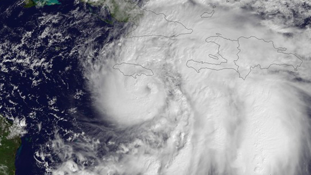
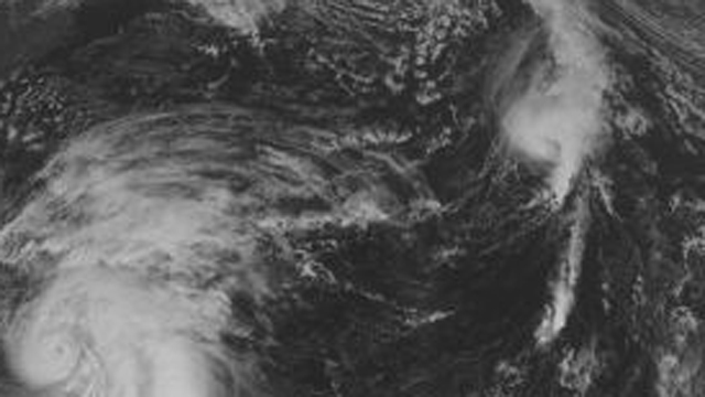
This National Oceanic & Atmospheric Administration photo taken Wednesday shows Sandy across the central Caribbean moving northward toward Jamaica and Cuba. Tropical Storm Tony is seen on the tail end of the cold front, along the central Atlantic, reports Weather.com:
Hurricane Sandy could be an early winter storm in the west, along with a blast of arctic air from the North that’s predicted to collide, with sloshing and parking over the country’s most populous coastal corridor starting this Sunday. The storm could reach its peak early Tuesday, but will also spread into midweek. It is likely to hit during a full moon when tides are near their highest, increasing coastal flooding potential, NOAA forecasts warn. And with some trees still leafy and the potential for snow, power outages could last to Election Day, some meteorologists fear. They say it has all the earmarks of a billion-dollar storm. Some have compared it to the so-called Perfect Storm that struck off the coast of New England in 1991…but that one didn’t hit as populated an area and is not comparable to the what the East Coast may be facing. Nor is it like last year’s Halloween storm, which was an early snow storm in the North East.
9. Sandy’s Plans After Reaching the East Coast Are Unknown

An estimate of 80-90% of all modules pull Hurricane Sandy North West, making landfall somewhere on the East coast from Maine to Delaware. The landing zone with over 500 miles will attract the attention of forecasters for several days. The zone has largely populated real estate. That will be the difference between New England getting a nasty Nor’easter and a more powerful devastating blow. Right now the landing spot for Sandy seems to be in the Mid-Atlantic via CBS Boston
10. The Newest Path for Sandy Could Be New Jersey as Early as Next Tuesday

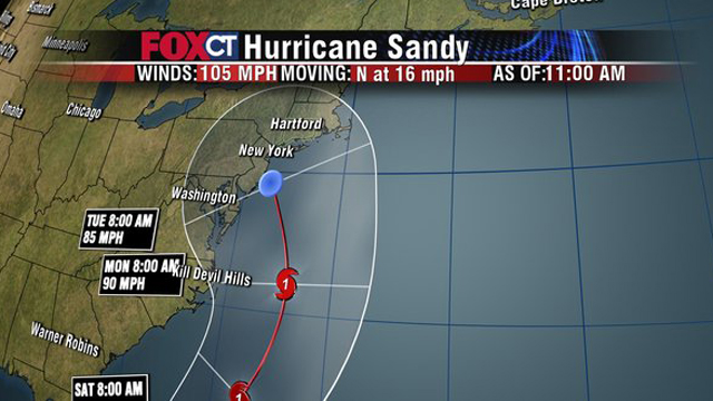
Hurricane Sandy cannot be stopped as she continues to head into the open waters of the Atlantic and she’ll hit the east if North Carolina this Saturday. It’s predicted the storm will have a significant effect in Connecticut by early Monday and Tuesday. It hits Central New Jersey Coast by early Tuesday according to Furey, from the National Hurricane Center.
“This will have a significance effect on the entire east coast, the storm will have a significant impact in Connecticut on Monday and early Tuesday