Hurricane Irma made its way to Orlando, Florida in the early morning hours of September 11, after making its first U.S. landfall in Cudjoe Key, in the Florida Keys, Sunday morning, and, later in the day, striking Marco Island and Naples. As of 10 a.m. Monday, the effects of the massive storm were still being felt in Orange County, especially through strong winds, but the hurricane warning had become a tropical storm warning.
More than 21 inches fell in two days. Mayor Teresa Jacobs said the winds on Monday morning remained “nearly hurricane force” and added to The Orlando Sentinel, “The damage from this storm is far greater than Hurricane Charley in 2004.”
Watch the mayor’s Monday morning pres conference on Irma here:
Some residents had to be rescued from flooded homes, and a curfew is in effect in Orlando until 6 p.m., until Irma dissipates more, the newspaper reported.
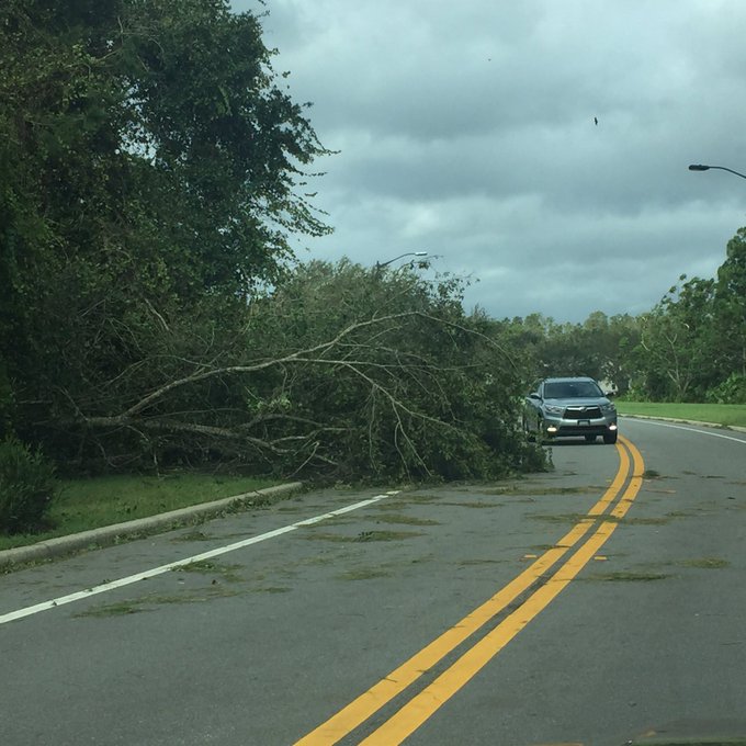
There were reports of downed power lines and fallen trees. At least 750,000 buildings in Orange, Seminole, Lake and Osceola counties were without power on Monday morning, according to The Sentinel.
Monitor the Orlando radar map here. Get an hourly forecast for Orlando here. Note that Orlando’s weather is charted out of the Melbourne, Florida office of the National Weather Service.
People in Orlando woke up – if they slept at all – to some damage.
The storm came into the area with force overnight. In the early morning hours of Monday, Irma had already arrived, and the Orlando area was feeling the effects of the storm, which had dissipated in strength before making its second landfall as a Category 2 storm.
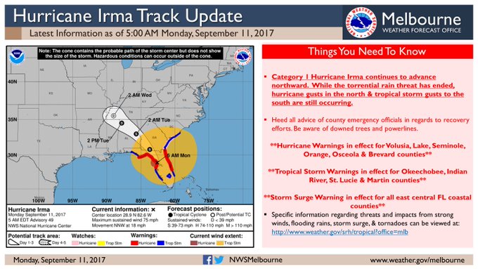
The National Weather Service warned people in Orange County around 4 a.m. Monday that they were still subjected to a hurricane warning.
Orange County was looking at wind gusts of around 100 mph around 1 a.m., as the center of the storm’s rotation approached Orange County. Tropical storm conditions were also expected Monday in Orlando, with tropical storm and possibly hurricane conditions occurring overnight.
By 1:30, a gust of 78 mph was recorded at the airport in Orlando.
Effects were expected to linger in Orlando until 4 a.m.
“Orlando is no longer within the cone of uncertainty, but the storm is nearly 400 miles wide and danger, particularly from possible tornadoes, remains,” The Orlando Sentinel reported on Sunday morning. Near noon, though, there were tornado watches in Orlando, and rain was starting to fall.
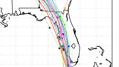
On late Sunday and early Monday morning, the forecast paths for the storm showed it mostly heading through western Florida to Georgia – not toward Orlando.
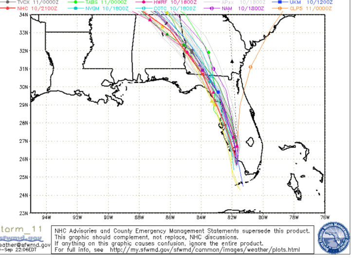
South Florida Waste Management DistrictSunday evening spaghetti plot.
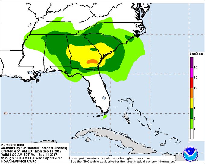
Here’s a rainfall map:
However, the story is so large that its effect reached Orlando anyway.
The National Weather Service projecting that hurricane conditions were possible in the city on Sunday, Sunday night, and Monday. See that weather forecast here. By Monday, though, the forecast had changed to tropical storm conditions being expected throughout the day with better weather on Tuesday.
This is where the storm was on Sunday morning when it made its first landfall, per the National Hurricane Center:
“The center of Hurricane Irma made landfall at Cudjoe Key in the lower Florida Keys at 9:10 am EDT. A gust to 106 mph (171 km/h) was just reported at the National Key Deer Refuge in Big Pine Key.”
Here were the Sunday arrival times for Irma:
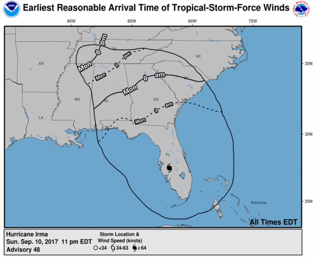
National Hurricane Center
You can see a round up of sites where you can track the hurricane’s path in real time here.
