National Hurricane Center
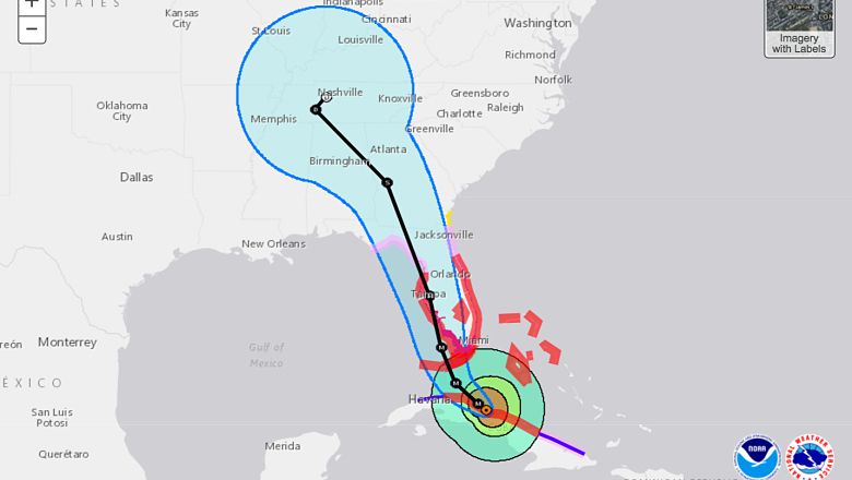
A Hurricane Warning has been issued for much of southwest Florida, including every county except for Citrus County, though it will be updated by mid-day today. The latest GFS and European models show Irma coming through Tampa, bringing a very dangerous Category 3 or a Category 4 to the Bay area on Sunday evening. The worst of the storm is set to hit in the overnight hours. The most severe weather will start letting up around 8 a.m. Eastern on Monday morning.
“With this track, we would see winds of 100 mph across much of the area with higher gusts. A surge of 5-8 feet is possiblee. Cuba HAS weakened Irma to 125, and could weaken it more. We just hope for the West track to continue longer. It still has NOT made the turn. If it were to stay West, it’s possible, coming in from such a sharp angle, but strongest winds would stay offshore. Still, that is currently not the forecast. You MUST prepare for the winds expected and we all hope it continues West,” said Tampa-area meteorologist Denis Phillips.
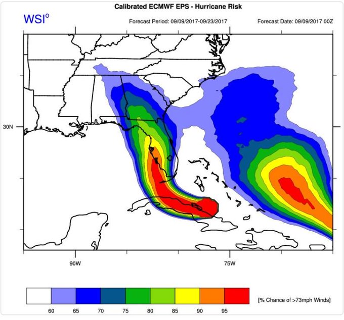
Below you will see an image and a gif of the latest GFS model as of 12 noon Eastern. There will be another update in a couple of hours.

Below you will see an image and a gif of the latest European model. This runs again at 2 p.m. Eastern.
The euro hurricane model #ecmwf predicting #hurricaneirma Florida landfall now doing a little curve AROUND the state’s tip to enter Tampa
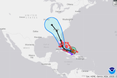
Hurricane Irma continues her westward movement, clipping the north of Cuba as she slowly pushes forward. Just about everyone is waiting for Irma to make her turn, which was originally predicted for the east coast. The more west she moves, the greater chance she has of heading into the Gulf. The warm waters there will cause her to increase in speed.
When Irma makes landfall, she is expected to be a Category 4, regardless of her entry point.