National Hurricane Center
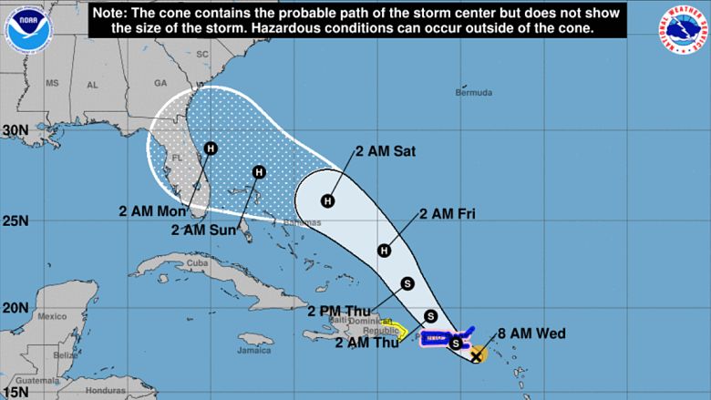
Will Hurricane Dorian hit Tampa? The simple answer is that meteorologists don’t know. The latest models do not agree on the path that Dorian will take after he barrels past the Bahamas on the north side of the islands. Dorian is expected to strengthen to a powerful Category 3 hurricane before possibly making landfall somewhere on Florida’s east coast on Monday, September 2.
Many living in the Bay area are becoming increasingly concerned about Dorian, which is set to be upgraded from a tropical storm to a hurricane on Wednesday evening. There are a couple of models that show Dorian making his way west across the state of Florida, arriving in Tampa sometime early next week.
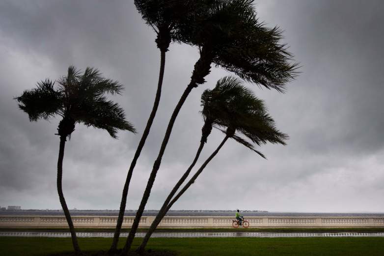
While Tampa isn’t expected to experience the most severe weather from this storm, conditions won’t be ideal and could include heavy rain, localized flooding, high winds, and power outages.
Here’s what you need to know:
If the Euro Model Plays out, Tampa Will See Conditions Similar to Hurricane Irma in 2017
National Hurricane Center
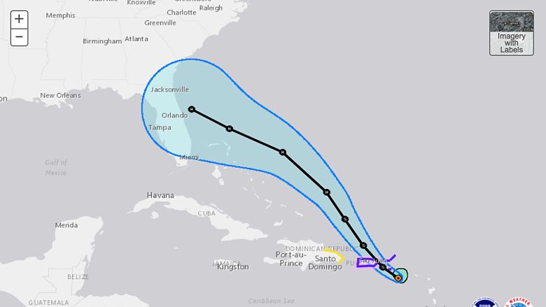
As it stood on Wednesday afternoon, the Euro computer model showed Dorian heading across the state of Florida, into Tampa. According to Tampa-area meteorologist Denis Phillips, this path would cause Tampa to experience very similar conditions to those caused by Hurricane Irma back in 2017.

“IF Dorian makes landfall in Florida as forecast, the worst would be on the East coast. But we would still have wind and rain here, especially interior counties. It’s a rather small storm, but it will probably get a bit larger before any potential landfall. So my point is, if the track plays out as the NHC says, it would likely bring conditions similar to what Irma brought the Bay Area in terms of wind, just in a smaller area,” Phillips wrote in a Facebook post on Wednesday.
“Lots will happen the next few days. Just realize the Bay Area will not see the worst of this storm,” Phillips added.
Those who were in Tampa for Hurricane Irma may remember a lot of rainfall, some flooding, especially along the coast, and some substantial wind gusts. Some areas lost power for days. With Dorian coming in from the east, storm surge isn’t going to be a big issue, which is good news for folks on the west coast.
There Is Still a Chance That Tampa Doesn’t See Anything From Hurricane Dorian
It’s simply too soon to tell how Tampa’s weather will shape up over the holiday weekend. Thus far, things are predicted to be seasonably normal, with about a 70 percent chance of thunderstorms Saturday, Sunday, and Monday. That forecast is expected to change in the coming days, as Dorian’s track becomes more clear.
If Dorian follows the current GFS track, he will head up the east coast and may not make landfall in Florida at all. If this were to happen, Tampa would be spared of bad weather. Outer rainbands are possible, but this storm is fairly small so it’s entirely possible that Tampa could have a sunny Monday while Dorian rages in the Atlantic Ocean.
READ NEXT: Map of Florida With Latest GFS & Euro Models