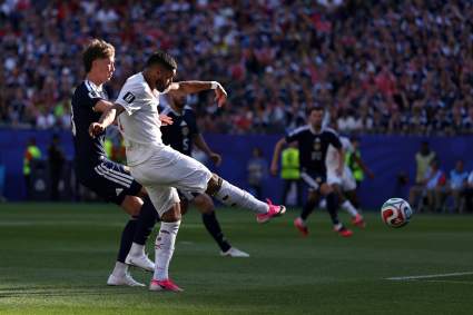
North & South Carolina Evacuation Map & Routes for Hurricane Dorian

Heavy Breaking news

Evacuations are already being issued in parts of the Carolinas ahead of Hurricane Dorian, which is now a Category 4 storm after stalling near Grand Bahama Island. The storm’s path is a bit unpredictable and it’s unclear if it will make landfall, move north and then out into the ocean, or if it will cause dangerous flooding in coastal areas. Some evacuation orders have already been issued for North Carolina and South Carolina. Read on for details about evacuation zones and maps in the Carolinas. And stay tuned to local news, as evacuation details can change rapidly when hurricanes are involved.

Evacuation orders as of Monday night for North Carolina include:

  • Oak Island has issued a mandatory evacuation for visitors and tourists, Star News Online shared.
  • Oak Island has issued a voluntary evacuation for low-lying areas
  • Oak Island will declare a state of emergency Tuesday at noon and activate the above evacuation orders. It’s unclear when or if the bridge to Oak Island will close, Star News Online noted.
  • Boiling Spring Lake issued a voluntary evacuation
  • Bald Head Island issued a mandatory evacuation for non-residents
  • UNCW issued a mandatory evacuation
  • New Hanover County beach towns are considering evacuations due to storm surges, so stay tuned if you are in those regions.
  • Dare County visitors were issued a mandatory evacuation, starting Tuesday at 12 p.m.

New Hanover County manager Chris Coudriet told Star News Online that he doesn’t expect a mandatory evacuation to be issued for the entire county, as they also didn’t do that for Hurricane Florence.

Evacuation orders as of Monday night for South Carolina include:

  • Coastal South Carolina residents have mandatory evacuations, WSOCTV reported.
  • This includes people in Colleton, Beaufort, Jasper, Charleston, Dorchester, Berkeley, Horry, and Georgetown counties. (They were told to be evacuated by noon on Monday.)
  • Residents of Dare County will be under a mandatory evacuation starting Wednesday at 6 a.m., WSOCTV reported. (But stay tuned to local news in case that changes).
  • The mandatory evacuation in Dare County includes Duck, Southern Shores, Kitty Hawk, Kill Devil Hills, Nags Head, Manteo, unincorporated areas including Hatteras Island, Roanoke Island, and Dare mainland, NBC 12 reported.
  • UNCW students were issued a mandatory evacuation.

What To Do If You’re Evacuating

Evacuation orders can change at any time, so keep an eye on your local news for changes. Note that the “Know Your Zone” designations are set up in Virginia and South Carolina, not North Carolina.

According to the State of North Carolina, you should do the following if you are considering evacuating:

  • Listen to local media.
  • Fill your car with gasoline. Take only one vehicle to lower the amount of traffic.
  • Leave early enough to avoid being trapped by severe weather.
  • Plan where your family will meet and go. Tell family or friends of your plans.
  • Map out your path, using travel paths listed by police.
  • If possible, leave and go to a friend’s home in a safe area. Next, try a motel or hotel. As a last resort, go to a shelter. Remember, shelters are not made for comfort.
  • Take your family’s and pet’s emergency kits. Bring key family papers.
  • Bring extra cash. Banks may be closed, and cash tellers may not work.
  • Lock doors and windows before leaving your house. Unplug radios, toasters, televisions and small appliances. Be sure to turn off water, gas and power.
  • Ask neighbors if they need a ride.

Evacuation Routes & Map in North Carolina

In North Carolina, many interstates and major highways to and from the coast can accommodate heavy traffic, which allow for better evacuations. The map below shows coastal routes to I-95, as provided by the North Carolina Department of Transportation.

North Carolina

Above is the main hurricane evacuation map for North Carolina. You can view it in a larger size here. On the road, routes will be indicated by circular blue roadside signs. Here’s a version below that you can zoom into.

View this document on Scribd

Dare County Emergency Management said in a statement: “Those evacuating to areas north of Dare County are encouraged to travel westbound on Highway 64 to Interstate 95. Evacuating through the rural areas to the west of Dare County will help avoid traffic backups and congestion that may prolong evacuation by traveling northbound through the Hampton Roads portion of Virginia.”

North Carolina also shared below what to take to a shelter.

View this document on Scribd

NCDOT typically recommends that drivers take designated evacuation routes and not back roads. Designated evacuation routes include Interstate 40, I-40, U.S. 74-76, U.S. 117, N.C. 211 and N.C. 210. But the map above shares more specific details.

You can get real-time information about North Carolina’s roadways and congestion on the map here. And listen to NOAA Weather Radio or your local stations for more evacuation details.


Evacuation Routes & Map in South Carolina

If you’re unsure as to which evacuation zone you’re in within South Carolina, this map will help. It’s the Know Your Zone interactive map from SCEMD. At this link you can just enter your address and find your zone. You can also use an app on iOS or Google to determine your evacuation zone using your phone’s location or physical address.

Here is the Know Your Zone map for South Carolina’s northern coast.

View this document on Scribd

Here is the Know Your Zone map for South Carolina’s central coast.

View this document on Scribd

Here is the Know Your Zone map for South Carolina’s southern coast.

View this document on Scribd

Here is the Know Your Zone map for South Carolina’s “Hurricane Conglomerates” (all the above combined.)

View this document on Scribd

In South Carolina, the Charlotte Motor Speedway is opening for evacuees.

A full list of emergency shelters in South Carolina is available here.

READ NEXT: Hurricane Dorian Maps: Projected Path & Live Trackers for September 2