Go to main menu
Go to search form
Heavy
Sports
Alerts
Hi,
Subscriber
Search
Sports
News, stats, rumors, predictions and roster moves around the NFL, NBA, MLB, NHL and more.
More From Sports
Fallout Continues From Maple Leafs Press Conference Introducing John Chayka
2 minutes ago
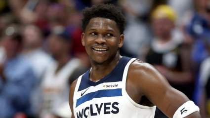
Anthony Edwards Injury Management Gets New Update Ahead of Timberwolves-Spurs Game 2
3 minutes ago
Bears New 6’0″ 210-lb RB Could Push Roschon Johnson Out of Job
5 minutes ago
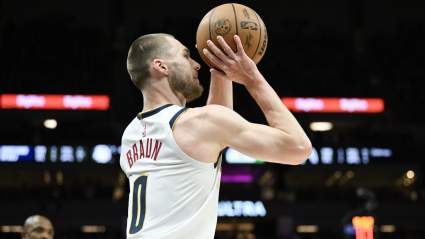
Nuggets’ Christian Braun Reveals Who’s to Blame for Loss to Timberwolves
7 minutes ago
Browns Put on Notice Over Latest Deshaun Watson Decision
10 minutes ago
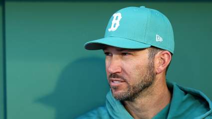
Red Sox Coach Sides with Alex Cora on Key Lineup Issue
10 minutes ago
Tatsuro Taira Can Become the First Japanese UFC Champion
5 minutes ago
LeBron James Drops Major Quote on Retirement Decision Before Game 1 vs OKC
10 minutes ago
Cardinals and QB Aaron Rodgers Make Sense as a Pair According to Mike Florio
15 minutes ago
76ers’ Joel Embiid’s Injury Complaints Draw Massive Backlash After Game 1
16 minutes ago
Boston Red Sox Predicted to Trade $87 Million Infielder to Rangers
21 minutes ago
Seahawks GM Says Competitor Scale Determined Draft Picks
21 minutes ago
NHL Insider Reveals Which Penguins Veteran Won’t Be Back
24 minutes ago
Detroit Tigers Announce Roster Move After Recent Nationals Trade
10 minutes ago
Packers’ Front Office Still Faced With Big Post-Draft Decisions
25 minutes ago
Bills’ Damar Hamlin Faces Potential Career Setback This Offseason
28 minutes ago
Chris Finch Says Victor Wembanyama Should Have Been Called for Goaltending
27 minutes ago
Bucs’ 6-foot-4, 206-Pound WR Called ‘Favorite Pick’ in NFL Draft
34 minutes ago
This Former Top Prospect Finding Success In Yankees Farm System
42 minutes ago
Thunder’s Lu Dort Hits Back At Fans For Villain Identity Ahead of Lakers Matchup
45 minutes ago
Raiders Player Quickly Takes Tyree Wilson’s Old Number After Trade
46 minutes ago
Cowboys Writer Urges Jerry Jones To Poach All-Pro LB From Detroit Lions
50 minutes ago
Browns QB Deshaun Watson Gets Bad News on Future in Cleveland
51 minutes ago
Ex-Bills Cornerback Released by AFC North Team
49 minutes ago
Ravens Rise in Offseason Power Rankings After Impressive Offseason Moves
59 minutes ago
Padres Announce Joe Musgrove News During Giants Series
1 hour ago
How to Watch Arsenal vs Atlético Madrid Live Today: Serie A Match Preview, Stats, Lineup
1 hour ago
Chicago Cubs Release Former MLB 1st-Round Pick From Organization
44 minutes ago
Lakers’ Marcus Smart Details Mindset Ahead of Series vs. Thunder
1 hour ago
Luka Doncic Injury Is Good News For Austin Reaves In Lakers Vs Thunder Series: Report
1 hour ago
More from Sports
Load More Sports ↓
Close sidebar
Home
NFL
Expand sub-menu
Arizona Cardinals
Atlanta Falcons
Baltimore Ravens
Buffalo Bills
Carolina Panthers
Cincinnati Bengals
Cleveland Browns
Chicago Bears
Dallas Cowboys
Denver Broncos
Detroit Lions
Green Bay Packers
Houston Texans
Indianapolis Colts
Jacksonville Jaguars
Kansas City Chiefs
Los Angeles Chargers
Los Angeles Rams
Las Vegas Raiders
Miami Dolphins
Minnesota Vikings
New England Patriots
New Orleans Saints
New York Giants
New York Jets
Philadelphia Eagles
Pittsburgh Steelers
San Francisco 49ers
Seattle Seahawks
Tampa Bay Buccaneers
Tennessee Titans
Washington Commanders
NBA
Expand sub-menu
Atlanta Hawks
Boston Celtics
Brooklyn Nets
Charlotte Hornets
Chicago Bulls
Cleveland Cavaliers
Dallas Mavericks
Denver Nuggets
Detroit Pistons
Golden State Warriors
Houston Rockets
Indiana Pacers
Los Angeles Clippers
Los Angeles Lakers
Memphis Grizzlies
Miami Heat
Milwaukee Bucks
Minnesota Timberwolves
New Orleans Pelicans
New York Knicks
Oklahoma City Thunder
Orlando Magic
Philadelphia 76ers
Phoenix Suns
Portland Trail Blazers
Sacramento Kings
San Antonio Spurs
Toronto Raptors
Utah Jazz
Washington Wizards
MLB
Expand sub-menu
Arizona Diamondbacks
Athletics
Atlanta Braves
Baltimore Orioles
Boston Red Sox
Chicago Cubs
Chicago White Sox
Cincinnati Reds
Cleveland Guardians
Colorado Rockies
Detroit Tigers
Houston Astros
Kansas City Royals
Los Angeles Angels
Los Angeles Dodgers
Miami Marlins
Milwaukee Brewers
Minnesota Twins
New York Mets
New York Yankees
Philadelphia Phillies
Pittsburgh Pirates
San Diego Padres
San Francisco Giants
Seattle Mariners
St. Louis Cardinals
Tampa Bay Rays
Texas Rangers
Toronto Blue Jays
Washington Nationals
NHL
Expand sub-menu
Anaheim Ducks
Boston Bruins
Buffalo Sabres
Calgary Flames
Carolina Hurricanes
Chicago Blackhawks
Colorado Avalanche
Columbus Blue Jackets
Dallas Stars
Detroit Red Wings
Edmonton Oilers
Florida Panthers
Los Angeles Kings
Minnesota Wild
Montreal Canadiens
Nashville Predators
New Jersey Devils
New York Islanders
New York Rangers
Ottawa Senators
Philadelphia Flyers
Pittsburgh Penguins
San Jose Sharks
Seattle Kraken
St. Louis Blues
Tampa Bay Lightning
Toronto Maple Leafs
Utah Mammoth
Vancouver Canucks
Vegas Golden Knights
Washington Capitals
Winnipeg Jets
More Sports
Expand sub-menu
College Basketball
College Football
Cricket
Formula 1
Golf
NASCAR
UFC
WNBA
Olympics
Pro Wrestling
Tennis