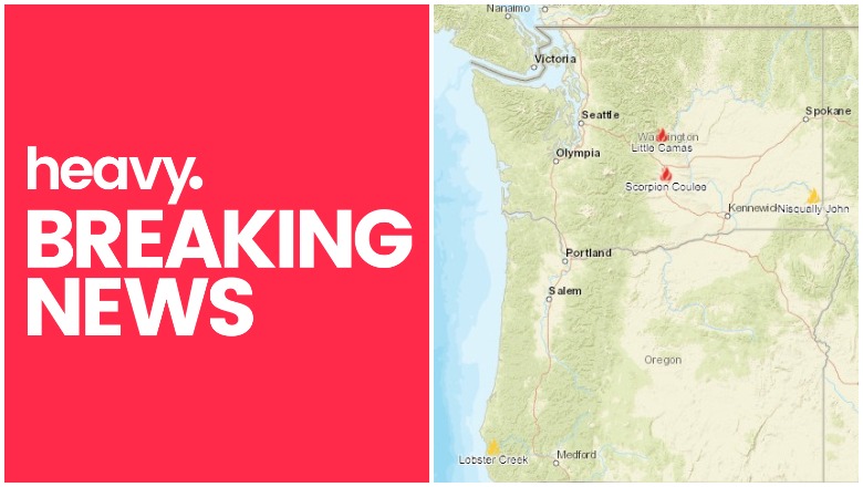
NIFC Oregon & Washington fires near me
Oregon and Washington have mostly positive news on fire suppression efforts, except for the Klamathon fire on the California-Oregon border. As of the time of publication, this is the one fire that you’ll want to keep a close eye on. You can see an interactive map of the Oregon and Washington fires here, provided by Oregon.gov, or view an interactive map from NIFC.gov here. Another interactive map is here. Read on for details about active fires in Oregon and Washington, and previously active fires that were just recently contained.
Klamathon Fire
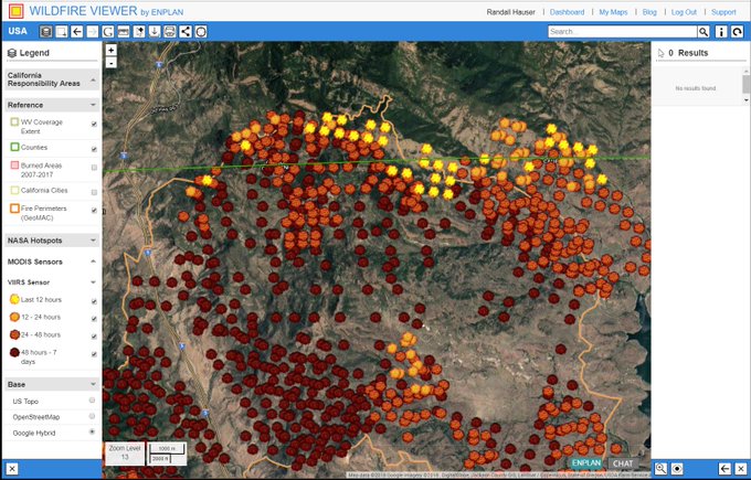
This fire is off Klamathon Road and Copco Road, south of Hornbrook (Siskiyou County.) On Friday it was 9,600 acres and 5 percent contained. It’s grown significantly since then, now at 32,250 acres and 30 percent contained. So although it’s grown, firefighters are also increasing containment. You can see an interactive map of the Klamathon fire above, from Gmap4 and MapingSupport.com. Unfortunately, this map will no longer be active as of July 15 due to new rules from Google.
According to Inciweb, the following evacuations are in effect as of July 9 at 7:19 a.m.:
- The communities of Hornbrook, Hilt, Colestin and Irongate Reservoir.
- Klamath River Community Estates – east of Black Mountain to Desavado Road, south of Copco Road to Ager Beswick Road
- East Irongate Estates: Areas south of Irongate Reservoir/Copco Road, north of Ager/Beswick Road, west of Desavado Road and east of Snackenbury Creek
- Copco Lake Area: Areas east of Jenny/Fall Creek, south of the Oregon State Line, north of Copco Road and west of Topsey Grade.
The following evacuation warnings have been issued:
- Pheasant Valley area, east of Interstate 5, South of the Summit of Black Mountain, west of Ager and north of Yreka Ager Road.
- Airport Road area, southwest of York Road, west of Airport Road north of Shelly Road and east of Ager Road
- Bogus Creek area, south of Ager Beswick Road, east of York Road and west of Bogus Creek
The following evacuation shelters are open:
- An evacuation shelter is open at the Jackson Street School, 405 Jackson St, Yreka, CA 96097
- Small Animals can be taken to Jackson Street Elementary shelter.
- Large Animal Shelter: Siskiyou County Fairgrounds, 1712 Fairlane Rd, Yreka
Moderate fire activity is expected today, with the Klamath River Country Estates still threatened, according to Inciweb. In addition, the fire continues to threaten the communities of Hill, Colestin, and Jackson County, Oregon. Communities of Hilt and Colestin, along with the Horseshoe Ranch Wildlife Area, Klamath Forest, Soda Mountain Wilderness, and Cascade Siksiyou National Monument may be threatened.
Little Camas
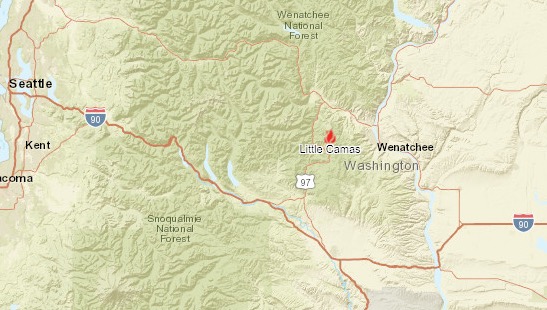
This Washington fire is 324 acres and 34 percent contained. It’s located six miles southwest of Cashmere. Visit this map to zoom in and learn more about the fire. The cause of this fire, which started on July 5, is still under investigation. The coordinates for the fire are 47.424 latitude, -120.561 longitude. Estimated total containment is July 20.
Inciweb last updated their details on the fire last night, stating that 334 firefighters were working on suppressing the fire. “The Camas Meadows Bible Camp and three adjacent homes are currently under a level 1 evacuation notice. Due to fire activity in the area, Forest Service Trail Red Hill #1223 and Tronsen Ridge Trail #1204 from Ruby Creek Trail to the 5 Miles Road junction are closed to public access. The remainder of the area is open.”
A Monday cold front may lead to some increased fire activity and smoke production.
Lobster Creek Fire
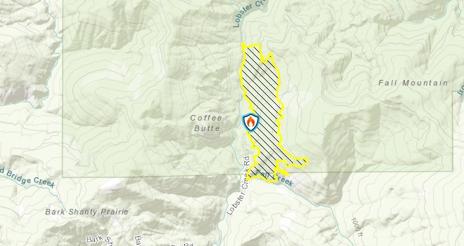
This Oregon fire is 397 acres and now 100 percent contained. It’s located 10 miles east of Gold Beach. The exact location is at 42.591 latitude, -124.254 longitude. The fire’s cause is under investigation.
Nisqually John Fire
This Washington fire was 1,388 acres, 11 miles northwest of Clarkston, Washington. It is no longer listed on Inciweb and appears to have been fully contained.
Scorpion Coulee
This fire had started on July 6 and grew to 200 acres. It was 10 miles south of Ellensburg, Washington and has been fully suppressed.
