Go to main menu
Go to search form
Heavy
Sports
Alerts
Hi,
Subscriber
Search
Sports
News, stats, rumors, predictions and roster moves around the NFL, NBA, MLB, NHL and more.
More From Sports
Daniel Cormier Reacts to Dustin Poirier’s Arrest
29 seconds ago
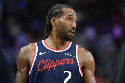
Report: Miami Heat Receive Major Kawhi Leonard Trade Update From Insider
3 minutes ago
Timberwolves Proposed to Add $90 Million Star Wing After LaMelo Ball Trade
4 minutes ago
Vikings Issued Blunt Message on Giants’ Kayvon Thibodeaux
4 minutes ago
Nuggets Proposed to Form Massive $634 Million Big 3 Around Nikola Jokic
5 minutes ago
Giants Urged to Address Jaxson Dart’s ‘Guilty’ Pleasure
6 minutes ago
LA Clippers Sign Play-Making Point Guard After NBA Draft
4 minutes ago
Is Christian Pulisic Playing vs. Turkey? Latest Update on USMNT Star
14 minutes ago
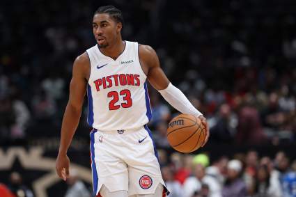
Detroit Pistons Rookie Takes Jaden Ivey’s No. 23 Jersey
15 minutes ago
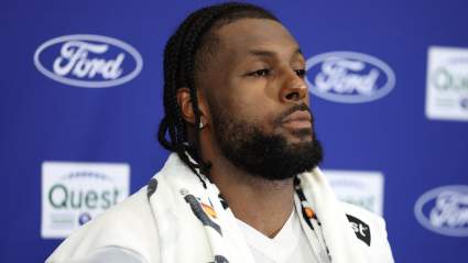
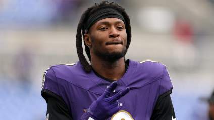
Disgruntled Former Ravens WR Makes Plea for New Team
20 minutes ago
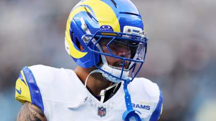
Rams 6-Touchdown Weapon Gets Bold Prediction Before Training Camp
21 minutes ago
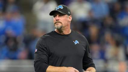
Lions Urged To Target 5-Time Pro Bowl Former 1st Round Pick
23 minutes ago
Lakers’ Initial Offer Frustrated Austin Reaves Before Dramatic Turnaround
21 minutes ago
Los Angeles Lakers Sign Play-Making Point Guard After NBA Draft
18 minutes ago
Maple Leafs Picking 1-2 in 2026 NHL Draft Would Be Cataclysmic
31 minutes ago
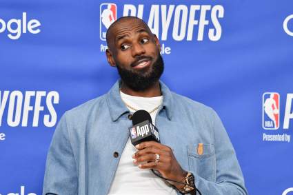
Lakers Fans Get Negative Update About Keeping LeBron James
35 minutes ago
Deshaun Watson Could Force Browns Into Tough Call
32 minutes ago
Why is the Diamondbacks-Cardinals Game Delayed Today? When Will it Start?
3 minutes ago
Joseph Woll Sounds Off After Trade From Maple Leafs
40 minutes ago
Why is it Spelled Turkiye? World Cup Team’s Name Change Explained
48 minutes ago
Ex-Bengals All-Pro Offers Blunt Take on HC Zac Taylor
50 minutes ago
Warriors Get Concerning Update on Reported Plan A Trade Target
43 minutes ago
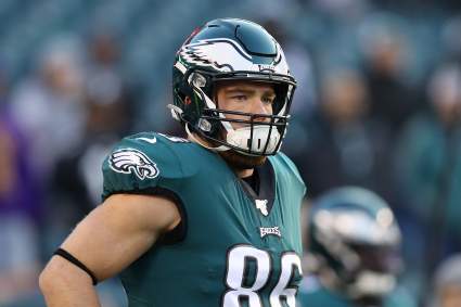
Ex-Eagles Star Zach Ertz Gets Emotional Speaking With Jason Kelce
52 minutes ago
Carolina Hurricanes Reportedly Offer Young Star for Connor Hellebuyck
55 minutes ago
New OC Zac Robinson Called ‘Ideal Fit’ for Injury-Prone Buccaneers Star
58 minutes ago
Controversial Ex-Bills WR Announces Major Career News
1 hour ago
Commanders’ $120 Million WR Target Deemed ‘Untradable’ After Latest Social Media Post
1 hour ago
Chicago Cubs Sign 13-Year MLB Veteran Amid Injuries Piling Up
1 hour ago
Carson Hocevar Says Tyler Reddick’s San Diego Actions Devalues Winning
1 hour ago
Lions CB Facing Life in Prison Gets Dire News at First Court Appearance
1 hour ago
More from Sports
Load More Sports ↓
Close sidebar
Home
NFL
Expand sub-menu
Arizona Cardinals
Atlanta Falcons
Baltimore Ravens
Buffalo Bills
Carolina Panthers
Cincinnati Bengals
Cleveland Browns
Chicago Bears
Dallas Cowboys
Denver Broncos
Detroit Lions
Green Bay Packers
Houston Texans
Indianapolis Colts
Jacksonville Jaguars
Kansas City Chiefs
Los Angeles Chargers
Los Angeles Rams
Las Vegas Raiders
Miami Dolphins
Minnesota Vikings
New England Patriots
New Orleans Saints
New York Giants
New York Jets
Philadelphia Eagles
Pittsburgh Steelers
San Francisco 49ers
Seattle Seahawks
Tampa Bay Buccaneers
Tennessee Titans
Washington Commanders
NBA
Expand sub-menu
Atlanta Hawks
Boston Celtics
Brooklyn Nets
Charlotte Hornets
Chicago Bulls
Cleveland Cavaliers
Dallas Mavericks
Denver Nuggets
Detroit Pistons
Golden State Warriors
Houston Rockets
Indiana Pacers
Los Angeles Clippers
Los Angeles Lakers
Memphis Grizzlies
Miami Heat
Milwaukee Bucks
Minnesota Timberwolves
New Orleans Pelicans
New York Knicks
Oklahoma City Thunder
Orlando Magic
Philadelphia 76ers
Phoenix Suns
Portland Trail Blazers
Sacramento Kings
San Antonio Spurs
Toronto Raptors
Utah Jazz
Washington Wizards
MLB
Expand sub-menu
Arizona Diamondbacks
Athletics
Atlanta Braves
Baltimore Orioles
Boston Red Sox
Chicago Cubs
Chicago White Sox
Cincinnati Reds
Cleveland Guardians
Colorado Rockies
Detroit Tigers
Houston Astros
Kansas City Royals
Los Angeles Angels
Los Angeles Dodgers
Miami Marlins
Milwaukee Brewers
Minnesota Twins
New York Mets
New York Yankees
Philadelphia Phillies
Pittsburgh Pirates
San Diego Padres
San Francisco Giants
Seattle Mariners
St. Louis Cardinals
Tampa Bay Rays
Texas Rangers
Toronto Blue Jays
Washington Nationals
NHL
Expand sub-menu
Anaheim Ducks
Boston Bruins
Buffalo Sabres
Calgary Flames
Carolina Hurricanes
Chicago Blackhawks
Colorado Avalanche
Columbus Blue Jackets
Dallas Stars
Detroit Red Wings
Edmonton Oilers
Florida Panthers
Los Angeles Kings
Minnesota Wild
Montreal Canadiens
Nashville Predators
New Jersey Devils
New York Islanders
New York Rangers
Ottawa Senators
Philadelphia Flyers
Pittsburgh Penguins
San Jose Sharks
Seattle Kraken
St. Louis Blues
Tampa Bay Lightning
Toronto Maple Leafs
Utah Mammoth
Vancouver Canucks
Vegas Golden Knights
Washington Capitals
Winnipeg Jets
More Sports
Expand sub-menu
College Basketball
College Football
Cricket
Formula 1
Golf
NASCAR
UFC
WNBA
Olympics
Pro Wrestling
Heavy on Soccer
Tennis