Go to main menu
Go to search form
Heavy
Sports
Alerts
Hi,
Subscriber
Search
Sports
News, stats, rumors, predictions and roster moves around the NFL, NBA, MLB, NHL and more.
More From Sports
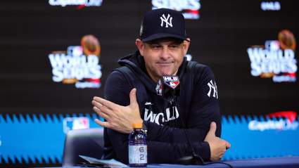
New York Yankees’ Aaron Boone Gets Honest About the Chicago White Sox Before Series
41 seconds ago
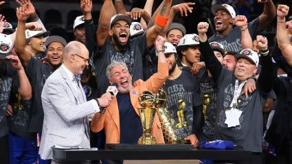
James Dolan Sends Sobering Message on Knicks’ Championship Future
1 minute ago
2026 Ohio Derby Post Positions: Full Field, Odds
4 minutes ago
Pacers Star Tyrese Haliburton’s Fiancee Addresses Bachelorette Party Tragedy
2 minutes ago
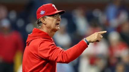
Phillies Manager Gets Honest About Andrew Painter’s Struggles
11 minutes ago
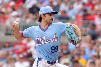
Spencer Strider is Big Loser After Atlanta Braves Roster Moves
12 minutes ago
Broncos Get Critical News on Jonathon Cooper After Scathing Comments
12 minutes ago
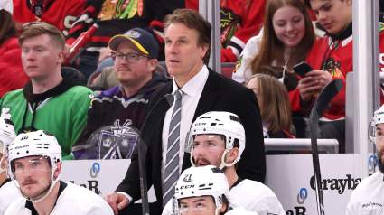
Jim Hiller Releases 1st Statement As Maple Leafs Head Coach
16 minutes ago
Knicks Make Final Decision on White House Visit After Finals Victory
18 minutes ago
Mariners Trade 5-Year MLB Arm to Royals Before Orioles Game
16 minutes ago
Dodgers Considered ‘Realistic Fit’ for Tarik Skubal Ahead of MLB Trade Deadline
26 minutes ago
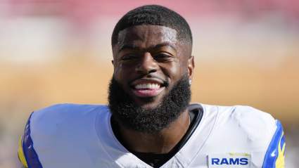
Browns’ Jared Verse Reveals NSFW Final Message to Former Rams Teammates
27 minutes ago
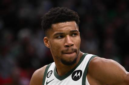
Bucks Insider Reveals Celtics’ Major ‘Fear’ in Trading for Giannis Antetokounmpo
27 minutes ago
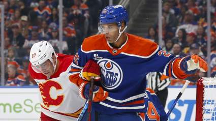
Oilers Named Landing Spot For Multiple Potential Darnell Nurse Replacements
29 minutes ago
Ghana Star Thomas Partey Misses World Cup Opener Amid Controversy
31 minutes ago
Braves Let Go of 4-Year MLB Player Before Giants Game
25 minutes ago
Commanders Bring in 2-Time Super Bowl Champion WR
34 minutes ago
Packers Have New Name Emerging as Potential Breakout Player in 2026
39 minutes ago
Atlanta Braves Announce Surprising Austin Riley Change Before Giants Game
15 minutes ago
Vancouver Canucks Star Drawing Trade Interest Ahead of the 2026 NHL Draft
43 minutes ago
Mike Kafka Shares Brutally Honest First Impression Of Lions QB Jared Goff
46 minutes ago
Ghana World Cup Squad 2026: Club Team, Age For All 26 Players
46 minutes ago
Panama World Cup Squad 2026: Club Team, Age For All 26 Players
49 minutes ago
Giants Announce Official Dates, Times of West Virginia-Based Training Camp
49 minutes ago
Atlanta Braves Announce Ha-Seong Kim Change Before Giants Game
12 minutes ago
Who Is Jude Bellingham? 5 Fast Facts About England’s World Cup Star
57 minutes ago
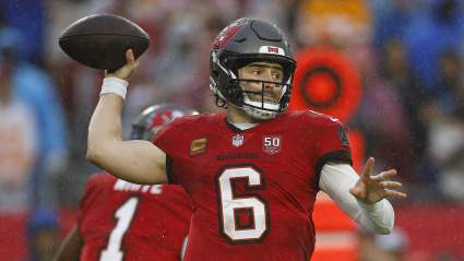
Three Landing Spots For Buccaneers QB Baker Mayfield
1 hour ago
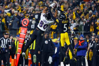
Steelers Earn the Respect of Former AFC North Coach
1 hour ago
Lakers Linked to 5-Time All-Star Alongside LeBron James’ Return
38 minutes ago
Why Was Harry Kane Allowed to Retake His Penalty Against Croatia?
1 hour ago
More from Sports
Load More Sports ↓
Close sidebar
Home
NFL
Expand sub-menu
Arizona Cardinals
Atlanta Falcons
Baltimore Ravens
Buffalo Bills
Carolina Panthers
Cincinnati Bengals
Cleveland Browns
Chicago Bears
Dallas Cowboys
Denver Broncos
Detroit Lions
Green Bay Packers
Houston Texans
Indianapolis Colts
Jacksonville Jaguars
Kansas City Chiefs
Los Angeles Chargers
Los Angeles Rams
Las Vegas Raiders
Miami Dolphins
Minnesota Vikings
New England Patriots
New Orleans Saints
New York Giants
New York Jets
Philadelphia Eagles
Pittsburgh Steelers
San Francisco 49ers
Seattle Seahawks
Tampa Bay Buccaneers
Tennessee Titans
Washington Commanders
NBA
Expand sub-menu
Atlanta Hawks
Boston Celtics
Brooklyn Nets
Charlotte Hornets
Chicago Bulls
Cleveland Cavaliers
Dallas Mavericks
Denver Nuggets
Detroit Pistons
Golden State Warriors
Houston Rockets
Indiana Pacers
Los Angeles Clippers
Los Angeles Lakers
Memphis Grizzlies
Miami Heat
Milwaukee Bucks
Minnesota Timberwolves
New Orleans Pelicans
New York Knicks
Oklahoma City Thunder
Orlando Magic
Philadelphia 76ers
Phoenix Suns
Portland Trail Blazers
Sacramento Kings
San Antonio Spurs
Toronto Raptors
Utah Jazz
Washington Wizards
MLB
Expand sub-menu
Arizona Diamondbacks
Athletics
Atlanta Braves
Baltimore Orioles
Boston Red Sox
Chicago Cubs
Chicago White Sox
Cincinnati Reds
Cleveland Guardians
Colorado Rockies
Detroit Tigers
Houston Astros
Kansas City Royals
Los Angeles Angels
Los Angeles Dodgers
Miami Marlins
Milwaukee Brewers
Minnesota Twins
New York Mets
New York Yankees
Philadelphia Phillies
Pittsburgh Pirates
San Diego Padres
San Francisco Giants
Seattle Mariners
St. Louis Cardinals
Tampa Bay Rays
Texas Rangers
Toronto Blue Jays
Washington Nationals
NHL
Expand sub-menu
Anaheim Ducks
Boston Bruins
Buffalo Sabres
Calgary Flames
Carolina Hurricanes
Chicago Blackhawks
Colorado Avalanche
Columbus Blue Jackets
Dallas Stars
Detroit Red Wings
Edmonton Oilers
Florida Panthers
Los Angeles Kings
Minnesota Wild
Montreal Canadiens
Nashville Predators
New Jersey Devils
New York Islanders
New York Rangers
Ottawa Senators
Philadelphia Flyers
Pittsburgh Penguins
San Jose Sharks
Seattle Kraken
St. Louis Blues
Tampa Bay Lightning
Toronto Maple Leafs
Utah Mammoth
Vancouver Canucks
Vegas Golden Knights
Washington Capitals
Winnipeg Jets
More Sports
Expand sub-menu
College Basketball
College Football
Cricket
Formula 1
Golf
NASCAR
UFC
WNBA
Olympics
Pro Wrestling
Heavy on Soccer
Tennis