National Hurricane Center
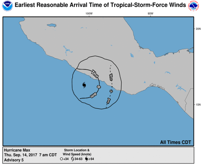
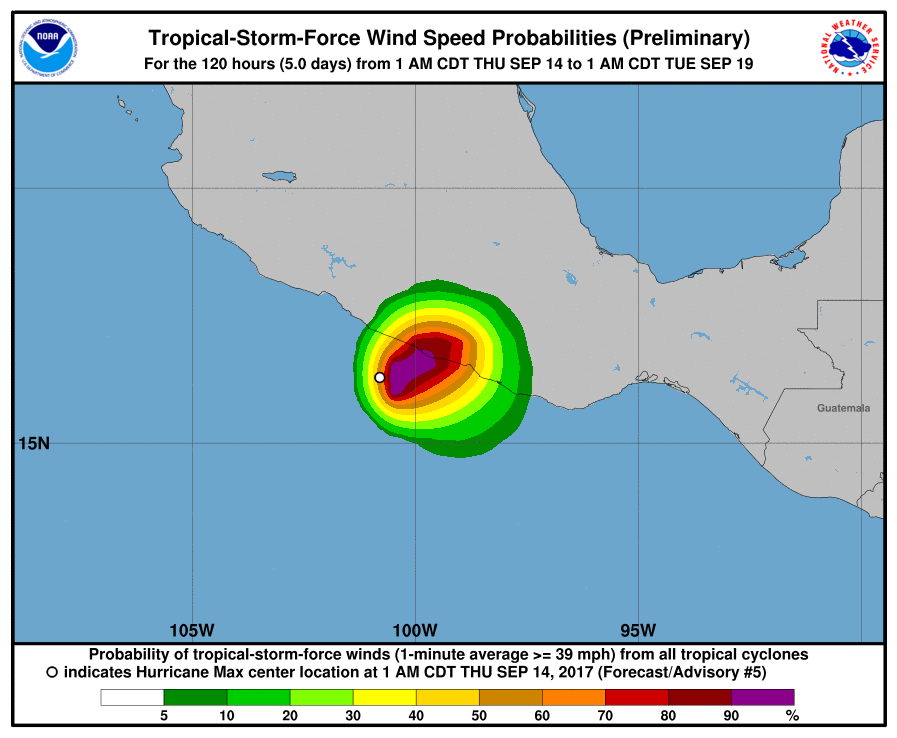
Hurricane Max is expected to hit southwestern Mexico on Thursday, according to the National Hurricane Center.
With maximum sustained winds of 75 miles per hour, the Category 1 storm is moving east in the Pacific Ocean at 6 miles per hour. It’s currently about 55 miles southwest of Acapulco.
The hurricane is expected to strengthen before it makes landfall.
Hurricane-force winds extend outward up to 10 miles from the eye of the storm.

Rainfall could reach 10 to 10 inches in the Mexican state of Guerrero and western portions of the state of Oaxaca, according to the latest advisory from the National Hurricane Center. Maximum amounts in excess
of 20 inches are possible over coastal areas of Guerrero.
These torrential rains may produce life-threatening flash floods and
mudslides.A dangerous storm surge is expected to produce significant coastal flooding near and to the east of where the center makes landfall. Near the coast, the surge will be accompanied by large and destructive waves.
Hurricane Max comes just days after a massive earthquake hit southwest Mexico about 50 miles southwest of Pijijiapan, near the border of Guatemala. The earthquake, which killed at least 90 people, could be felt in the the capital of Mexico City.
Hurricane Max also comes on the heels of two major hurricanes this season, Hurricane Harvey in Texas and Hurricane Irma, which devastated the Caribbean islands and Florida. Both storms killed dozens of people and caused billions of dollars in damage.
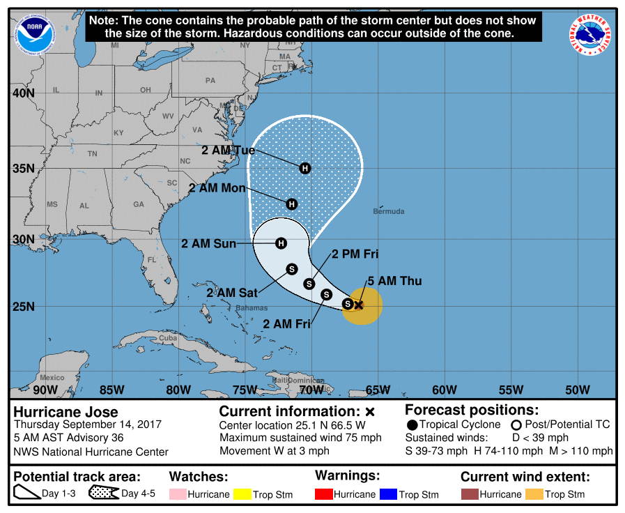
Hurricane Jose is still lingering in the Atlantic Ocean and is no longer expected to hit the United States.

