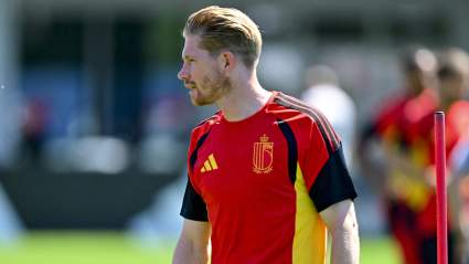
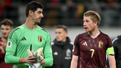
Hurricane Ian: Live Web Cams & Storm Chaser Streams for Florida Landfall

Hurricane Ian live web cams

NOAA Hurricane Ian live web cams

All eyes are on Hurricane Ian as the storm nears Florida and gets close to making landfall. Below are live radars to help you track the storm, along with live web cams from areas in the storm’s potential landfall path. Landfall is estimated to likely take place Wednesday evening, but conditions with hurricanes can change rapildy. Some webcams included in the story below will likely go down as the storm passes. The live radar feeds should stay online. The first section has live radar feeds and the second section has live webcams and storm chaser feeds. The third section has storm chaser streams.


Live Radar Feeds

WFAA has a live Ian tracker here or embedded below.

NBC News is also tracking Ian live in the video below.

Fox is also providing live coverage.


Live Webcams as the Storm Nears Florida & Makes Landfall

In this section, you’ll find live webcams and live streams as the hurricane nears Florida and makes landfall. The hurricane’s exact landfall location isn’t known, so some of these streams may show the landfall while others may not. The video above is from the YouTube channel Florida Traffic and shows a live scan of Tampa Bay traffic cams.

The same channel has provided another live stream of “Hurrican Ian Florida Traffic Cams” below. They note: “Audio is Tampa Bay NOAA weather radio.”

The Fort Myers Beach Fishing Pier’s live stream is below.

As of 12:30 a.m. Eastern on Wednesday, September 28, the National Hurricane Center (NHC) provided a map of Ian’s projected path, which you can see via the link here. At that time, Ian was located 25.0N 18.9W, about 100 miles southwest of Naples, Florida. Maximum sustained winds were 120 mph and the storm was moving north-northeast or 15 degrees at 10 mph. The minimum central pressure was 953 MB or 28.14 inches.

You can view a series of Earthcam for on-the-ground streams, including EarthCamTampa, EarthCam St. Petersburg, EarthCam Port Charlotte, and EarthCam Naples.

Hurricane Track is providing live streams that show different locations in Florida as Ian nears. One stream is below and the channel is here.

The NOAA noted at 12:30 a.m: “This general motion with a reduction in forward speed is forecast tonight and Wednesday, followed by a turn toward the north on Thursday.
On the forecast track, the center of Ian is expected to pass west of the Florida Keys within the next few hours, and approach the west coast of Florida within the hurricane warning area on Wednesday. The center of Ian is forecast to move over central Florida Wednesday night and Thursday morning and emerge over the western Atlantic by late Thursday.”

The University of Tampa’s Vaughan Center Webcam is below.

A few more live cams of interest include: Southernmost Webcam in Key West, Surfcam Panama City, SurfCam Pensacola, SurfCam St. George Island, and live Duval Street.

The NOAA noted that as of 12:30 a.m. Eastern on Wednesday, Ian was expected to make landfall Wednesday afternoon or evening. The path keeps shifting, Orlando Sentinel reported, although landfall is still expected on the southwest coast. Areas under hurricane warnings included Orange, Seminole, Osceola, Polk, and Lake counties, Orlando Sentinel noted.

Pelican Pete’s Waterfront Webcam in St. Petersburg is below.

WFLA has live webcams you can see here.

The University of Tampa has a Riverfront Webcam live below.

SpectrumNews9 has multiple cameras here.

Fox13 Tampa Bay has multiple cameras here that update every minute.

Siesta Beach’s live webcam in Sarasota is here (the owner disabled embedding.) White Sands Beach Resort in Anna Maria Island, Florida, has a live pool camera you can watch below.

They also have a beach camera here:

And a second beach camera here:

The YouTube channel Force 13 is providing live updates through an automated stream below.


The Following Storm Chaser Streams Are Also Reporting

Jayjack Storm Trax is in Florida and reporting live. The YouTube channel is here. He’s periodically streaming live, and did so on Tuesday in the video below.

Reed Timmer is also in the area. His YouTube channel is here. Below is a live stream from earlier in the day on Tuesday.

Colorado Weather Nut is streaming on Twitch.

MesoHunter is also streaming on location in Florida. His YouTube channel is here. A pre-live-coverage video is below.

Chris FL Tornado is in the area. His YouTube channel is here. He’s also on Twitter and shared his plan in this video.

StormChaserIRL is in the area. His Twitch channel is here.

Another YouTube channel to follow is TwisterChasers. They have a live feed with updates on Ian below.

Brandon Copic is also in the region. His YouTube channel is here. Below is a stream from early on Wednesday/late on Tuesday.

Meteorologist Jock Williams is providing updates here.

You can also find updates from Live Storms Media on YouTube here. Below is a video from early Wednesday morning/late Tuesday night in Naples.

Storm chaser Vince Waelti is also providing updates. Below is a late-Tuesday-night update.

READ NEXT: Hallmark Reveals Countdown to Christmas Lineup